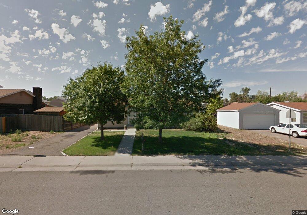
6950 E 73rd Ave Commerce City, CO 80022
Kemp NeighborhoodEstimated Value: $305,000 - $411,127
3
Beds
2
Baths
1,161
Sq Ft
$326/Sq Ft
Est. Value
About This Home
This home is located at 6950 E 73rd Ave, Commerce City, CO 80022 and is currently estimated at $378,032, approximately $325 per square foot. 6950 E 73rd Ave is a home located in Adams County with nearby schools including Kearney Middle School and Adams City High School.
Ownership History
Date
Name
Owned For
Owner Type
Purchase Details
Closed on
May 3, 2016
Sold by
Connors William R and Connors Dina M
Bought by
Connors Dina M
Current Estimated Value
Purchase Details
Closed on
Jun 24, 2005
Sold by
Ford Family Trust
Bought by
Connors William R and Connors Dina M
Home Financials for this Owner
Home Financials are based on the most recent Mortgage that was taken out on this home.
Original Mortgage
$131,400
Outstanding Balance
$105,955
Interest Rate
7.45%
Mortgage Type
Unknown
Estimated Equity
$272,077
Purchase Details
Closed on
Apr 27, 2005
Sold by
Ford Charlene K and Ford Robert G
Bought by
Ford Family Trust
Home Financials for this Owner
Home Financials are based on the most recent Mortgage that was taken out on this home.
Original Mortgage
$131,400
Outstanding Balance
$105,955
Interest Rate
7.45%
Mortgage Type
Unknown
Estimated Equity
$272,077
Create a Home Valuation Report for This Property
The Home Valuation Report is an in-depth analysis detailing your home's value as well as a comparison with similar homes in the area
Home Values in the Area
Average Home Value in this Area
Purchase History
| Date | Buyer | Sale Price | Title Company |
|---|---|---|---|
| Connors Dina M | -- | None Available | |
| Connors William R | $164,250 | Security Title | |
| Ford Family Trust | -- | -- |
Source: Public Records
Mortgage History
| Date | Status | Borrower | Loan Amount |
|---|---|---|---|
| Open | Connors William R | $131,400 |
Source: Public Records
Tax History
| Year | Tax Paid | Tax Assessment Tax Assessment Total Assessment is a certain percentage of the fair market value that is determined by local assessors to be the total taxable value of land and additions on the property. | Land | Improvement |
|---|---|---|---|---|
| 2025 | $2,207 | $25,430 | $5,780 | $19,650 |
| 2024 | $2,207 | $23,370 | $5,310 | $18,060 |
| 2023 | $1,942 | $26,050 | $5,750 | $20,300 |
| 2022 | $1,661 | $18,480 | $5,770 | $12,710 |
| 2021 | $1,685 | $18,480 | $5,770 | $12,710 |
| 2020 | $1,578 | $17,520 | $5,010 | $12,510 |
| 2019 | $1,575 | $17,520 | $5,010 | $12,510 |
| 2018 | $964 | $10,440 | $4,460 | $5,980 |
| 2017 | $915 | $10,440 | $4,460 | $5,980 |
| 2016 | $1,005 | $11,090 | $2,230 | $8,860 |
| 2015 | $1,025 | $11,090 | $2,230 | $8,860 |
| 2014 | $676 | $7,290 | $1,830 | $5,460 |
Source: Public Records
Map
Nearby Homes
- 7384 Oneida Dr
- 6881 E 74th Ave
- 6641 E 73rd Place
- 7131 Pontiac St
- 6601 E 71st Ave
- 7491 Niagara St
- 7301 Leyden St
- 7398 Kearney St
- 6780 Bax Ct
- 6651 E 78th Ave
- 6813 Locust St Unit 6813/6815
- 7695 Kearney Dr
- 7761 Kearney Dr
- 6312 Kearney St
- 7900 Quince St
- 7951 Olive St
- 6601 E 79th Ave
- 6721 Leyden St
- 7951 Newport St
- 5971 E 69th Ave
- 7270 Oneida St
- 7290 Oneida St
- 7285 Olive St
- 6990 E 73rd Ave
- 7273 Olive St
- 7260 Oneida St
- 7252 Oneida St
- 7261 Olive St
- 7000 E 73rd Ave
- 7240 Oneida St
- 7255 Olive St
- 7251 Oneida St
- 7241 Oneida St
- 7295 Oneida St
- 7025 E 72nd Place
- 7249 Olive St
- 7020 E 73rd Ave
- 6801 E 72nd Place
- 7241 Olive St
- 7028 E 73rd Ave
Your Personal Tour Guide
Ask me questions while you tour the home.