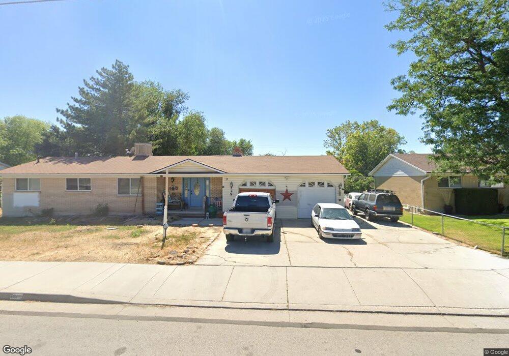
6950 S 2700 W West Jordan, UT 84084
Estimated Value: $614,000 - $668,000
5
Beds
3
Baths
3,222
Sq Ft
$198/Sq Ft
Est. Value
About This Home
This home is located at 6950 S 2700 W, West Jordan, UT 84084 and is currently estimated at $638,647, approximately $198 per square foot. 6950 S 2700 W is a home located in Salt Lake County with nearby schools including West Jordan Middle School, West Jordan High School, and Learning Tree School - Southwest.
Ownership History
Date
Name
Owned For
Owner Type
Purchase Details
Closed on
Dec 5, 2017
Sold by
Jones Lindon B and L Brent Jones Family Trust
Bought by
Rodriguez Jose L and Rodriguez Susan D
Current Estimated Value
Home Financials for this Owner
Home Financials are based on the most recent Mortgage that was taken out on this home.
Original Mortgage
$274,725
Outstanding Balance
$233,987
Interest Rate
4.4%
Mortgage Type
FHA
Estimated Equity
$404,660
Purchase Details
Closed on
Oct 14, 2015
Sold by
Jones Lindon B
Bought by
Jones Lindon B and K Brent Jones Family Trust
Purchase Details
Closed on
Aug 6, 1997
Sold by
Jones Lindon B and Jones Sandra A
Bought by
City Of West Jordan
Create a Home Valuation Report for This Property
The Home Valuation Report is an in-depth analysis detailing your home's value as well as a comparison with similar homes in the area
Home Values in the Area
Average Home Value in this Area
Purchase History
| Date | Buyer | Sale Price | Title Company |
|---|---|---|---|
| Rodriguez Jose L | -- | Meridian Title | |
| Jones Lindon B | -- | None Available | |
| City Of West Jordan | -- | -- |
Source: Public Records
Mortgage History
| Date | Status | Borrower | Loan Amount |
|---|---|---|---|
| Open | Rodriguez Jose L | $274,725 |
Source: Public Records
Tax History Compared to Growth
Tax History
| Year | Tax Paid | Tax Assessment Tax Assessment Total Assessment is a certain percentage of the fair market value that is determined by local assessors to be the total taxable value of land and additions on the property. | Land | Improvement |
|---|---|---|---|---|
| 2025 | $2,730 | $561,400 | $197,100 | $364,300 |
| 2024 | $2,730 | $525,200 | $189,500 | $335,700 |
| 2023 | $2,773 | $502,900 | $177,800 | $325,100 |
| 2022 | $2,858 | $509,800 | $174,300 | $335,500 |
| 2021 | $2,307 | $374,600 | $145,200 | $229,400 |
| 2020 | $2,337 | $356,100 | $145,200 | $210,900 |
| 2019 | $2,276 | $340,100 | $122,000 | $218,100 |
| 2018 | $2,151 | $318,800 | $113,600 | $205,200 |
| 2017 | $2,002 | $295,500 | $113,600 | $181,900 |
| 2016 | $1,784 | $247,400 | $119,900 | $127,500 |
| 2015 | $1,806 | $244,100 | $122,200 | $121,900 |
| 2014 | $1,648 | $219,400 | $110,800 | $108,600 |
Source: Public Records
Map
Nearby Homes
- 6918 S Harvest Cir
- 2683 W Carson Ln
- 8524 S Michele River Ave W Unit 109
- 2421 W 6900 S
- 2312 W Hidden Bend Cove Unit 107
- 6893 S 3200 W
- 7361 S 2700 W
- 6924 S 2160 W
- 6512 Timpanogos Way
- 2510 W Jordan Meadows Ln
- 2573 Jordan Meadows Ln
- 2333 W Ledgewood Dr
- 3383 W 6880 S
- 6453 Fremont Peak Cir
- 6925 S Lexington Dr
- 6672 S 3335 W
- 2332 Broderick Dr
- 1951 W 7125 S
- 3052 W Matterhorn Dr
- 2886 W 7550 S
- 6964 S 2700 W
- 6932 S 2700 W
- 6951 S 2700 W
- 6978 S 2700 W
- 6921 S 2700 W
- 6910 S 2700 W
- 6992 S 2700 W
- 6911 S 2700 W
- 6904 S 2700 W
- 6904 S 2700 W Unit 2
- 6908 Harvest Cir
- 6901 S 2700 W
- 2754 W 7000 S
- 6918 Harvest Cir
- 6898 Harvest Cir
- 6891 S 2700 W
- 2715 W 6870 S
- 2733 W 7000 S
- 2774 W 7000 S
- 6988 S Harvest Cir