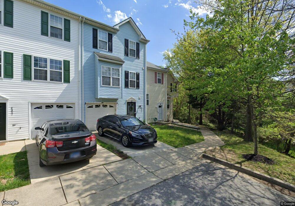
6951 Walker Mill Rd Capitol Heights, MD 20743
Estimated Value: $283,000 - $363,000
--
Bed
4
Baths
1,301
Sq Ft
$252/Sq Ft
Est. Value
About This Home
This home is located at 6951 Walker Mill Rd, Capitol Heights, MD 20743 and is currently estimated at $328,023, approximately $252 per square foot. 6951 Walker Mill Rd is a home located in Prince George's County with nearby schools including John H. Bayne Elementary School, Walker Mill Middle School, and Central High School.
Ownership History
Date
Name
Owned For
Owner Type
Purchase Details
Closed on
Aug 10, 2005
Sold by
Simmons Joyce M
Bought by
Littlejohn Joyce M
Current Estimated Value
Home Financials for this Owner
Home Financials are based on the most recent Mortgage that was taken out on this home.
Original Mortgage
$205,700
Outstanding Balance
$125,201
Interest Rate
8.34%
Mortgage Type
Adjustable Rate Mortgage/ARM
Estimated Equity
$202,822
Purchase Details
Closed on
Jan 25, 1999
Sold by
T & D Developers Inc
Bought by
Simmons Joyce M and Tony Littlejohn
Create a Home Valuation Report for This Property
The Home Valuation Report is an in-depth analysis detailing your home's value as well as a comparison with similar homes in the area
Home Values in the Area
Average Home Value in this Area
Purchase History
| Date | Buyer | Sale Price | Title Company |
|---|---|---|---|
| Littlejohn Joyce M | -- | -- | |
| Simmons Joyce M | $146,000 | -- |
Source: Public Records
Mortgage History
| Date | Status | Borrower | Loan Amount |
|---|---|---|---|
| Open | Littlejohn Joyce M | $205,700 |
Source: Public Records
Tax History Compared to Growth
Tax History
| Year | Tax Paid | Tax Assessment Tax Assessment Total Assessment is a certain percentage of the fair market value that is determined by local assessors to be the total taxable value of land and additions on the property. | Land | Improvement |
|---|---|---|---|---|
| 2025 | $4,319 | $295,267 | -- | -- |
| 2024 | $4,319 | $264,333 | $0 | $0 |
| 2023 | $3,858 | $233,400 | $60,000 | $173,400 |
| 2022 | $2,548 | $229,133 | $0 | $0 |
| 2021 | $3,592 | $224,867 | $0 | $0 |
| 2020 | $4,011 | $220,600 | $60,000 | $160,600 |
| 2019 | $3,105 | $216,800 | $0 | $0 |
| 2018 | $3,869 | $213,000 | $0 | $0 |
| 2017 | $3,841 | $209,200 | $0 | $0 |
| 2016 | -- | $190,800 | $0 | $0 |
| 2015 | $3,307 | $172,400 | $0 | $0 |
| 2014 | $3,307 | $154,000 | $0 | $0 |
Source: Public Records
Map
Nearby Homes
- 6805 Milltown Ct
- 7001 Migliori Ct
- 6909 Bank Run Terrace
- 1311 Karen Blvd Unit 407
- 1301 Karen Blvd Unit 403
- 1705 Addison Rd S
- 1621 Addison Rd S
- 1601 Addison Rd S
- 1631 Addison Rd S Unit 1631
- 6902 Diamond Ct
- 1408 Shady Glen Dr
- 1218 Iron Forge Rd
- 6808 Amber Hill Ct
- 710 Iona Terrace
- 708 Iona Terrace
- 7609 Starshine Dr
- 1804 Glendora Dr
- 7613 Starshine Dr
- 6807 Elmhurst St
- 2208 Breton Dr
- 6953 Walker Mill Rd
- 6955 Walker Mill Rd
- 6957 Walker Mill Rd
- 6959 Walker Mill Rd
- 6961 Walker Mill Rd
- 6963 Walker Mill Rd
- 6911 Walker Mill Rd
- 6971 Walker Mill Rd
- 6973 Walker Mill Rd
- 6831 Milltown Ct
- 6975 Walker Mill Rd
- 6843 Milltown Ct
- 6847 Milltown Ct Unit 8
- 6847 Milltown Ct
- 6851 Milltown Ct
- 6841 Milltown Ct
- 6851 Milltown Ct Unit NONE
- 6829 Milltown Ct
- 6845 Milltown Ct
- 6977 Walker Mill Rd