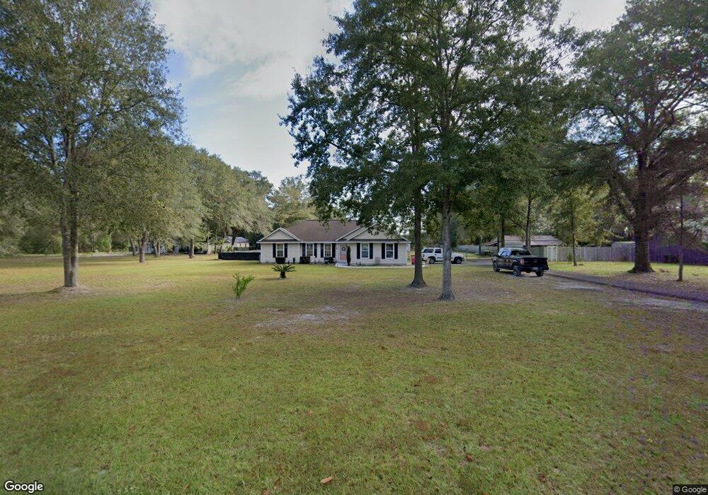
6952 Clark Rd Blackshear, GA 31516
Estimated Value: $241,883 - $374,000
3
Beds
2
Baths
1,462
Sq Ft
$195/Sq Ft
Est. Value
About This Home
This home is located at 6952 Clark Rd, Blackshear, GA 31516 and is currently estimated at $284,721, approximately $194 per square foot. 6952 Clark Rd is a home located in Pierce County with nearby schools including Pierce County High School.
Ownership History
Date
Name
Owned For
Owner Type
Purchase Details
Closed on
Jun 24, 2011
Sold by
Federal National Mortgage Association
Bought by
Barkley Thomas R
Current Estimated Value
Purchase Details
Closed on
Jan 4, 2011
Sold by
Simmons Jamie E
Bought by
Bank Of America Na
Purchase Details
Closed on
Jan 16, 1980
Sold by
Clark John A
Bought by
Clark John A
Purchase Details
Closed on
Jan 4, 1980
Sold by
Clark John A
Bought by
Clark John A
Purchase Details
Closed on
Mar 30, 1979
Sold by
Clark G A
Bought by
Clark John A
Purchase Details
Closed on
Mar 29, 1966
Bought by
Clark G A
Create a Home Valuation Report for This Property
The Home Valuation Report is an in-depth analysis detailing your home's value as well as a comparison with similar homes in the area
Purchase History
We collect this data history from publicly available records. To have your information removed, we recommend requesting removal directly through your county’s website.
| Date | Buyer | Sale Price | Title Company |
|---|---|---|---|
| Barkley Thomas R | $85,000 | -- | |
| Bank Of America Na | $93,388 | -- | |
| Federal National Mortgage Association | $93,388 | -- | |
| Clark John A | -- | -- | |
| Clark John A | -- | -- | |
| Clark John A | -- | -- | |
| Clark G A | -- | -- |
Source: Public Records
Tax History
| Year | Tax Paid | Tax Assessment Tax Assessment Total Assessment is a certain percentage of the fair market value that is determined by local assessors to be the total taxable value of land and additions on the property. | Land | Improvement |
|---|---|---|---|---|
| 2025 | $1,755 | $72,094 | $5,080 | $67,014 |
| 2024 | $1,659 | $70,801 | $5,080 | $65,721 |
| 2023 | $1,646 | $70,267 | $5,080 | $65,187 |
| 2022 | $1,095 | $40,505 | $3,740 | $36,765 |
| 2021 | $1,034 | $39,024 | $3,740 | $35,284 |
| 2020 | $1,011 | $37,542 | $3,740 | $33,802 |
| 2019 | $1,018 | $37,542 | $3,740 | $33,802 |
| 2018 | $970 | $35,881 | $3,561 | $32,320 |
| 2017 | $955 | $34,758 | $3,561 | $31,197 |
| 2016 | $948 | $34,758 | $3,561 | $31,197 |
| 2015 | $1,086 | $34,758 | $3,561 | $31,197 |
| 2014 | $1,086 | $34,758 | $3,561 | $31,197 |
| 2013 | $1,086 | $34,758 | $3,561 | $31,197 |
Source: Public Records
Map
Nearby Homes
- 6622 Georgia 121
- 4582 Saint Johns Church Rd
- 4701 Riggins Rd
- 4240 White Tail Way
- 4003 Oxford Ln
- 6254 Bluebird Dr
- 4314 Old Hoboken Rd
- 6910 Greenfield Rd
- 6927 Greenfield Rd
- 4131 Mulligan Cir
- 35 Acres + - Willie Bowen Rd
- 0 Southside Dr
- 3952 Golfview Dr
- 6656 Pine Ridge Cir
- 6663 Pine Ridge Cir
- 3300 Connor Ln
- 8245 Central Ave
- 6731 Youmans Chapel Rd
- 3547 Chapel Ln
- 8280 Central Ave
Your Personal Tour Guide
Ask me questions while you tour the home.