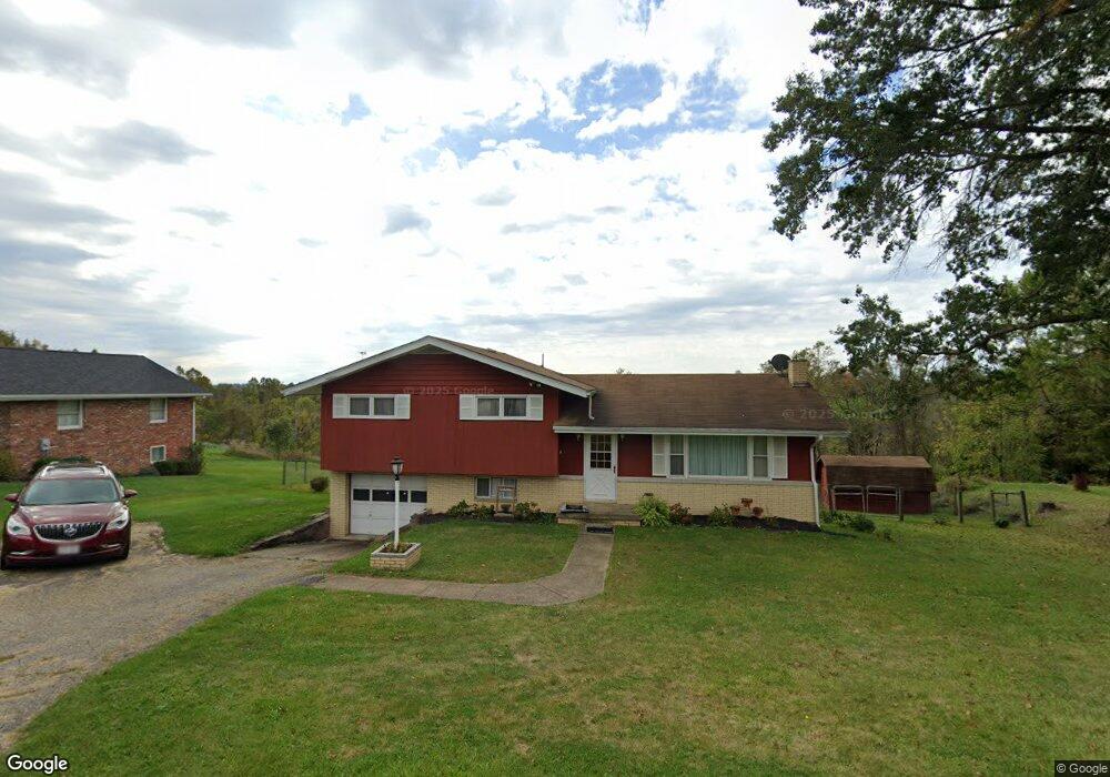
69538 Heils Lane Rd Bridgeport, OH 43912
Estimated Value: $166,088 - $241,000
3
Beds
2
Baths
1,221
Sq Ft
$157/Sq Ft
Est. Value
About This Home
This home is located at 69538 Heils Lane Rd, Bridgeport, OH 43912 and is currently estimated at $192,272, approximately $157 per square foot. 69538 Heils Lane Rd is a home located in Belmont County with nearby schools including Bridgeport Elementary School, Bridgeport Middle School, and Bridgeport High School.
Ownership History
Date
Name
Owned For
Owner Type
Purchase Details
Closed on
Nov 10, 2011
Sold by
Ochsenbine Thomas E and Ochsenbine Kimberly Jo
Bought by
Patterson Thaddaus U and Patterson Patricia D
Current Estimated Value
Purchase Details
Closed on
Jul 5, 2011
Sold by
Benline Elizabeth A and Benline James M
Bought by
Ochsenbine Thomas E and Ochsenbine Kimberly Jo
Purchase Details
Closed on
May 9, 1995
Sold by
Benline James M
Bought by
Benline James M
Purchase Details
Closed on
Jan 1, 1986
Sold by
Benline Elizabeth A
Bought by
Benline Elizabeth A
Create a Home Valuation Report for This Property
The Home Valuation Report is an in-depth analysis detailing your home's value as well as a comparison with similar homes in the area
Home Values in the Area
Average Home Value in this Area
Purchase History
| Date | Buyer | Sale Price | Title Company |
|---|---|---|---|
| Patterson Thaddaus U | $122,500 | Attorney | |
| Ochsenbine Thomas E | $35,000 | Attorney | |
| Benline James M | -- | -- | |
| Benline Elizabeth A | -- | -- |
Source: Public Records
Tax History Compared to Growth
Tax History
| Year | Tax Paid | Tax Assessment Tax Assessment Total Assessment is a certain percentage of the fair market value that is determined by local assessors to be the total taxable value of land and additions on the property. | Land | Improvement |
|---|---|---|---|---|
| 2024 | $1,668 | $46,210 | $6,320 | $39,890 |
| 2023 | $1,527 | $38,840 | $5,070 | $33,770 |
| 2022 | $1,527 | $38,836 | $5,068 | $33,768 |
| 2021 | $1,520 | $38,840 | $5,068 | $33,772 |
| 2020 | $1,357 | $32,360 | $4,220 | $28,140 |
| 2019 | $1,426 | $32,360 | $4,220 | $28,140 |
| 2018 | $1,387 | $32,360 | $4,220 | $28,140 |
| 2017 | $1,635 | $36,970 | $3,780 | $33,190 |
| 2016 | $1,639 | $36,970 | $3,780 | $33,190 |
| 2015 | $1,714 | $36,970 | $3,780 | $33,190 |
| 2014 | $1,331 | $30,640 | $3,440 | $27,200 |
| 2013 | $1,434 | $30,640 | $3,440 | $27,200 |
Source: Public Records
Map
Nearby Homes
- 69895 Woods Rd
- 56745 Ferryview Rd
- 69282 Zelda Ave
- 69341 Old Cadiz Rd
- 70540 Colerain Rd
- 0 Ferryview Rd
- 57365 Washington Blvd
- 16 Patterson Rd
- 55273 Poplar Ave
- 20 Locust Ave
- 17 Sunset Dr
- 19 Sunset Dr
- 1836 Colerain Pike
- 68511 Liston Ave
- 902 National Rd
- 56316 National Rd
- 866 Main St
- 16 Hillcrest Dr
- 54980 Maple Ave
- 839 W Vine St
- 69520 Heils Lane Rd
- 69562 Heils Lane Rd
- 69523 Heils Lane Rd
- 69523 Heils Lane Rd
- 69523 Heils Lane Rd
- 69565 Heils Lane Rd
- 69578 Heils Lane Rd
- 69579 Heils Lane Rd
- 69590 Heils Lane Rd
- 69632 Heils Lane Rd
- 69690 Heils Lane Rd
- 69645 Heils Lane Rd
- 69459 Heils Lane Rd
- 69810 Sunset Heights
- 70064 Sunset Heights
- 69822 Sunset Heights
- 70012 Sunset Heights
- 69837 Sunset Heights
- 69879 Sunset Heights
- 69871 Sunset Heights