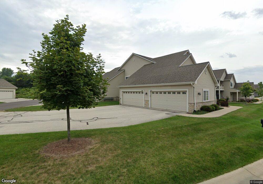
6954 N Weather Edge Cir Unit 251 Lannon, WI 53046
Estimated Value: $382,289 - $502,000
--
Bed
--
Bath
--
Sq Ft
12
Acres
About This Home
This home is located at 6954 N Weather Edge Cir Unit 251, Lannon, WI 53046 and is currently estimated at $431,822. 6954 N Weather Edge Cir Unit 251 is a home located in Waukesha County with nearby schools including Lannon Elementary School, Templeton Middle School, and Hamilton High School.
Ownership History
Date
Name
Owned For
Owner Type
Purchase Details
Closed on
Feb 22, 2023
Sold by
Bandy Stephan P
Bought by
Stephan P Bandy And Kristy L Bandy Living Rev
Current Estimated Value
Purchase Details
Closed on
Mar 12, 2018
Sold by
Roberts Gary A and Roberts Patricia L
Bought by
Bandy Stephen P and Bandy Kristy
Purchase Details
Closed on
Jun 16, 2008
Sold by
Whispering Ridge Development Llc
Bought by
Roberts Gary A and Roberts Patricia L
Home Financials for this Owner
Home Financials are based on the most recent Mortgage that was taken out on this home.
Original Mortgage
$208,980
Interest Rate
6.05%
Mortgage Type
Purchase Money Mortgage
Create a Home Valuation Report for This Property
The Home Valuation Report is an in-depth analysis detailing your home's value as well as a comparison with similar homes in the area
Home Values in the Area
Average Home Value in this Area
Purchase History
| Date | Buyer | Sale Price | Title Company |
|---|---|---|---|
| Stephan P Bandy And Kristy L Bandy Living Rev | -- | -- | |
| Bandy Stephen P | $266,000 | None Available | |
| Roberts Gary A | $232,200 | Stewart Title Guaranty Co |
Source: Public Records
Mortgage History
| Date | Status | Borrower | Loan Amount |
|---|---|---|---|
| Previous Owner | Roberts Gary A | $208,980 |
Source: Public Records
Tax History Compared to Growth
Tax History
| Year | Tax Paid | Tax Assessment Tax Assessment Total Assessment is a certain percentage of the fair market value that is determined by local assessors to be the total taxable value of land and additions on the property. | Land | Improvement |
|---|---|---|---|---|
| 2024 | $4,236 | $281,600 | $68,000 | $213,600 |
| 2023 | $3,976 | $281,600 | $68,000 | $213,600 |
| 2022 | $3,955 | $281,600 | $68,000 | $213,600 |
| 2021 | $3,356 | $281,600 | $68,000 | $213,600 |
| 2020 | $3,257 | $281,600 | $68,000 | $213,600 |
| 2019 | $2,890 | $213,100 | $45,000 | $168,100 |
| 2018 | $2,734 | $213,100 | $45,000 | $168,100 |
| 2017 | $3,151 | $213,100 | $45,000 | $168,100 |
| 2016 | $2,912 | $213,100 | $45,000 | $168,100 |
| 2015 | $2,963 | $213,100 | $45,000 | $168,100 |
| 2014 | $3,128 | $210,900 | $45,000 | $165,900 |
| 2013 | $3,128 | $210,900 | $45,000 | $165,900 |
Source: Public Records
Map
Nearby Homes
- 21834 N Weather Edge Cir Unit A
- 21679 S Weather Edge Cir
- 21864 N Weather Edge Cir Unit A
- W220N7095 Town Line St
- N66W21277 Sagebrush Dr
- N66W21471 Sagebrush Dr
- N66W21075 Sweet Clover Dr
- N66W20903 Sweet Clover Dr
- N66W21009 Sagebrush Dr
- Lt15 Fairview Dr
- W214N6672 Fairview Dr
- W214N6683 Fairview Dr
- 7018 Stonewood Ln
- 7022 Stonewood Ln
- 7034 Stonewood Ln
- 7038 Stonewood Ln
- 20910 Gray St
- 20900 Gray St
- 20860 Gray St
- W214N6711 Fairview Dr
- 6958 N Weather Edge Cir Unit 252
- 21834 N Weather Edge Cir Unit B
- 21834 N Weather Edge Cir Unit G
- 21834 N Weather Edge Cir Unit H
- 21834 N Weather Edge Cir Unit F
- 21834 N Weather Edge Cir Unit E
- 21834D N Weather Edge Cir Unit 424
- 21864G N Weather Edge Cir Unit 447
- 21864C N Weather Edge Cir Unit 443
- 21890 N Weather Edge Cir Unit D
- 21890 N Weather Edge Cir Unit 21890
- 21890 N Weather Edge Cir Unit H
- 21790 N Weather Edge Cir Unit D
- 21790 N Weather Edge Cir Unit C
- 21790 N Weather Edge Cir Unit A
- 21790 N Weather Edge Cir Unit 21790
- 21890E N Weather Edge Cir Unit 435
- 21778 S Weather Edge Cir Unit 201
- 21867 S Weather Edge Cir
- 21899 S Weather Edge Cir