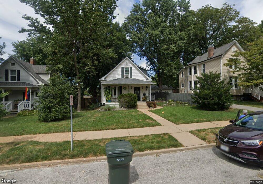
6957 Arthur Ave Saint Louis, MO 63139
Lindenwood Park NeighborhoodEstimated Value: $164,000 - $258,000
--
Bed
3
Baths
1,344
Sq Ft
$153/Sq Ft
Est. Value
About This Home
This home is located at 6957 Arthur Ave, Saint Louis, MO 63139 and is currently estimated at $205,848, approximately $153 per square foot. 6957 Arthur Ave is a home located in St. Louis City with nearby schools including Mason Elementary School, Long International Middle School, and Roosevelt High School.
Ownership History
Date
Name
Owned For
Owner Type
Purchase Details
Closed on
Jul 27, 2004
Sold by
Dwyer Welch Theresa and Welch Gary Lee
Bought by
Schaffer Pamela M and Schaffer Pamela
Current Estimated Value
Home Financials for this Owner
Home Financials are based on the most recent Mortgage that was taken out on this home.
Original Mortgage
$87,000
Interest Rate
6.26%
Mortgage Type
Balloon
Purchase Details
Closed on
May 19, 2000
Sold by
Dwyer Thomas H
Bought by
Dwyer Welch Theresa and Grither Christine Dwyer
Create a Home Valuation Report for This Property
The Home Valuation Report is an in-depth analysis detailing your home's value as well as a comparison with similar homes in the area
Home Values in the Area
Average Home Value in this Area
Purchase History
| Date | Buyer | Sale Price | Title Company |
|---|---|---|---|
| Schaffer Pamela M | -- | -- | |
| Dwyer Welch Theresa | -- | -- |
Source: Public Records
Mortgage History
| Date | Status | Borrower | Loan Amount |
|---|---|---|---|
| Closed | Schaffer Pamela M | $87,000 |
Source: Public Records
Tax History Compared to Growth
Tax History
| Year | Tax Paid | Tax Assessment Tax Assessment Total Assessment is a certain percentage of the fair market value that is determined by local assessors to be the total taxable value of land and additions on the property. | Land | Improvement |
|---|---|---|---|---|
| 2025 | $1,859 | $25,680 | $2,850 | $22,830 |
| 2024 | $1,769 | $21,870 | $2,850 | $19,020 |
| 2023 | $1,769 | $21,870 | $2,850 | $19,020 |
| 2022 | $1,693 | $20,140 | $2,850 | $17,290 |
| 2021 | $1,690 | $20,140 | $2,850 | $17,290 |
| 2020 | $1,537 | $18,430 | $2,850 | $15,580 |
| 2019 | $1,532 | $18,430 | $2,850 | $15,580 |
| 2018 | $1,311 | $15,240 | $2,620 | $12,620 |
| 2017 | $1,289 | $15,240 | $2,620 | $12,620 |
| 2016 | $1,213 | $14,140 | $2,620 | $11,510 |
| 2015 | $1,101 | $14,130 | $2,620 | $11,510 |
| 2014 | $1,060 | $14,130 | $2,620 | $11,510 |
| 2013 | -- | $13,600 | $2,620 | $10,980 |
Source: Public Records
Map
Nearby Homes
- 6953 Arthur Ave
- 3308 Jamieson Ave
- 6811 Marquette Ave
- 6653 Hancock Ave
- 3316 Commonwealth Ave
- 3558 Wabash Ave
- 3203 Ivanhoe Ave
- 6656 Oleatha Ave
- 7038 Pernod Ave
- 6625 Hancock Ave
- 7047 Tholozan Ave
- 6631 Pernod Ave
- 6659 Tholozan Ave
- 6611 Pernod Ave
- 6621 Tholozan Ave
- 6568 Smiley Ave
- 7113 Arsenal St
- 3815 Mccausland Ave Unit 4
- 7114 Drury Ln
- 6523 Fyler Ave
- 6963 Arthur Ave
- 6947 Arthur Ave
- 6958 Fyler Ave
- 6969 Arthur Ave
- 6945 Arthur Ave
- 6939 Arthur Ave
- 6954 Fyler Ave
- 6944 Fyler Ave
- 6954 Arthur Ave
- 6962 Arthur Ave
- 6948 Fyler Ave
- 6948 Arthur Ave
- 6933 Arthur Ave
- 6964 Arthur Ave
- 6944 Arthur Ave
- 6968 Arthur Ave
- 6938 Arthur Ave
- 6974 Arthur Ave
- 6938 Fyler Ave
- 6929 Arthur Ave