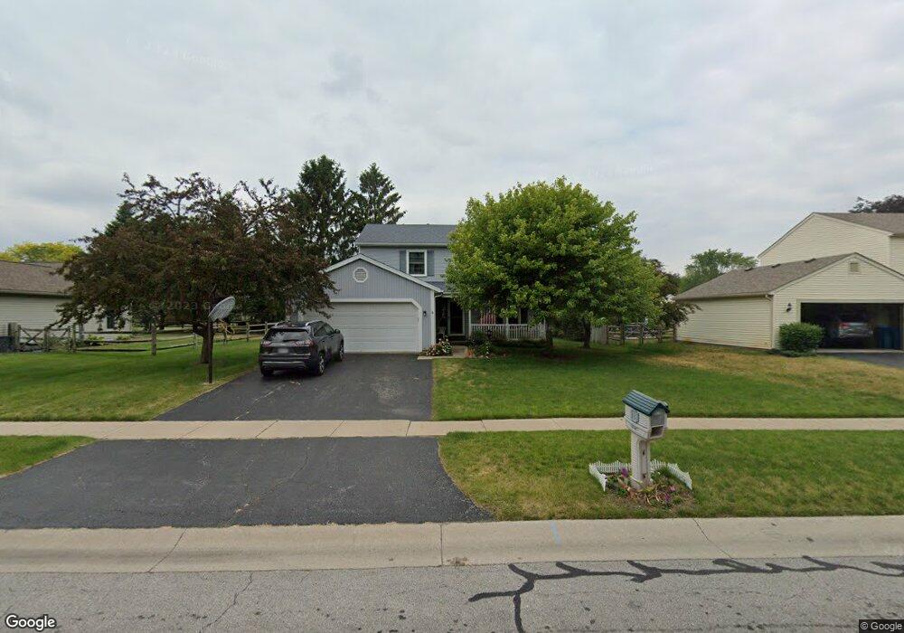
6958 Oakshade Rd Sylvania, OH 43560
Estimated Value: $310,686 - $335,000
4
Beds
3
Baths
1,926
Sq Ft
$169/Sq Ft
Est. Value
About This Home
This home is located at 6958 Oakshade Rd, Sylvania, OH 43560 and is currently estimated at $325,672, approximately $169 per square foot. 6958 Oakshade Rd is a home located in Lucas County with nearby schools including Stranahan Elementary School, Sylvania Timberstone Junior High School, and Sylvania Southview High School.
Ownership History
Date
Name
Owned For
Owner Type
Purchase Details
Closed on
Jan 11, 2008
Sold by
Borell John A
Bought by
Borell John A and Borell Peggy J
Current Estimated Value
Home Financials for this Owner
Home Financials are based on the most recent Mortgage that was taken out on this home.
Original Mortgage
$85,000
Interest Rate
6.17%
Mortgage Type
New Conventional
Purchase Details
Closed on
Jan 7, 2008
Sold by
Borell John A and Borell Peggy J
Bought by
Borell John A
Home Financials for this Owner
Home Financials are based on the most recent Mortgage that was taken out on this home.
Original Mortgage
$85,000
Interest Rate
6.17%
Mortgage Type
New Conventional
Purchase Details
Closed on
Sep 15, 1988
Create a Home Valuation Report for This Property
The Home Valuation Report is an in-depth analysis detailing your home's value as well as a comparison with similar homes in the area
Home Values in the Area
Average Home Value in this Area
Purchase History
| Date | Buyer | Sale Price | Title Company |
|---|---|---|---|
| Borell John A | -- | Liberty Title | |
| Borell John A | -- | Liberty Title | |
| -- | $26,900 | -- |
Source: Public Records
Mortgage History
| Date | Status | Borrower | Loan Amount |
|---|---|---|---|
| Closed | Borell John A | $85,000 |
Source: Public Records
Tax History Compared to Growth
Tax History
| Year | Tax Paid | Tax Assessment Tax Assessment Total Assessment is a certain percentage of the fair market value that is determined by local assessors to be the total taxable value of land and additions on the property. | Land | Improvement |
|---|---|---|---|---|
| 2024 | $2,188 | $77,385 | $15,435 | $61,950 |
| 2023 | $4,052 | $62,825 | $12,600 | $50,225 |
| 2022 | $4,082 | $62,825 | $12,600 | $50,225 |
| 2021 | $4,180 | $62,825 | $12,600 | $50,225 |
| 2020 | $4,046 | $55,090 | $10,990 | $44,100 |
| 2019 | $3,898 | $55,090 | $10,990 | $44,100 |
| 2018 | $3,674 | $55,090 | $10,990 | $44,100 |
| 2017 | $3,735 | $49,175 | $10,920 | $38,255 |
| 2016 | $3,664 | $140,500 | $31,200 | $109,300 |
| 2015 | $3,456 | $140,500 | $31,200 | $109,300 |
| 2014 | $3,241 | $47,290 | $10,500 | $36,790 |
| 2013 | $3,241 | $47,290 | $10,500 | $36,790 |
Source: Public Records
Map
Nearby Homes
- 3800 Harrowsfield Rd
- 3655 Woodspring Rd
- 3757 N Mccord Rd
- 6606 Blossman Rd
- 21 Shenandoah Cir
- 22 Shenandoah Cir
- 3507 Indian Oaks Ln
- 6657 Margate Blvd Unit 3
- 6732 5th Ave
- 6718 5th Ave Unit F
- 7413 Sylvania Ave
- 3302 Zone Ave
- 4301 Appomattox Dr
- 6537 Woodhall Dr Unit 8
- 4022 Stonehenge Dr Unit 4022
- 6537 Abbey Run Unit D5
- 6554 Abbey Run Unit 5
- 6636 Kingsbridge Dr Unit 4
- 6626 Kingsbridge Dr Unit 4
- 3330 Wilford Dr
- 6966 Oakshade Rd
- 3738 Wheatlands Rd
- 3746 Wheatlands Rd
- 3725 Farmbrook Dr
- 3735 Farmbrook Dr
- 6953 Oakshade Rd
- 3709 Woodspring Rd
- 6947 Oakshade Rd
- 3752 Wheatlands Rd
- 3741 Farmbrook Dr
- 6941 Oakshade Rd
- 3725 Wheatlands Rd
- 7006 Oakshade Rd
- 3737 Wheatlands Rd
- 3731 Wheatlands Rd
- 3701 Woodspring Rd
- 3747 Farmbrook Dr
- 3760 Wheatlands Rd
- 3680 Woodspring Rd
- 3726 Rye Hill Ln