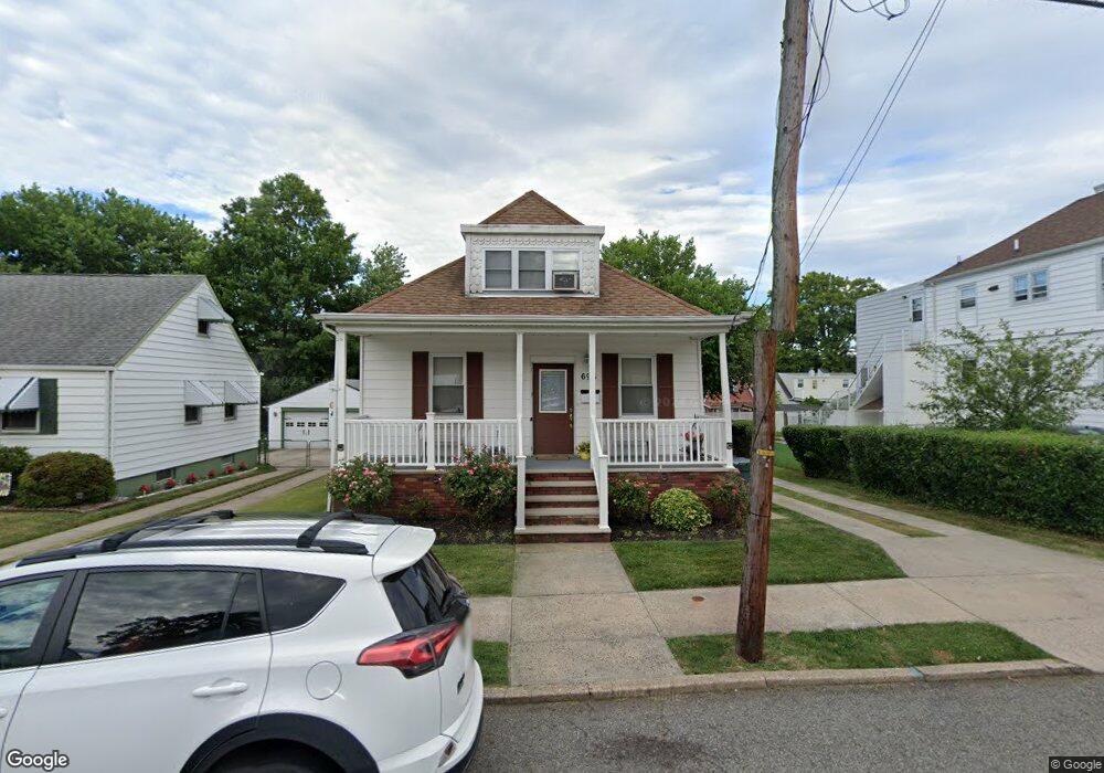
696 Colgate Ave Perth Amboy, NJ 08861
Chickentown NeighborhoodEstimated Value: $424,000 - $574,000
--
Bed
--
Bath
1,545
Sq Ft
$322/Sq Ft
Est. Value
About This Home
This home is located at 696 Colgate Ave, Perth Amboy, NJ 08861 and is currently estimated at $497,385, approximately $321 per square foot. 696 Colgate Ave is a home located in Middlesex County with nearby schools including Perth Amboy High School, Academy for Urban Leadership Charter School, and Assumption Catholic School.
Ownership History
Date
Name
Owned For
Owner Type
Purchase Details
Closed on
Feb 28, 2001
Sold by
Torres David
Bought by
Jimenez Ken and Jimenez Ramona
Current Estimated Value
Purchase Details
Closed on
Oct 17, 1996
Sold by
Stankovitz Dennis
Bought by
Torres David
Home Financials for this Owner
Home Financials are based on the most recent Mortgage that was taken out on this home.
Original Mortgage
$95,000
Interest Rate
8.22%
Create a Home Valuation Report for This Property
The Home Valuation Report is an in-depth analysis detailing your home's value as well as a comparison with similar homes in the area
Home Values in the Area
Average Home Value in this Area
Purchase History
| Date | Buyer | Sale Price | Title Company |
|---|---|---|---|
| Jimenez Ken | $125,000 | -- | |
| Torres David | $105,000 | -- |
Source: Public Records
Mortgage History
| Date | Status | Borrower | Loan Amount |
|---|---|---|---|
| Previous Owner | Torres David | $95,000 |
Source: Public Records
Tax History Compared to Growth
Tax History
| Year | Tax Paid | Tax Assessment Tax Assessment Total Assessment is a certain percentage of the fair market value that is determined by local assessors to be the total taxable value of land and additions on the property. | Land | Improvement |
|---|---|---|---|---|
| 2025 | $8,064 | $267,300 | $123,000 | $144,300 |
| 2024 | $8,048 | $267,300 | $123,000 | $144,300 |
| 2023 | $8,048 | $267,300 | $123,000 | $144,300 |
| 2022 | $7,952 | $267,300 | $123,000 | $144,300 |
| 2021 | $7,963 | $267,300 | $123,000 | $144,300 |
| 2020 | $7,960 | $267,300 | $123,000 | $144,300 |
| 2019 | $7,990 | $267,300 | $123,000 | $144,300 |
| 2018 | $7,920 | $267,300 | $123,000 | $144,300 |
| 2017 | $7,904 | $267,300 | $123,000 | $144,300 |
| 2016 | $7,698 | $267,300 | $123,000 | $144,300 |
| 2015 | $7,752 | $267,300 | $123,000 | $144,300 |
| 2014 | $7,800 | $267,300 | $123,000 | $144,300 |
Source: Public Records
Map
Nearby Homes
- 700 Colgate Ave
- 692 Colgate Ave
- 699 Raritan Ave
- 697 Raritan Ave
- 701 Raritan Ave
- 688 Colgate Ave
- 704 Colgate Ave
- 695 Raritan Ave
- 705 Raritan Ave
- 693 Raritan Ave
- 706 Colgate Ave
- 686 Colgate Ave
- 695 Colgate Ave
- 697 Colgate Ave
- 699 Colgate Ave
- 709 Raritan Ave
- 689 Raritan Ave
- 693 Colgate Ave
- 701 Colgate Ave
- 691 Colgate Ave