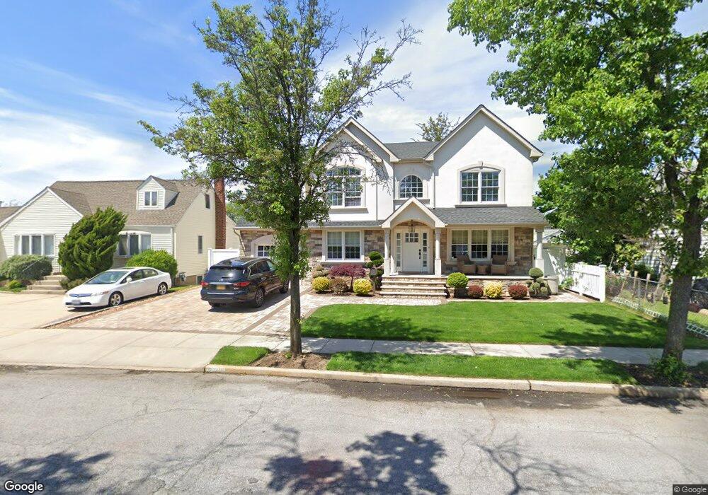
696 Forte Blvd Franklin Square, NY 11010
Estimated Value: $926,000 - $1,436,245
5
Beds
2
Baths
2,904
Sq Ft
$407/Sq Ft
Est. Value
About This Home
This home is located at 696 Forte Blvd, Franklin Square, NY 11010 and is currently estimated at $1,181,123, approximately $406 per square foot. 696 Forte Blvd is a home located in Nassau County with nearby schools including Hebrew Academy of Nassau County (HANC), The Waldorf School of Garden City, and Our Lady of Lourdes School.
Ownership History
Date
Name
Owned For
Owner Type
Purchase Details
Closed on
Sep 23, 2014
Sold by
Pugh Margaret and Aprea Phyllis
Bought by
Cardoso Duarte
Current Estimated Value
Home Financials for this Owner
Home Financials are based on the most recent Mortgage that was taken out on this home.
Original Mortgage
$371,200
Outstanding Balance
$283,757
Interest Rate
4.1%
Mortgage Type
Purchase Money Mortgage
Estimated Equity
$897,366
Purchase Details
Closed on
Dec 22, 2007
Sold by
Aprea Michael
Create a Home Valuation Report for This Property
The Home Valuation Report is an in-depth analysis detailing your home's value as well as a comparison with similar homes in the area
Home Values in the Area
Average Home Value in this Area
Purchase History
| Date | Buyer | Sale Price | Title Company |
|---|---|---|---|
| Cardoso Duarte | $464,000 | None Available | |
| -- | -- | -- |
Source: Public Records
Mortgage History
| Date | Status | Borrower | Loan Amount |
|---|---|---|---|
| Open | Cardoso Duarte | $371,200 |
Source: Public Records
Tax History Compared to Growth
Tax History
| Year | Tax Paid | Tax Assessment Tax Assessment Total Assessment is a certain percentage of the fair market value that is determined by local assessors to be the total taxable value of land and additions on the property. | Land | Improvement |
|---|---|---|---|---|
| 2025 | $17,927 | $854 | $348 | $506 |
| 2024 | $7,282 | $817 | $348 | $469 |
| 2023 | $15,307 | $771 | $326 | $445 |
| 2022 | $15,307 | $824 | $348 | $476 |
| 2021 | $21,449 | $809 | $342 | $467 |
| 2020 | $16,641 | $1,076 | $556 | $520 |
| 2019 | $15,792 | $1,153 | $465 | $688 |
| 2018 | $16,046 | $1,085 | $0 | $0 |
| 2017 | $7,501 | $1,026 | $596 | $430 |
| 2016 | $12,720 | $1,026 | $596 | $430 |
| 2015 | -- | $1,026 | $596 | $430 |
| 2014 | -- | $1,026 | $596 | $430 |
| 2013 | $3,429 | $1,026 | $596 | $430 |
Source: Public Records
Map
Nearby Homes
- 757 Marion St
- 791 Caryl St
- 576 Western Park Dr
- 249 Grange St
- 279 Semton Blvd
- 350 Paul Place
- 600 Dogwood Ave
- 301 Hoffman St
- 231 Dogwood Ave
- 956 Hancock Ave
- 850 First Ave
- 19 Richard St
- 190 Commonwealth St
- 422 Saint Agnes Place
- 708 Anderson Ave
- 242 James St
- 198 Guildford Ct
- 249 Hoffman St
- 303 Nassau Blvd
- 911 First Ave