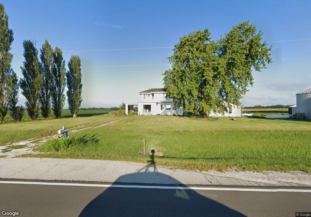
696 Illinois 96 Warsaw, IL 62379
Estimated Value: $69,000 - $176,000
4
Beds
2
Baths
2,432
Sq Ft
$43/Sq Ft
Est. Value
About This Home
This home is located at 696 Illinois 96, Warsaw, IL 62379 and is currently estimated at $105,022, approximately $43 per square foot. 696 Illinois 96 is a home located in Hancock County with nearby schools including Warsaw Elementary School and Warsaw Senior High School.
Ownership History
Date
Name
Owned For
Owner Type
Purchase Details
Closed on
Nov 21, 2024
Bought by
Silverwood Brent
Current Estimated Value
Home Financials for this Owner
Home Financials are based on the most recent Mortgage that was taken out on this home.
Original Mortgage
$47,000
Outstanding Balance
$46,456
Interest Rate
6.32%
Mortgage Type
New Conventional
Estimated Equity
$58,566
Purchase Details
Closed on
Oct 6, 2018
Bought by
Jimenez Jeanne
Purchase Details
Closed on
Feb 3, 2015
Sold by
Boley Dennis D and Boley Brandy
Bought by
Beeler Austin L and Beeler Elizabeth D
Create a Home Valuation Report for This Property
The Home Valuation Report is an in-depth analysis detailing your home's value as well as a comparison with similar homes in the area
Home Values in the Area
Average Home Value in this Area
Purchase History
| Date | Buyer | Sale Price | Title Company |
|---|---|---|---|
| Silverwood Brent | $67,000 | -- | |
| Silverwood Brent | $67,000 | None Listed On Document | |
| Jimenez Jeanne | $78,250 | -- | |
| Beeler Austin L | -- | -- |
Source: Public Records
Mortgage History
| Date | Status | Borrower | Loan Amount |
|---|---|---|---|
| Open | Silverwood Brent | $47,000 |
Source: Public Records
Tax History Compared to Growth
Tax History
| Year | Tax Paid | Tax Assessment Tax Assessment Total Assessment is a certain percentage of the fair market value that is determined by local assessors to be the total taxable value of land and additions on the property. | Land | Improvement |
|---|---|---|---|---|
| 2024 | $3,004 | $38,243 | $1,569 | $36,674 |
| 2023 | $3,004 | $37,723 | $1,548 | $36,175 |
| 2022 | $2,872 | $32,539 | $1,335 | $31,204 |
| 2021 | $2,430 | $28,696 | $1,177 | $27,519 |
| 2020 | $2,384 | $27,046 | $1,109 | $25,937 |
| 2019 | $2,397 | $26,386 | $1,082 | $25,304 |
| 2018 | $1,891 | $27,258 | $1,118 | $26,140 |
| 2017 | $1,710 | $24,110 | $1,118 | $22,992 |
| 2015 | -- | $24,375 | $1,107 | $23,268 |
| 2014 | -- | $25,825 | $1,040 | $24,785 |
Source: Public Records
Map
Nearby Homes
- 1275 Francis Sartory Rd
- 3 Jermar Ct
- 0 E Co Road 350 Unit 23229905
- 420 Orleans Ct
- 725 Bunker Dr
- 1182 N Co Road 630
- 320 Le Claire St
- 640 Crawford St
- 445 Wilcox St
- 455 S 6th St
- 615 Webster St
- 335 Cedar St
- 945 Lafayette St
- 805 Mulberry St
- 515 Clay St
- 515 Mulberry St
- 205 Clay St
- 401 N 3rd St
- 255 N 2nd St
- 255 Polk St