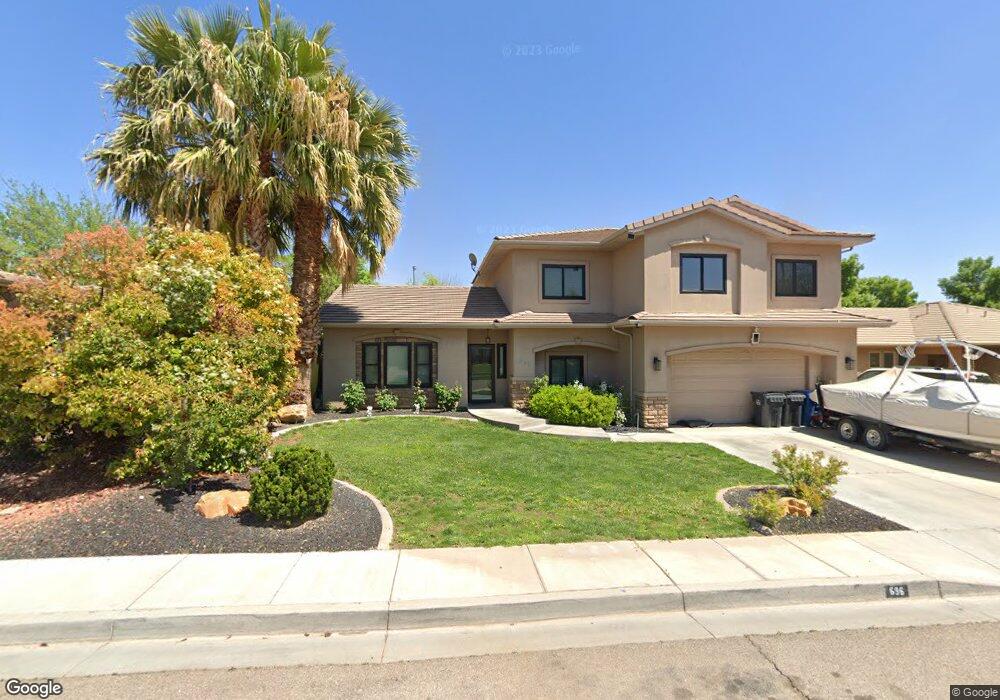
696 N 1620 West Cir Saint George, UT 84770
Estimated Value: $438,000 - $668,000
4
Beds
3
Baths
2,554
Sq Ft
$216/Sq Ft
Est. Value
About This Home
This home is located at 696 N 1620 West Cir, Saint George, UT 84770 and is currently estimated at $550,961, approximately $215 per square foot. 696 N 1620 West Cir is a home located in Washington County with nearby schools including Sunset School, Snow Canyon Middle School, and Lava Ridge Intermediate School.
Ownership History
Date
Name
Owned For
Owner Type
Purchase Details
Closed on
Nov 17, 2008
Sold by
Gomez Tomas and Galdamez Sonia
Bought by
Hubbard Mike S and Hubbard Kara T
Current Estimated Value
Home Financials for this Owner
Home Financials are based on the most recent Mortgage that was taken out on this home.
Original Mortgage
$261,952
Outstanding Balance
$171,867
Interest Rate
6.07%
Mortgage Type
FHA
Estimated Equity
$379,094
Purchase Details
Closed on
Jun 23, 2006
Sold by
Puffer O Todd and Puffer Elena C
Bought by
Gomez Tomas and Galdamez Sonia
Home Financials for this Owner
Home Financials are based on the most recent Mortgage that was taken out on this home.
Original Mortgage
$73,000
Interest Rate
6.63%
Mortgage Type
Stand Alone Second
Create a Home Valuation Report for This Property
The Home Valuation Report is an in-depth analysis detailing your home's value as well as a comparison with similar homes in the area
Home Values in the Area
Average Home Value in this Area
Purchase History
| Date | Buyer | Sale Price | Title Company |
|---|---|---|---|
| Hubbard Mike S | -- | United Title Services | |
| Gomez Tomas | -- | United Title Services |
Source: Public Records
Mortgage History
| Date | Status | Borrower | Loan Amount |
|---|---|---|---|
| Open | Hubbard Mike S | $261,952 | |
| Previous Owner | Gomez Tomas | $73,000 | |
| Previous Owner | Gomez Tomas | $292,000 |
Source: Public Records
Tax History Compared to Growth
Tax History
| Year | Tax Paid | Tax Assessment Tax Assessment Total Assessment is a certain percentage of the fair market value that is determined by local assessors to be the total taxable value of land and additions on the property. | Land | Improvement |
|---|---|---|---|---|
| 2025 | $1,828 | $278,740 | $46,750 | $231,990 |
| 2023 | $1,930 | $288,420 | $35,750 | $252,670 |
| 2022 | $2,023 | $284,240 | $35,750 | $248,490 |
| 2021 | $1,838 | $385,200 | $45,000 | $340,200 |
| 2020 | $1,671 | $329,800 | $45,000 | $284,800 |
| 2019 | $1,616 | $311,500 | $50,000 | $261,500 |
| 2018 | $1,464 | $145,695 | $0 | $0 |
| 2017 | $1,312 | $126,830 | $0 | $0 |
| 2016 | $1,366 | $122,100 | $0 | $0 |
| 2015 | $1,299 | $111,430 | $0 | $0 |
| 2014 | $1,409 | $121,605 | $0 | $0 |
Source: Public Records
Map
Nearby Homes
- 1732 N 540 W Unit 120
- 1732 W 540 N Unit 120
- 1732 W 540 N Unit 13
- 1732 W 540 N Unit 68
- 1732 W 540 N Unit 17
- 1732 W 540 N Unit 92
- 1385 W 625 N
- 1385 W 625 North St
- 1735 W 540 N Unit 1006
- 1735 W 540 N Unit 2302
- 1735 W 540 N Unit 2302
- 1735 W 540 N Unit 1202
- 1735 W 540 N Unit 1001
- 954 N 1725 W Unit 32
- 1793 W 950 N Unit 3
- 727 N 1275 W
- 1708 W 1020 N Unit 146
- 695 N Daybreak Dr
- 1244 W 620 Cir N
- 1742 W 1020 N Unit 123
- 696 N 1620 W
- 710 N 1620 West Cir
- 682 N 1620 West Cir
- 682 N 1620 W
- 710 N 1620 Cir W
- 699 N 1590 W
- 707 N 1590 W
- 724 N 1620 Cir W
- 724 N 1620 West Cir
- 695 N 1620 Cir W
- 695 N 1620 West Cir
- 668 N 1620 Cir W
- 668 N 1620 West Cir
- 709 N 1620 West Cir
- 681 N 1620 W
- 681 N 1620 West Cir
- 1600 W 700 N
- 721 N 1590 W
- 709 N 1620 Cir W
- 1602 W 650 N