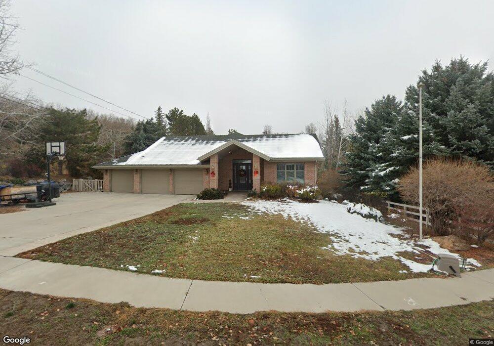
696 Riverbirch Cir American Fork, UT 84003
Estimated Value: $1,084,000 - $1,578,000
5
Beds
5
Baths
5,786
Sq Ft
$217/Sq Ft
Est. Value
About This Home
This home is located at 696 Riverbirch Cir, American Fork, UT 84003 and is currently estimated at $1,257,967, approximately $217 per square foot. 696 Riverbirch Cir is a home located in Utah County with nearby schools including Barratt Elementary School, American Fork Junior High School, and American Fork High School.
Ownership History
Date
Name
Owned For
Owner Type
Purchase Details
Closed on
Aug 9, 2017
Sold by
Wong Kei Fung and Wong Yuki Wai
Bought by
Wong Yuk Wai and Poon Tsz Ki
Current Estimated Value
Purchase Details
Closed on
Feb 26, 2015
Sold by
Callahan Michael E and Callahan Leslie A
Bought by
Wong Kei Fung and Wong Yuk Wai
Purchase Details
Closed on
Sep 11, 2014
Sold by
Callahan Michael E and Callahan Leslie A
Bought by
Michael And Leslie Callahan Family Trust and Callahan Leslie A
Purchase Details
Closed on
Aug 22, 2014
Sold by
Robinson James S and Robinson Debra A
Bought by
Robinson James S and Robinson Debra Ann
Purchase Details
Closed on
Apr 28, 2010
Sold by
Michael Earl Callahan Family Limited Par
Bought by
Callahan Michael E and Callahan Leslie A
Purchase Details
Closed on
Jun 24, 2003
Sold by
Callahan Michael E and Callahan Leslie
Bought by
Michael Earl Callahan Family Lp
Home Financials for this Owner
Home Financials are based on the most recent Mortgage that was taken out on this home.
Original Mortgage
$533,200
Interest Rate
5.37%
Purchase Details
Closed on
Feb 3, 2003
Sold by
Callahan Michael E and Callahan Leslie A
Bought by
Michael Earl Callahan Family Lp
Create a Home Valuation Report for This Property
The Home Valuation Report is an in-depth analysis detailing your home's value as well as a comparison with similar homes in the area
Home Values in the Area
Average Home Value in this Area
Purchase History
| Date | Buyer | Sale Price | Title Company |
|---|---|---|---|
| Wong Yuk Wai | -- | None Available | |
| Wong Kei Fung | -- | Select Title Ins Agency | |
| Michael And Leslie Callahan Family Trust | -- | None Available | |
| Robinson James S | -- | None Available | |
| Callahan Michael E | -- | Greenbrier Title Insurance | |
| Michael Earl Callahan Family Lp | -- | Signature Title | |
| Callahan Michael A | -- | Signature Title | |
| Michael Earl Callahan Family Lp | -- | -- |
Source: Public Records
Mortgage History
| Date | Status | Borrower | Loan Amount |
|---|---|---|---|
| Previous Owner | Callahan Michael A | $533,200 |
Source: Public Records
Tax History Compared to Growth
Tax History
| Year | Tax Paid | Tax Assessment Tax Assessment Total Assessment is a certain percentage of the fair market value that is determined by local assessors to be the total taxable value of land and additions on the property. | Land | Improvement |
|---|---|---|---|---|
| 2025 | $4,806 | $605,660 | $326,900 | $774,300 |
| 2024 | $4,806 | $534,050 | $0 | $0 |
| 2023 | $4,473 | $526,955 | $0 | $0 |
| 2022 | $4,712 | $547,745 | $0 | $0 |
| 2021 | $4,130 | $750,000 | $228,900 | $521,100 |
| 2020 | $4,021 | $708,200 | $211,900 | $496,300 |
| 2019 | $3,672 | $668,800 | $202,900 | $465,900 |
| 2018 | $3,581 | $623,700 | $157,800 | $465,900 |
| 2017 | $3,650 | $343,035 | $0 | $0 |
| 2016 | $3,653 | $319,000 | $0 | $0 |
| 2015 | $3,710 | $307,505 | $0 | $0 |
| 2014 | -- | $292,600 | $0 | $0 |
Source: Public Records
Map
Nearby Homes
- 435 N 800 E
- 1045 N 930 E Unit 58
- 1053 N 930 E Unit 73
- The McKenzie Plan at Autumn Crest
- The Christine Plan at Autumn Crest
- The Avery Plan at Autumn Crest
- The Madison Plan at Autumn Crest
- The Roosevelt Plan at Autumn Crest
- The Annie Plan at Autumn Crest
- The Michelle Plan at Autumn Crest
- 410 N 600 E
- 1121 E 580 N
- 1059 N 930 E
- 1058 N 930 E Unit 64
- 1089 N 950 E
- 926 N 400 E
- 290 Chipman Ave
- 1038 N 350 E
- 1024 N 350 E
- 1008 N 350 E
- 688 Riverbirch Cir
- 167 E 700 N
- 167 E 700 N Unit 2
- 984 E 700 N Unit 1.00
- 672 Riverbirch Cir
- 697 Riverbirch Cir
- 675 Riverbirch Cir
- 783 E 700 N
- 826 E 700 N
- 761 E 700 N
- 664 Riverbirch Cir
- 663 Riverbirch Cir
- 730 E 700 N
- 730 E 700 N Unit 7
- 730 E 700 N Unit 11
- 730 E 700 N Unit 10
- 730 E 700 N Unit 9
- 730 E 700 N Unit 8
- 730 E 700 N Unit 1
- 730 E 700 N Unit 3