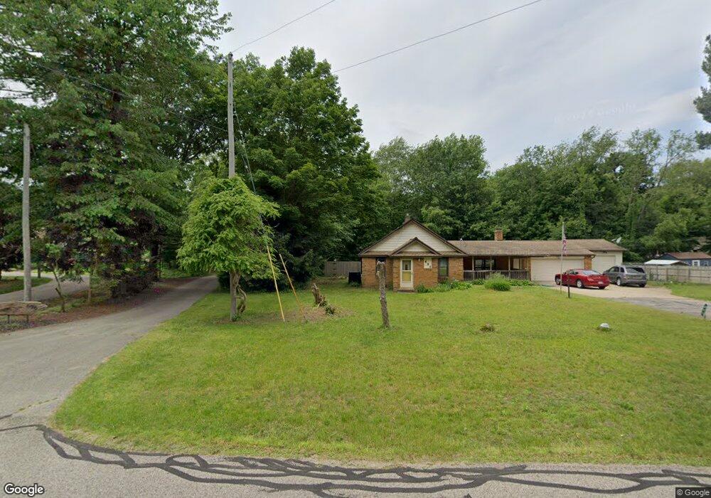
696 Whitman Ave Holland, MI 49423
Estimated Value: $402,000 - $501,972
2
Beds
2
Baths
1,408
Sq Ft
$321/Sq Ft
Est. Value
About This Home
This home is located at 696 Whitman Ave, Holland, MI 49423 and is currently estimated at $452,493, approximately $321 per square foot. 696 Whitman Ave is a home located in Ottawa County with nearby schools including Holland High School, Vanderbilt Charter Academy, and Calvary Schools of Holland - Plasman Campus.
Ownership History
Date
Name
Owned For
Owner Type
Purchase Details
Closed on
Jun 28, 2012
Sold by
Huizinga John and Huizinga Carol J
Bought by
Wallin Louis W and Wallin Barbara A
Current Estimated Value
Home Financials for this Owner
Home Financials are based on the most recent Mortgage that was taken out on this home.
Original Mortgage
$148,500
Outstanding Balance
$23,033
Interest Rate
3.83%
Mortgage Type
New Conventional
Estimated Equity
$429,460
Purchase Details
Closed on
Jan 20, 2004
Sold by
Huizinga John and Huizinga Carol J
Bought by
Huizinga John and Huizinga Carol J
Create a Home Valuation Report for This Property
The Home Valuation Report is an in-depth analysis detailing your home's value as well as a comparison with similar homes in the area
Home Values in the Area
Average Home Value in this Area
Purchase History
| Date | Buyer | Sale Price | Title Company |
|---|---|---|---|
| Wallin Louis W | $165,000 | Lighthouse Title Inc | |
| Huizinga John | -- | -- |
Source: Public Records
Mortgage History
| Date | Status | Borrower | Loan Amount |
|---|---|---|---|
| Open | Wallin Louis W | $148,500 |
Source: Public Records
Tax History Compared to Growth
Tax History
| Year | Tax Paid | Tax Assessment Tax Assessment Total Assessment is a certain percentage of the fair market value that is determined by local assessors to be the total taxable value of land and additions on the property. | Land | Improvement |
|---|---|---|---|---|
| 2025 | $3,039 | $234,200 | $0 | $0 |
| 2024 | $1,998 | $217,400 | $0 | $0 |
| 2023 | $1,916 | $195,900 | $0 | $0 |
| 2022 | $2,723 | $177,100 | $0 | $0 |
| 2021 | $2,854 | $156,200 | $0 | $0 |
| 2020 | $2,865 | $146,200 | $0 | $0 |
| 2019 | $2,930 | $134,800 | $0 | $0 |
| 2018 | $2,714 | $109,400 | $0 | $0 |
| 2017 | $2,695 | $109,400 | $0 | $0 |
| 2016 | $2,678 | $97,800 | $0 | $0 |
| 2015 | -- | $89,800 | $0 | $0 |
| 2014 | -- | $84,200 | $0 | $0 |
Source: Public Records
Map
Nearby Homes
- 1761 S Shore Dr
- 1704 Summit St
- 645 Harrington Ave
- 1933 S Shore Dr
- 1981 N Shorewood Ln Unit 6
- 1982 S Shore Dr Unit 2
- 1992 S Shore Dr Unit 2
- 1992 S Shore Dr Unit 3
- 1991 N Shorewood Ln Unit 4
- The Andover 3 Plan at Shorewood Lane
- The Andover 2 Plan at Shorewood Lane
- Andover Plan at Shorewood Lane
- 1995 N Shorewood Ln Unit 2
- 1504 S Shore Dr
- 6579 Partridge Ln
- 4732 Northern Ct Unit 18
- 1337 Heather Dr
- 1331 Bayview Dr
- 1329 Bayview Dr
- 6621 Forest Beach Dr
- 1796 S Shore Dr
- 702 Whitman Ave
- 678 Whitman Ave
- 697 Coolidge Ave
- 1798 S Shore Dr
- 674 Whitman Ave
- 691 Coolidge Ave
- 709 Coolidge Ave
- 662 Whitman Ave
- 703 Coolidge Ave
- 683 Whitman Ave
- 1748 Virginia Place
- 677 Whitman Ave
- 1792 S Shore Dr
- 656 Whitman Ave
- 694 Coolidge Ave
- 719 Coolidge Ave
- 1754 Virginia Place
- 1716 Virginia Place
- 671 Whitman Ave