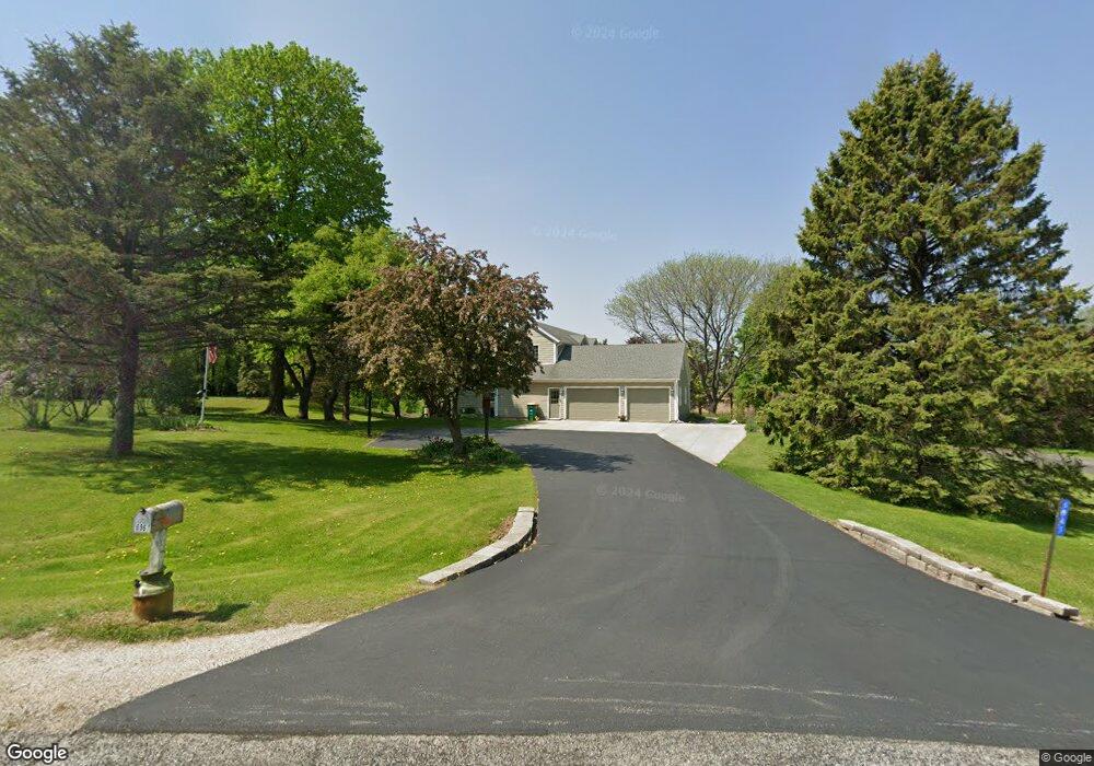
6961 Colt Cir West Bend, WI 53090
Estimated Value: $454,503 - $553,000
Studio
--
Bath
--
Sq Ft
46,609
Sq Ft Lot
About This Home
This home is located at 6961 Colt Cir, West Bend, WI 53090 and is currently estimated at $511,376. 6961 Colt Cir is a home located in Washington County with nearby schools including Green Tree Elementary School, Silverbrook Intermediate School, and East High School.
Ownership History
Date
Name
Owned For
Owner Type
Purchase Details
Closed on
Aug 11, 2006
Sold by
Discher Laerence E and Discher Catherine C
Bought by
Lemke John and Lemke Sara
Current Estimated Value
Home Financials for this Owner
Home Financials are based on the most recent Mortgage that was taken out on this home.
Original Mortgage
$265,000
Outstanding Balance
$155,107
Interest Rate
6.78%
Mortgage Type
New Conventional
Estimated Equity
$356,269
Create a Home Valuation Report for This Property
The Home Valuation Report is an in-depth analysis detailing your home's value as well as a comparison with similar homes in the area
Home Values in the Area
Average Home Value in this Area
Purchase History
| Date | Buyer | Sale Price | Title Company |
|---|---|---|---|
| Lemke John | $295,000 | None Available |
Source: Public Records
Mortgage History
| Date | Status | Borrower | Loan Amount |
|---|---|---|---|
| Open | Lemke John | $265,000 |
Source: Public Records
Tax History
| Year | Tax Paid | Tax Assessment Tax Assessment Total Assessment is a certain percentage of the fair market value that is determined by local assessors to be the total taxable value of land and additions on the property. | Land | Improvement |
|---|---|---|---|---|
| 2025 | $3,424 | $275,700 | $51,800 | $223,900 |
| 2024 | $3,218 | $275,700 | $51,800 | $223,900 |
| 2023 | $2,893 | $275,700 | $51,800 | $223,900 |
| 2022 | $3,047 | $275,700 | $51,800 | $223,900 |
| 2021 | $3,249 | $275,700 | $51,800 | $223,900 |
| 2020 | $3,308 | $275,700 | $51,800 | $223,900 |
| 2019 | $3,158 | $275,700 | $51,800 | $223,900 |
| 2018 | $3,148 | $275,700 | $51,800 | $223,900 |
| 2017 | $3,087 | $275,700 | $51,800 | $223,900 |
| 2016 | $3,211 | $275,700 | $51,800 | $223,900 |
| 2015 | $3,128 | $275,700 | $51,800 | $223,900 |
| 2014 | $3,128 | $275,700 | $51,800 | $223,900 |
| 2013 | $3,551 | $275,700 | $51,800 | $223,900 |
Source: Public Records
Map
Nearby Homes
- 4444 Wurbro Dr
- 4593 Beaver Dam Rd
- 7165 Town Line Rd
- 4538 Church Dr
- 3222 Windsor Place
- Lt1 Beaver Dam Rd
- 6215 Riesch Rd
- 1423 Lower Forest Ct
- Lt1 Alpine Dr
- 6386 Alpine Dr
- 5036 County Highway D
- 715 Canterberry Ct Unit 109
- 715 Canterberry Ct Unit 105
- 2346 W Washington St
- 7864 Noah Ln
- 7345 Friendly Dr
- 4000 W Washington St
- 3460 Town Hall Rd
- 151 N University Dr Unit 215
- 125 N University Dr Unit 108
- 6945 Colt Cir
- 6927 Colt Cir
- 6946 Colt Cir
- 6966 Colt Cir
- 6978 Colt Cir
- 6972 Colt Cir
- 6960 Colt Cir
- 6930 Colt Cir
- 4447 Fox Hunter Ct
- 6915 Colt Cir
- 6916 Colt Cir
- 4401 Fox Hunter Ct
- 4470 Schuster Dr
- 6905 Colt Cir
- 7011 Raintree Ln
- 7014 Raintree Ln
- 6914 Colt Cir
- 4480 Schuster Dr
- 6951 Glacier Dr
- 7010 Glacier Dr
Your Personal Tour Guide
Ask me questions while you tour the home.