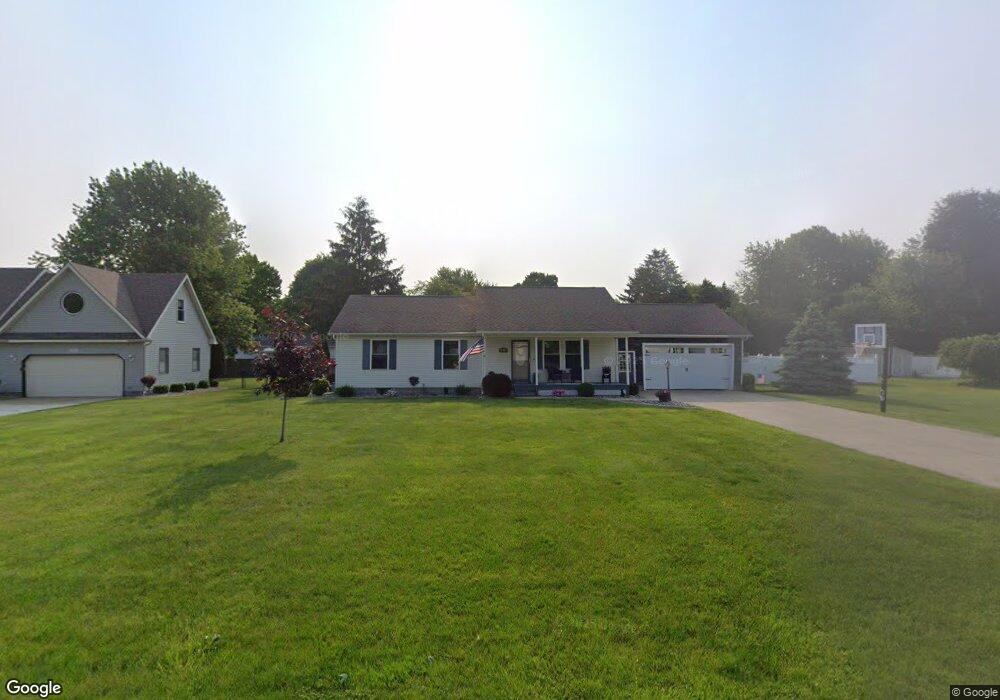
6966 Westwood Dr Conneaut, OH 44030
Kingsville NeighborhoodEstimated Value: $241,265 - $288,000
3
Beds
2
Baths
1,288
Sq Ft
$199/Sq Ft
Est. Value
About This Home
This home is located at 6966 Westwood Dr, Conneaut, OH 44030 and is currently estimated at $256,066, approximately $198 per square foot. 6966 Westwood Dr is a home located in Ashtabula County with nearby schools including Kingsville Elementary School, Ridgeview Elementary School, and Wallace H. Braden Junior High School.
Ownership History
Date
Name
Owned For
Owner Type
Purchase Details
Closed on
Nov 3, 2004
Sold by
Paulino Joseph H
Bought by
Hubbard Kevin R and Hubbard Stephany L
Current Estimated Value
Home Financials for this Owner
Home Financials are based on the most recent Mortgage that was taken out on this home.
Original Mortgage
$132,050
Outstanding Balance
$66,029
Interest Rate
5.81%
Mortgage Type
Purchase Money Mortgage
Estimated Equity
$190,037
Purchase Details
Closed on
Dec 26, 2003
Sold by
Buchanan James E
Bought by
Paulino Joseph H
Create a Home Valuation Report for This Property
The Home Valuation Report is an in-depth analysis detailing your home's value as well as a comparison with similar homes in the area
Home Values in the Area
Average Home Value in this Area
Purchase History
| Date | Buyer | Sale Price | Title Company |
|---|---|---|---|
| Hubbard Kevin R | $139,000 | Chicago Title | |
| Paulino Joseph H | $18,000 | Real Living Title Agency Ltd |
Source: Public Records
Mortgage History
| Date | Status | Borrower | Loan Amount |
|---|---|---|---|
| Open | Hubbard Kevin R | $132,050 |
Source: Public Records
Tax History Compared to Growth
Tax History
| Year | Tax Paid | Tax Assessment Tax Assessment Total Assessment is a certain percentage of the fair market value that is determined by local assessors to be the total taxable value of land and additions on the property. | Land | Improvement |
|---|---|---|---|---|
| 2024 | $4,759 | $66,920 | $9,730 | $57,190 |
| 2023 | $2,309 | $66,920 | $9,730 | $57,190 |
| 2022 | $1,917 | $49,840 | $7,490 | $42,350 |
| 2021 | $1,919 | $49,840 | $7,490 | $42,350 |
| 2020 | $1,940 | $49,840 | $7,490 | $42,350 |
| 2019 | $2,237 | $54,920 | $9,560 | $45,360 |
| 2018 | $2,153 | $54,920 | $9,560 | $45,360 |
| 2017 | $2,012 | $54,920 | $9,560 | $45,360 |
| 2016 | $1,872 | $47,330 | $8,230 | $39,100 |
| 2015 | $1,870 | $47,330 | $8,230 | $39,100 |
| 2014 | $1,808 | $47,330 | $8,230 | $39,100 |
| 2013 | $1,621 | $42,840 | $5,320 | $37,520 |
Source: Public Records
Map
Nearby Homes
- 7002 Reed Rd
- 6926 Reed Rd
- 7032 Reed Rd
- 3241 S Forest Dr
- 7328 Harmon Rd
- 7435 Glenwood Rd
- 7463 Glenwood Rd
- 0 Creek Rd Unit 5172426
- 7527 Tamkrist Trail
- 7544 Glenwood Rd
- 3339 Lake Rd
- 7630 Darling Ave
- 2928 Placid Pointe Rd
- 4377 E Center St
- 7351 Regal Dr
- 3988 Lake Rd
- 0 Village Green Unit 5169512
- 6767 N Main St
- 7842 Cleveland Dr
- 4017 Lake Rd Unit 17
- 6990 Westwood Dr
- 6981 Fairview Dr
- 6971 Fairview Dr
- 6956 Westwood Dr
- 6991 Fairview Dr
- 6987 Westwood Dr
- 6967 Westwood Dr
- 7001 Fairview Dr
- 7008 Westwood Dr
- 6957 Westwood Dr
- 6951 Fairview Dr
- 7007 Westwood Dr
- 7011 Fairview Dr
- 6978 Fairview Dr
- 6988 Fairview Dr
- 6968 Fairview Dr
- 7018 Westwood Dr
- 6946 Westwood Dr
- 6998 Fairview Dr
- 6945 Westwood Dr