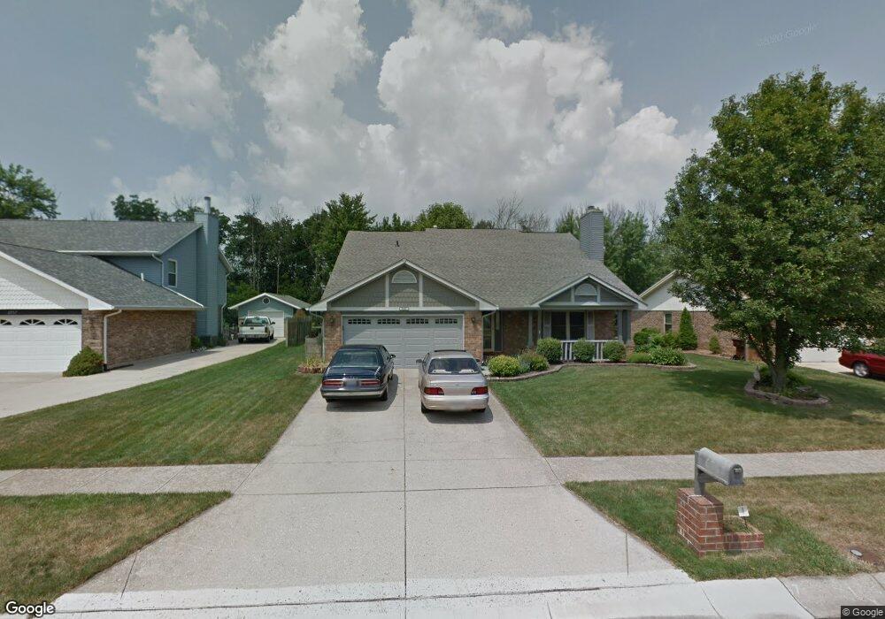
6967 Charlesgate Rd Dayton, OH 45424
Estimated Value: $288,000 - $315,000
3
Beds
3
Baths
2,199
Sq Ft
$138/Sq Ft
Est. Value
About This Home
This home is located at 6967 Charlesgate Rd, Dayton, OH 45424 and is currently estimated at $304,495, approximately $138 per square foot. 6967 Charlesgate Rd is a home located in Montgomery County with nearby schools including Wayne High School and Huber Heights Christian Academy.
Ownership History
Date
Name
Owned For
Owner Type
Purchase Details
Closed on
Oct 10, 2019
Sold by
Cattelan Ronald B
Bought by
Gore Jeffrey S and Gore Toni A
Current Estimated Value
Home Financials for this Owner
Home Financials are based on the most recent Mortgage that was taken out on this home.
Original Mortgage
$161,985
Outstanding Balance
$141,907
Interest Rate
3.5%
Mortgage Type
VA
Estimated Equity
$162,588
Purchase Details
Closed on
May 30, 2018
Sold by
Cattelan Ronald B
Bought by
Gore Jeffery S and Gore Toni A
Purchase Details
Closed on
Jun 24, 1994
Sold by
Cattelan Evelyn J
Bought by
Cattelan Ronald B
Create a Home Valuation Report for This Property
The Home Valuation Report is an in-depth analysis detailing your home's value as well as a comparison with similar homes in the area
Home Values in the Area
Average Home Value in this Area
Purchase History
| Date | Buyer | Sale Price | Title Company |
|---|---|---|---|
| Gore Jeffrey S | $158,600 | Partners Land Title Agency | |
| Gore Jeffery S | $165,000 | None Available | |
| Cattelan Ronald B | -- | -- |
Source: Public Records
Mortgage History
| Date | Status | Borrower | Loan Amount |
|---|---|---|---|
| Open | Gore Jeffrey S | $161,985 |
Source: Public Records
Tax History Compared to Growth
Tax History
| Year | Tax Paid | Tax Assessment Tax Assessment Total Assessment is a certain percentage of the fair market value that is determined by local assessors to be the total taxable value of land and additions on the property. | Land | Improvement |
|---|---|---|---|---|
| 2024 | $4,414 | $84,000 | $15,710 | $68,290 |
| 2023 | $4,414 | $84,000 | $15,710 | $68,290 |
| 2022 | $4,130 | $61,760 | $11,550 | $50,210 |
| 2021 | $4,170 | $61,760 | $11,550 | $50,210 |
| 2020 | $4,174 | $61,760 | $11,550 | $50,210 |
| 2019 | $3,690 | $48,220 | $12,080 | $36,140 |
| 2018 | $3,702 | $48,220 | $12,080 | $36,140 |
| 2017 | $3,680 | $48,220 | $12,080 | $36,140 |
| 2016 | $3,657 | $46,690 | $10,500 | $36,190 |
| 2015 | $2,864 | $46,690 | $10,500 | $36,190 |
| 2014 | $2,864 | $46,690 | $10,500 | $36,190 |
| 2012 | -- | $52,650 | $10,500 | $42,150 |
Source: Public Records
Map
Nearby Homes
- 6938 Charlesgate Rd
- 6809 Casa Grande Ct
- 2036 Cedar Lake Dr
- 6991 Salon Cir Unit 4444
- 2024 Cedar Lake Dr
- The Rosewood Plan at Gables of Huber Heights - The Gables of Huber Heights
- The Gable Plan at Gables of Huber Heights - The Gables of Huber Heights
- The Cedar Plan at Gables of Huber Heights - The Gables of Huber Heights
- 4264 Forestedge St
- 1235 Gable Way
- 8848 Deer Hollow Dr
- 7191 Honeylocust St
- 6652 Loblolly Dr
- 7113 Honeylocust St
- 7185 Honeylocust St
- 2020 Cedar Lake Dr
- 5073 Catalpa Dr
- 8930 Century Ln
- 3290 Dry Run St
- 7221 Serpentine Dr
- 6957 Charlesgate Rd
- 6977 Charlesgate Rd
- 6947 Charlesgate Rd
- 6987 Charlesgate Rd
- 6978 Charlesgate Rd
- 6968 Charlesgate Rd
- 6937 Charlesgate Rd
- 6997 Charlesgate Rd
- 6958 Charlesgate Rd
- 6948 Charlesgate Rd
- 8698 Deer Bend Dr
- 6930 Citrus Cir
- 6927 Charlesgate Rd
- 8687 Deer Bend Dr
- 6920 Citrus Cir
- 6905 Deer Bluff Dr
- 6919 Deer Bluff Dr
- 8688 Deer Bend Dr
- 6921 Deer Bluff Dr
- 6965 Caldwell Cir