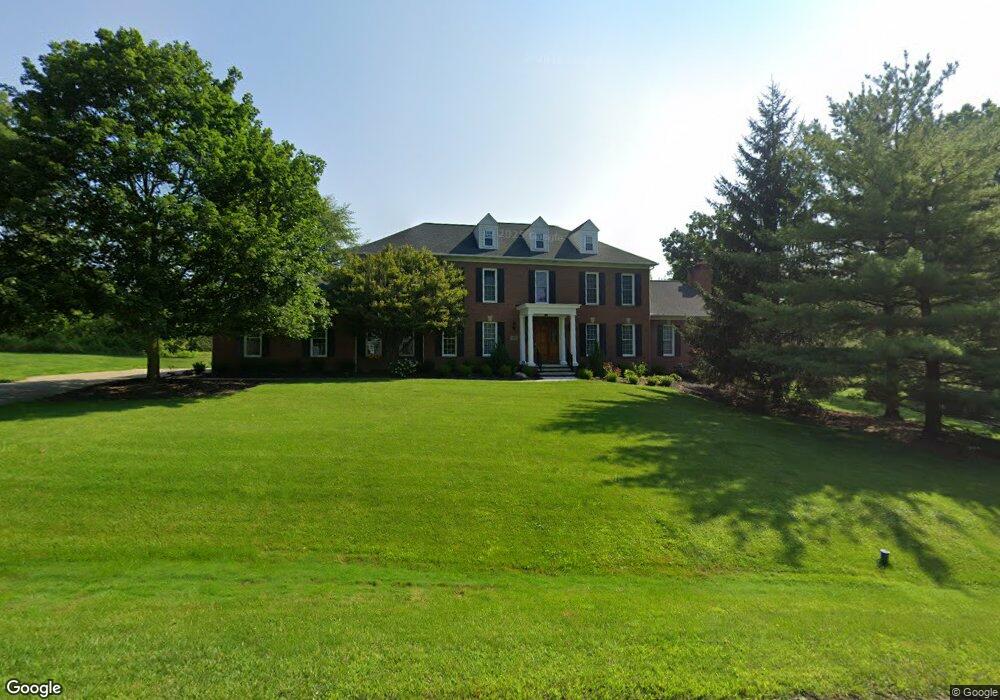
6967 Saint Regis Blvd Hudson, OH 44236
Estimated Value: $680,000 - $748,000
4
Beds
5
Baths
3,384
Sq Ft
$209/Sq Ft
Est. Value
About This Home
This home is located at 6967 Saint Regis Blvd, Hudson, OH 44236 and is currently estimated at $705,763, approximately $208 per square foot. 6967 Saint Regis Blvd is a home located in Summit County with nearby schools including Ellsworth Hill Elementary School, East Woods Intermediate School, and Hudson Middle School.
Ownership History
Date
Name
Owned For
Owner Type
Purchase Details
Closed on
May 31, 1995
Sold by
Clark Stephen W
Bought by
Penny Gregory P and Penny Elizabeth M
Current Estimated Value
Home Financials for this Owner
Home Financials are based on the most recent Mortgage that was taken out on this home.
Original Mortgage
$220,000
Interest Rate
7.88%
Mortgage Type
New Conventional
Create a Home Valuation Report for This Property
The Home Valuation Report is an in-depth analysis detailing your home's value as well as a comparison with similar homes in the area
Home Values in the Area
Average Home Value in this Area
Purchase History
| Date | Buyer | Sale Price | Title Company |
|---|---|---|---|
| Penny Gregory P | $320,000 | -- |
Source: Public Records
Mortgage History
| Date | Status | Borrower | Loan Amount |
|---|---|---|---|
| Closed | Penny Gregory P | $220,000 |
Source: Public Records
Tax History Compared to Growth
Tax History
| Year | Tax Paid | Tax Assessment Tax Assessment Total Assessment is a certain percentage of the fair market value that is determined by local assessors to be the total taxable value of land and additions on the property. | Land | Improvement |
|---|---|---|---|---|
| 2025 | $10,277 | $197,558 | $30,828 | $166,730 |
| 2024 | $10,277 | $197,558 | $30,828 | $166,730 |
| 2023 | $10,277 | $197,558 | $30,828 | $166,730 |
| 2022 | $9,780 | $167,479 | $26,128 | $141,351 |
| 2021 | $9,796 | $167,479 | $26,128 | $141,351 |
| 2020 | $9,627 | $167,480 | $26,130 | $141,350 |
| 2019 | $10,632 | $171,360 | $28,740 | $142,620 |
| 2018 | $10,598 | $171,360 | $28,740 | $142,620 |
| 2017 | $9,335 | $171,360 | $28,740 | $142,620 |
| 2016 | $9,400 | $146,290 | $26,130 | $120,160 |
| 2015 | $9,335 | $146,290 | $26,130 | $120,160 |
| 2014 | $9,361 | $146,290 | $26,130 | $120,160 |
| 2013 | $8,847 | $134,970 | $26,130 | $108,840 |
Source: Public Records
Map
Nearby Homes
- 9085 Sandpiper Dr
- 701 Gold Leaf Ct
- 10252 Wellman Rd Unit 8
- 139 Mccracken Rd
- 572 David Dr
- 9005 Sandpiper Dr
- 9011 Wood Thursh
- 9381 Hickory Ridge Dr
- 8929 Falcon Dr
- 708 Diane Ave
- 6167 Burr Oak Way
- 792 State Route 303
- 7753 Red Fox Trail
- 939 State Route 303
- 10101 Ravenwood Ct
- 7449 Hudson Park Dr
- 2714 Blue Heron Dr
- 9251 Chestnut Ct
- 9247 Chestnut Ct
- 10131 Buckhorn Trail
- 6957 Saint Regis Blvd
- 6977 Saint Regis Blvd
- 6952 Saint Regis Blvd
- 6947 Saint Regis Blvd
- 6985 Saint Ives Blvd
- 6934 Saint Regis Blvd
- 6968 Saint Regis Blvd
- 6999 Saint Ives Blvd
- 6935 Saint Ives Blvd
- 6933 Saint Regis Blvd
- 6920 Saint Regis Blvd
- 7015 Saint Ives Blvd
- 6919 Saint Ives Blvd
- 6982 Saint Ives Blvd
- 6966 Saint Ives Blvd
- 6998 Saint Ives Blvd
- 6917 Saint Regis Blvd
- 6950 Saint Ives Blvd
- 6904 Saint Regis Blvd
- 7014 Saint Ives Blvd