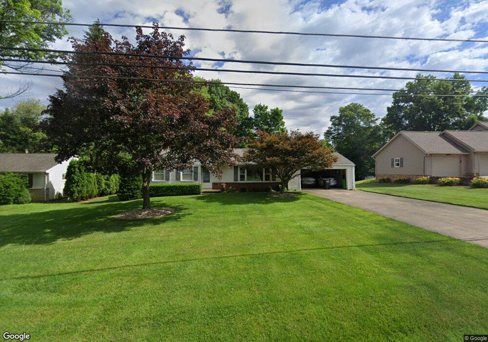
6969 Westwood St SW Massillon, OH 44646
Estimated Value: $187,000 - $226,000
3
Beds
1
Bath
1,279
Sq Ft
$164/Sq Ft
Est. Value
About This Home
This home is located at 6969 Westwood St SW, Massillon, OH 44646 and is currently estimated at $209,169, approximately $163 per square foot. 6969 Westwood St SW is a home located in Stark County with nearby schools including Pfeiffer Intermediate School, Edison Middle School, and Perry High School.
Ownership History
Date
Name
Owned For
Owner Type
Purchase Details
Closed on
Nov 20, 2023
Sold by
Weisburn Mary H
Bought by
Weisburn Benjamin
Current Estimated Value
Home Financials for this Owner
Home Financials are based on the most recent Mortgage that was taken out on this home.
Original Mortgage
$112,000
Outstanding Balance
$110,042
Interest Rate
7.49%
Mortgage Type
New Conventional
Estimated Equity
$99,127
Create a Home Valuation Report for This Property
The Home Valuation Report is an in-depth analysis detailing your home's value as well as a comparison with similar homes in the area
Home Values in the Area
Average Home Value in this Area
Purchase History
| Date | Buyer | Sale Price | Title Company |
|---|---|---|---|
| Weisburn Benjamin | $140,000 | None Listed On Document |
Source: Public Records
Mortgage History
| Date | Status | Borrower | Loan Amount |
|---|---|---|---|
| Open | Weisburn Benjamin | $112,000 |
Source: Public Records
Tax History Compared to Growth
Tax History
| Year | Tax Paid | Tax Assessment Tax Assessment Total Assessment is a certain percentage of the fair market value that is determined by local assessors to be the total taxable value of land and additions on the property. | Land | Improvement |
|---|---|---|---|---|
| 2025 | -- | $53,280 | $18,590 | $34,690 |
| 2024 | -- | $53,280 | $18,590 | $34,690 |
| 2023 | $1,590 | $40,850 | $12,530 | $28,320 |
| 2022 | $1,620 | $40,850 | $12,530 | $28,320 |
| 2021 | $1,725 | $40,850 | $12,530 | $28,320 |
| 2020 | $1,407 | $33,850 | $10,540 | $23,310 |
| 2019 | $1,270 | $33,850 | $10,540 | $23,310 |
| 2018 | $1,254 | $33,850 | $10,540 | $23,310 |
| 2017 | $1,158 | $30,210 | $9,380 | $20,830 |
| 2016 | $1,164 | $30,210 | $9,380 | $20,830 |
| 2015 | $1,175 | $30,210 | $9,380 | $20,830 |
| 2014 | $1,088 | $28,320 | $8,790 | $19,530 |
| 2013 | $520 | $28,320 | $8,790 | $19,530 |
Source: Public Records
Map
Nearby Homes
- 4160 Roselawn Ave SW
- 6534 Highton St SW
- 7349 Navarre Rd SW
- 4111 Harbrook St SW
- 7245 Jimmie St SW
- V/L Groveland Ave SW
- 4401 Kemary Ave SW
- 7216 Crusader St SW
- 0 Navarre Rd SW Unit 5093073
- 4585 Kemary Ave SW
- 4657 Stevie Ave SW
- 7503 Kenny St SW
- 4716 Stevie Ave SW
- 4691 Stevie Ave SW
- 4703 Stevie Ave SW
- 5910 Navarre Rd SW
- 8160 Navarre Rd SW
- 6014 Wentworth Rd SW
- 8202 Navarre Rd SW
- 2667 Ashwell Ave SW
- 6949 Westwood St SW
- 6995 Westwood St SW
- 6935 Westwood St SW
- 6970 Westwood St SW
- 3787 Greenford Ave SW
- 3767 Greenford Ave SW
- 6950 Westwood St SW
- 3747 Greenford Ave SW
- 6915 Westwood St SW
- 6930 Westwood St SW
- 3811 Greenford Ave SW
- 3844 Greenford Ave SW
- 6910 Westwood St SW
- 3827 Greenford Ave SW
- 6899 Westwood St SW
- 6900 Westwood St SW
- 3866 Greenford Ave SW
- 6877 Westwood St SW
- 3867 Greenford Ave SW
- 6878 Westwood St SW