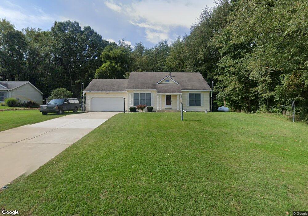
69696 Palmer Dr Paw Paw, MI 49079
Estimated Value: $306,000 - $519,000
3
Beds
2
Baths
1,368
Sq Ft
$275/Sq Ft
Est. Value
About This Home
This home is located at 69696 Palmer Dr, Paw Paw, MI 49079 and is currently estimated at $376,832, approximately $275 per square foot. 69696 Palmer Dr is a home located in Van Buren County with nearby schools including Paw Paw Early Elementary School, Paw Paw Later Elementary School, and Paw Paw Middle School.
Ownership History
Date
Name
Owned For
Owner Type
Purchase Details
Closed on
Sep 6, 2023
Sold by
Coppens Dennis L
Bought by
Coppens Dennis L
Current Estimated Value
Purchase Details
Closed on
Jun 29, 2012
Sold by
Coppens Dennis L and Coppens Nilsa
Bought by
Coppens Dennis L and Coppens Nilsa
Purchase Details
Closed on
Jul 20, 2011
Sold by
Federal Home Loan Mortgage Corporation
Bought by
Coppens Dennis L
Purchase Details
Closed on
Jan 5, 2007
Sold by
Drake Roger R
Bought by
Drake Roger R and Takla Elena M
Purchase Details
Closed on
Jul 5, 2001
Sold by
Fifer Oliver B
Bought by
Drake Roger R
Create a Home Valuation Report for This Property
The Home Valuation Report is an in-depth analysis detailing your home's value as well as a comparison with similar homes in the area
Home Values in the Area
Average Home Value in this Area
Purchase History
| Date | Buyer | Sale Price | Title Company |
|---|---|---|---|
| Coppens Dennis L | -- | None Listed On Document | |
| Coppens Dennis L | -- | None Listed On Document | |
| Coppens Dennis L | -- | None Listed On Document | |
| Coppens Dennis L | -- | None Listed On Document | |
| Coppens Dennis L | -- | None Available | |
| Coppens Dennis L | $104,000 | None Available | |
| Drake Roger R | -- | None Available | |
| Drake Roger R | $140,900 | -- |
Source: Public Records
Tax History Compared to Growth
Tax History
| Year | Tax Paid | Tax Assessment Tax Assessment Total Assessment is a certain percentage of the fair market value that is determined by local assessors to be the total taxable value of land and additions on the property. | Land | Improvement |
|---|---|---|---|---|
| 2025 | $708 | $144,100 | $0 | $0 |
| 2024 | $708 | $150,700 | $0 | $0 |
| 2023 | $674 | $142,700 | $0 | $0 |
| 2022 | $2,146 | $60,300 | $0 | $0 |
| 2021 | $2,757 | $91,900 | $5,000 | $86,900 |
| 2020 | $2,591 | $89,500 | $5,000 | $84,500 |
| 2019 | $2,467 | $75,800 | $75,800 | $0 |
| 2018 | $2,778 | $98,200 | $98,200 | $0 |
| 2017 | $2,708 | $90,900 | $0 | $0 |
| 2016 | $2,690 | $90,600 | $0 | $0 |
| 2015 | $2,436 | $90,600 | $0 | $0 |
| 2014 | $2,392 | $81,696 | $0 | $0 |
| 2013 | -- | $79,900 | $79,900 | $0 |
Source: Public Records
Map
Nearby Homes
- 0 Palmer Dr
- 43834 Eagle Lake Dr
- 0 70th Ave
- 43618 Carla Dr
- 77199 M-51
- 44850 Woodman Dr
- Parcel A Territorial Rd
- 60846 N Lakeshore Dr
- 66598 Territorial Rd
- 73541 39th St
- 58356 Cr 671
- 38126 72nd Ave Unit b
- 38126 72nd Ave
- 58797 Territorial Rd
- 80660 42nd St
- 81480 42nd St
- 44702 B 56th Ave
- 00 Lakeview Dr
- 310 Rogers St
- TBD Greenbriar Terrace
- 69776 Palmer Dr
- 69522 Palmer Dr
- 9999 Palmer Dr
- 5262 Palmer Dr
- 69940 Palmer Dr
- 43963 Eagle Lake Dr
- 44084 County Road 358
- 44188 Cr 35
- 79025 Palmer Dr
- 44081 South St
- 44103 South St
- 43862 Eagle Lake Dr
- 100 70th Ave
- 43870 Eagle Lake Dr
- 44163 South St
- 43848 Eagle Lake Dr
- 44188 County Road 358
- 57 South St
- 43974 Eagle Lake Dr
- 43884 Eagle Lake Dr