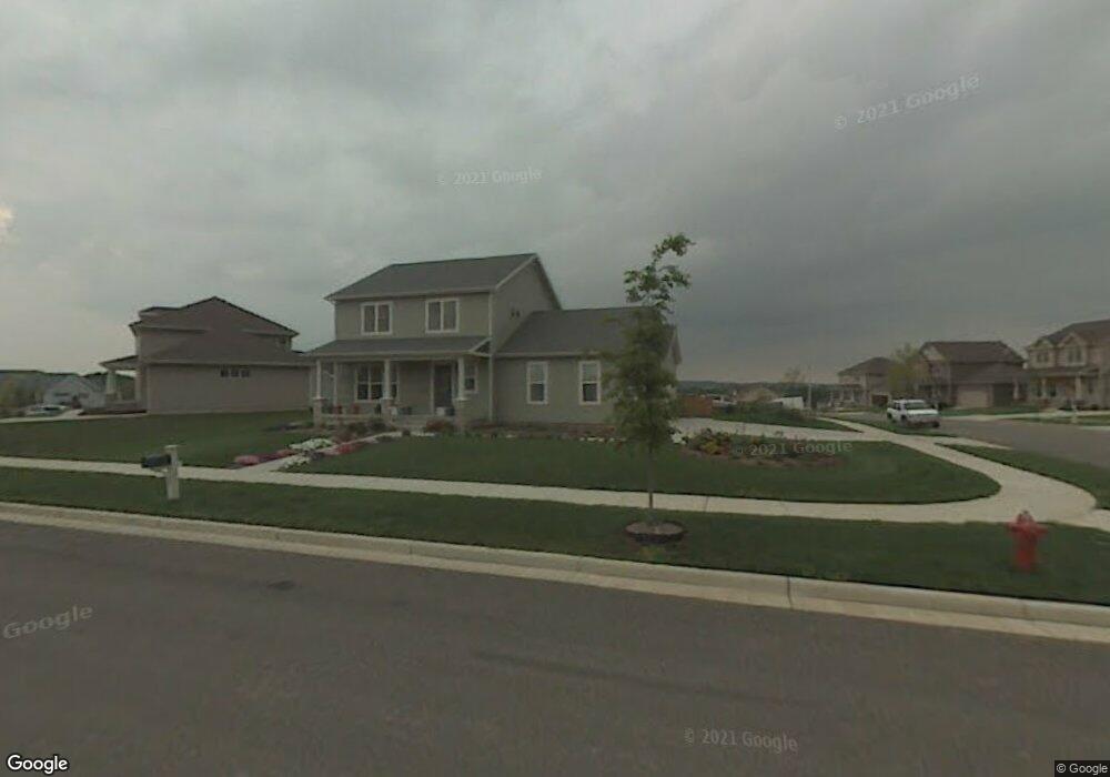
697 Harvest Ln Verona, WI 53593
Estimated Value: $489,000 - $529,440
3
Beds
3
Baths
1,808
Sq Ft
$287/Sq Ft
Est. Value
About This Home
This home is located at 697 Harvest Ln, Verona, WI 53593 and is currently estimated at $518,360, approximately $286 per square foot. 697 Harvest Ln is a home located in Dane County with nearby schools including Glacier Edge Elementary School, Savanna Oaks Middle School, and Verona Area High School.
Ownership History
Date
Name
Owned For
Owner Type
Purchase Details
Closed on
May 29, 2024
Sold by
Alonzo Jim and Alonzo Christina
Bought by
Alonzo Living Trust and Alonzo
Current Estimated Value
Purchase Details
Closed on
Feb 7, 2006
Sold by
Dsh Real Estate Llc
Bought by
Alonzo Jim L and Alonzo Christina M
Home Financials for this Owner
Home Financials are based on the most recent Mortgage that was taken out on this home.
Original Mortgage
$65,341
Interest Rate
5.87%
Mortgage Type
Stand Alone Second
Create a Home Valuation Report for This Property
The Home Valuation Report is an in-depth analysis detailing your home's value as well as a comparison with similar homes in the area
Home Values in the Area
Average Home Value in this Area
Purchase History
| Date | Buyer | Sale Price | Title Company |
|---|---|---|---|
| Alonzo Living Trust | -- | None Listed On Document | |
| Alonzo Jim L | $326,800 | None Available |
Source: Public Records
Mortgage History
| Date | Status | Borrower | Loan Amount |
|---|---|---|---|
| Previous Owner | Alonzo Jim L | $65,341 | |
| Previous Owner | Alonzo Jim L | $261,363 |
Source: Public Records
Tax History Compared to Growth
Tax History
| Year | Tax Paid | Tax Assessment Tax Assessment Total Assessment is a certain percentage of the fair market value that is determined by local assessors to be the total taxable value of land and additions on the property. | Land | Improvement |
|---|---|---|---|---|
| 2024 | $7,325 | $467,200 | $118,000 | $349,200 |
| 2023 | $6,876 | $391,400 | $110,800 | $280,600 |
| 2021 | $6,686 | $354,000 | $104,000 | $250,000 |
| 2020 | $7,152 | $354,000 | $104,000 | $250,000 |
| 2019 | $6,689 | $288,000 | $99,300 | $188,700 |
| 2018 | $6,638 | $288,000 | $99,300 | $188,700 |
| 2017 | $6,477 | $288,000 | $99,300 | $188,700 |
| 2016 | $6,220 | $288,000 | $99,300 | $188,700 |
| 2015 | $6,248 | $288,000 | $99,300 | $188,700 |
| 2014 | $6,241 | $288,000 | $99,300 | $188,700 |
| 2013 | $6,653 | $288,000 | $99,300 | $188,700 |
Source: Public Records
Map
Nearby Homes
- 731 Ariel Ln
- 657 Thornton Terrace
- 772 Marlow Bay
- 859 Kimball Ln
- 710 Mozart St
- 571 S Hillcrest Dr
- 511 Harvest Ln
- 1045 Range Trail
- 436 Goldenrod Cir Unit 14
- 102 Prairie Heights Dr Unit 416
- 955 Westminster Way
- 1208 Merry Blossom Ln
- 1252 Merry Blossom Ln
- 300 Military Ridge Dr
- 312 Schweitzer Dr
- 143 Paoli St
- 188 Depot Dr
- 6690 Grandview Rd
- 202 W Verona Ave
- 6500 Shady Bend Rd
- 673 Harvest Ln
- 680 Ethan Terrace
- 697 Ethan Terrace
- 665 Harvest Ln
- 689 Ethan Terrace
- 664 Ethan Terrace
- 681 Ethan Terrace
- 708 Ethan Terrace
- 673 Ethan Terrace
- 684 Harvest Ln
- 657 Harvest Ln
- 701 Harvest Ln
- 648 Ethan Terrace
- 724 Ethan Terrace
- 657 Ethan Terrace
- 696 Thornton Terrace
- 688 Thornton Terrace
- 676 Harvest Ln
- 680 Thornton Terrace
- 723 Ethan Terrace