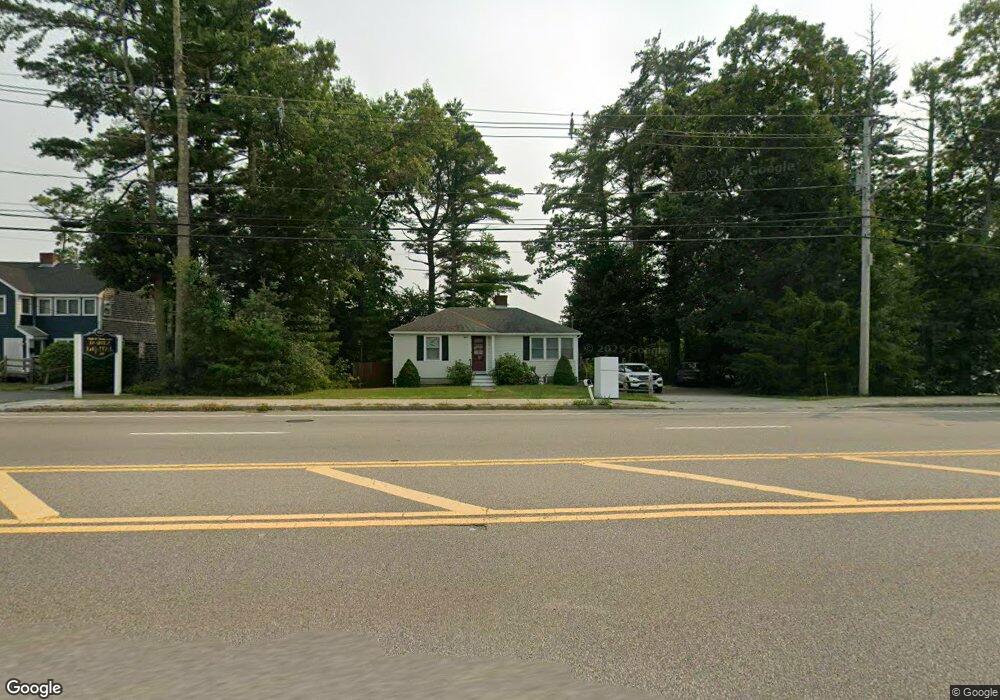
697 Plain St Marshfield, MA 02050
Estimated Value: $473,149 - $667,000
2
Beds
1
Bath
708
Sq Ft
$750/Sq Ft
Est. Value
About This Home
This home is located at 697 Plain St, Marshfield, MA 02050 and is currently estimated at $531,287, approximately $750 per square foot. 697 Plain St is a home located in Plymouth County with nearby schools including Martinson Elementary School, Furnace Brook Middle School, and Marshfield High School.
Ownership History
Date
Name
Owned For
Owner Type
Purchase Details
Closed on
Oct 29, 2024
Sold by
Frances Turbitt 2024 Irt and Turbitt
Bought by
Frances Turbir Ret and Turbitt
Current Estimated Value
Purchase Details
Closed on
Jul 24, 2024
Sold by
Turbitt Frences
Bought by
Frances Turbitt 2024 Irt and Turbitt
Purchase Details
Closed on
Jul 1, 2004
Sold by
Miner Linda and Poirer Ruby Ethel
Bought by
Turbitt Frances
Create a Home Valuation Report for This Property
The Home Valuation Report is an in-depth analysis detailing your home's value as well as a comparison with similar homes in the area
Home Values in the Area
Average Home Value in this Area
Purchase History
| Date | Buyer | Sale Price | Title Company |
|---|---|---|---|
| Frances Turbir Ret | -- | None Available | |
| Frances Turbir Ret | -- | None Available | |
| Frances Turbir Ret | -- | None Available | |
| Frances Turbitt 2024 Irt | -- | None Available | |
| Frances Turbitt 2024 Irt | -- | None Available | |
| Frances Turbitt 2024 Irt | -- | None Available | |
| Turbitt Frances | $225,000 | -- | |
| Turbitt Frances | $225,000 | -- |
Source: Public Records
Tax History
| Year | Tax Paid | Tax Assessment Tax Assessment Total Assessment is a certain percentage of the fair market value that is determined by local assessors to be the total taxable value of land and additions on the property. | Land | Improvement |
|---|---|---|---|---|
| 2025 | $3,665 | $370,200 | $218,400 | $151,800 |
| 2024 | $3,584 | $344,900 | $208,000 | $136,900 |
| 2023 | $3,640 | $327,700 | $201,100 | $126,600 |
| 2022 | $3,640 | $281,100 | $176,800 | $104,300 |
| 2021 | $3,503 | $265,600 | $169,900 | $95,700 |
| 2020 | $3,515 | $263,700 | $169,900 | $93,800 |
| 2019 | $3,247 | $242,700 | $159,500 | $83,200 |
| 2018 | $3,113 | $232,800 | $152,500 | $80,300 |
| 2017 | $3,035 | $221,200 | $145,600 | $75,600 |
| 2016 | $2,963 | $213,500 | $145,600 | $67,900 |
| 2015 | $2,760 | $207,700 | $145,600 | $62,100 |
| 2014 | $2,463 | $185,300 | $124,800 | $60,500 |
Source: Public Records
Map
Nearby Homes
- 2 Proprietors Dr Unit 25
- 2 Proprietors Dr Unit 26
- 2 Proprietors Dr Unit 27
- 848 Plain St Unit 41
- 848 Plain St Unit 23
- 451 School St Unit 5-2
- 3 Red Pony Path Unit 3
- 10 Royal Dane Dr Unit 85
- 5 Royal Dane Dr Unit 45
- 167 Planting Field Rd
- 341 Furnace St
- 889 Old Main Street Extension
- 60 Samuel Curtis Way
- 6 Hillside Ln
- 235 Main St
- 387 North St
- 14 Ferry St
- 1155 Main St
- 7 Spring St
- 2 Secret Pond Way Unit 35
- 709 Plain St
- 677 Plain St
- 677 Plain St Unit 1
- 696 Plain St Unit 1B
- 696 Plain St Unit 2B
- 696 Plain St Unit 5
- 696 Plain St Unit 3B
- 696 Plain St Unit 3A
- 696 Plain St
- 725 Plain St
- 669 Plain St
- 733 Plain St
- 663 Plain St
- 752 Plain St
- 678 Plain St Unit 10A
- 678 Plain St Unit 5, Bldg 26
- 678 Plain St Unit 8 B 25
- 678 Plain St Unit 11-25
- 678 Plain St Unit 11,26
- 678 Plain St Unit 25-4
Your Personal Tour Guide
Ask me questions while you tour the home.