697 Raven Run Rd Saxton, PA 16678
Estimated Value: $160,000 - $190,000
4
Beds
2
Baths
1,440
Sq Ft
$122/Sq Ft
Est. Value
About This Home
This home is located at 697 Raven Run Rd, Saxton, PA 16678 and is currently estimated at $175,333, approximately $121 per square foot. 697 Raven Run Rd is a home located in Bedford County with nearby schools including Tussey Mountain Middle School and Tussey Mountain High School.
Ownership History
Date
Name
Owned For
Owner Type
Purchase Details
Closed on
Aug 27, 2018
Sold by
Tenley Joshua M and Tenley Jessica L
Bought by
Sitch Taylor B and May Neil W
Current Estimated Value
Home Financials for this Owner
Home Financials are based on the most recent Mortgage that was taken out on this home.
Original Mortgage
$118,750
Outstanding Balance
$103,344
Interest Rate
4.5%
Mortgage Type
New Conventional
Estimated Equity
$71,989
Purchase Details
Closed on
Oct 28, 2011
Sold by
Rinard Doanld R and Rinard Deanna M
Bought by
Tenley Joshua M and Tenley Jessica
Home Financials for this Owner
Home Financials are based on the most recent Mortgage that was taken out on this home.
Original Mortgage
$94,346
Interest Rate
4.4%
Mortgage Type
FHA
Create a Home Valuation Report for This Property
The Home Valuation Report is an in-depth analysis detailing your home's value as well as a comparison with similar homes in the area
Home Values in the Area
Average Home Value in this Area
Purchase History
| Date | Buyer | Sale Price | Title Company |
|---|---|---|---|
| Sitch Taylor B | $125,000 | None Available | |
| Tenley Joshua M | $96,800 | None Available |
Source: Public Records
Mortgage History
| Date | Status | Borrower | Loan Amount |
|---|---|---|---|
| Open | Sitch Taylor B | $118,750 | |
| Previous Owner | Tenley Joshua M | $94,346 |
Source: Public Records
Tax History Compared to Growth
Tax History
| Year | Tax Paid | Tax Assessment Tax Assessment Total Assessment is a certain percentage of the fair market value that is determined by local assessors to be the total taxable value of land and additions on the property. | Land | Improvement |
|---|---|---|---|---|
| 2025 | $1,528 | $92,900 | $16,700 | $76,200 |
| 2024 | $1,565 | $92,900 | $16,700 | $76,200 |
| 2023 | $1,462 | $92,900 | $16,700 | $76,200 |
| 2022 | $1,444 | $92,900 | $16,700 | $76,200 |
| 2021 | $1,380 | $92,900 | $16,700 | $76,200 |
| 2020 | $1,348 | $92,900 | $16,700 | $76,200 |
| 2019 | $1,284 | $92,900 | $16,700 | $76,200 |
| 2018 | $1,277 | $92,900 | $16,700 | $76,200 |
| 2017 | $1,244 | $92,900 | $16,700 | $76,200 |
| 2016 | -- | $92,900 | $16,700 | $76,200 |
| 2014 | -- | $92,900 | $16,700 | $76,200 |
Source: Public Records
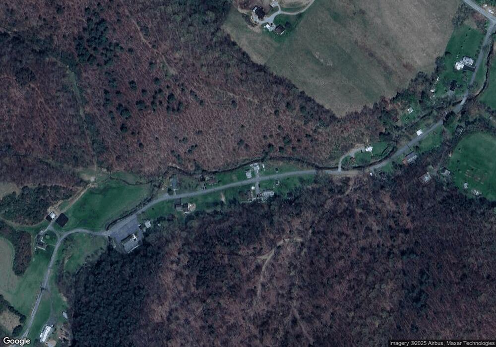
Map
Nearby Homes
- 00 Raven Run Rd
- 200 Blk Carberry Rd
- 00 Brumbaugh Cemetary Rd
- 303 16th St
- 1006 Main St
- 806 Spring St
- 1702 Mifflin St
- 908 Main St
- 601-603 Church St
- 702 Church St
- 615 Shoup St
- 1009 Six Mile Run Rd
- 0 Mosquito Hollow Rd
- 275 Stone Row Rd
- 18459 Upper Ridge Rd
- 00 Pine Ridge Rd
- 0 Tillamook Ln
- Lot 11 Tillamook Ln
- Lot 4 Tillamook Ln
- Lot 6 Polecat Hollow Rd
- 697 Raven Run Rd
- 694 Raven Run Rd
- 675 Raven Run Rd
- 723 Raven Run Rd
- 706 Raven Run Rd
- 658 Raven Run Rd
- 767 Raven Run Rd
- 770 Raven Run Rd
- 616 Raven Run Rd
- 800 Raven Run Rd
- 814 Raven Run Rd
- 814 Raven Run Rd
- 0 Raven Run Rd
- 818 Raven Run Rd
- 837 Raven Run Rd
- 573 Raven Run Rd
- 855 Raven Run Rd
- 8937 Raystown Rd
- 8827 Raystown Rd
- 8795 Raystown Rd