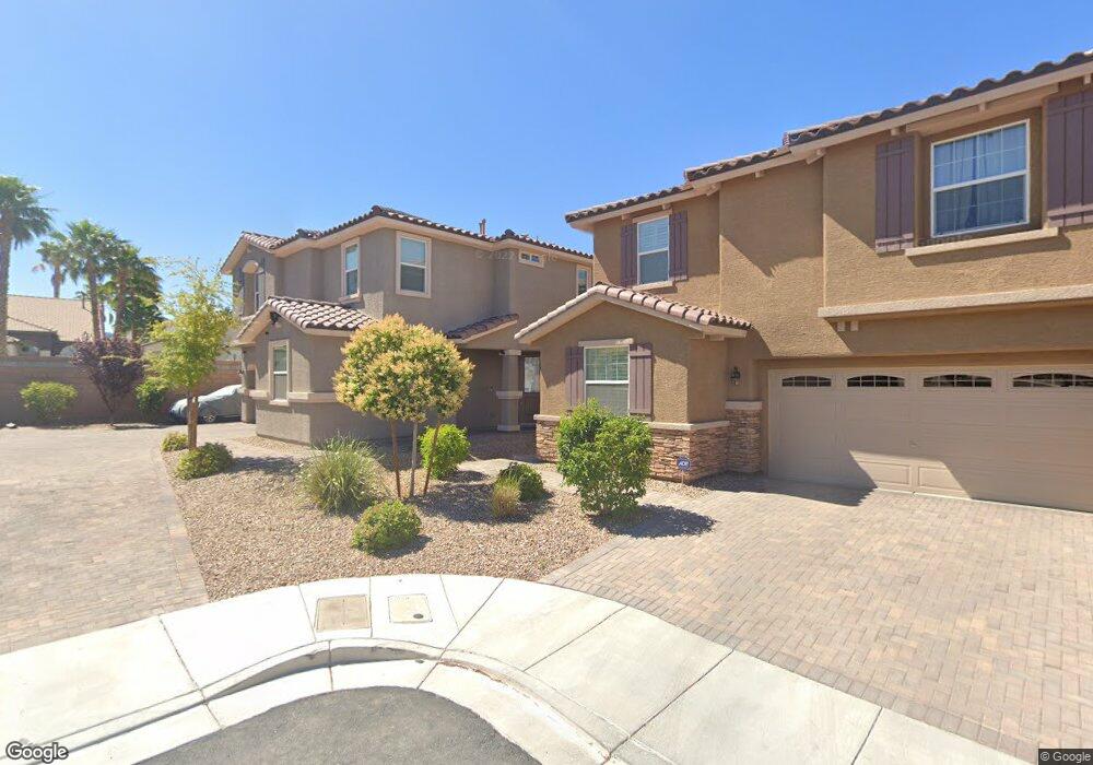
697 Steve Wruck Ct Henderson, NV 89052
MacDonald Ranch NeighborhoodEstimated Value: $619,000 - $723,000
3
Beds
3
Baths
2,658
Sq Ft
$250/Sq Ft
Est. Value
About This Home
This home is located at 697 Steve Wruck Ct, Henderson, NV 89052 and is currently estimated at $665,116, approximately $250 per square foot. 697 Steve Wruck Ct is a home with nearby schools including Glen C. Taylor Elementary School, Bob Miller Middle School, and Coronado High School.
Ownership History
Date
Name
Owned For
Owner Type
Purchase Details
Closed on
Jan 8, 2019
Sold by
Ramos Dimas and Ramos Norma U
Bought by
Ramos Dimas and The Ramos Family Revocable Living Trust
Current Estimated Value
Purchase Details
Closed on
Apr 18, 2016
Sold by
Hacienda Trails Llc
Bought by
Ramos Dimas and Ramos Norma U
Home Financials for this Owner
Home Financials are based on the most recent Mortgage that was taken out on this home.
Original Mortgage
$283,272
Outstanding Balance
$225,411
Interest Rate
3.73%
Mortgage Type
New Conventional
Estimated Equity
$439,705
Create a Home Valuation Report for This Property
The Home Valuation Report is an in-depth analysis detailing your home's value as well as a comparison with similar homes in the area
Home Values in the Area
Average Home Value in this Area
Purchase History
| Date | Buyer | Sale Price | Title Company |
|---|---|---|---|
| Ramos Dimas | -- | None Available | |
| Ramos Dimas | $354,090 | First American Title Centra |
Source: Public Records
Mortgage History
| Date | Status | Borrower | Loan Amount |
|---|---|---|---|
| Open | Ramos Dimas | $283,272 |
Source: Public Records
Tax History Compared to Growth
Tax History
| Year | Tax Paid | Tax Assessment Tax Assessment Total Assessment is a certain percentage of the fair market value that is determined by local assessors to be the total taxable value of land and additions on the property. | Land | Improvement |
|---|---|---|---|---|
| 2025 | $4,290 | $184,079 | $51,818 | $132,261 |
| 2024 | $4,165 | $184,079 | $51,818 | $132,261 |
| 2023 | $3,408 | $170,987 | $47,408 | $123,579 |
| 2022 | $4,044 | $151,282 | $38,955 | $112,327 |
| 2021 | $3,926 | $141,843 | $35,648 | $106,195 |
| 2020 | $3,809 | $140,498 | $35,648 | $104,850 |
| 2019 | $3,698 | $136,704 | $33,810 | $102,894 |
| 2018 | $3,590 | $123,852 | $26,093 | $97,759 |
| 2017 | $3,613 | $124,626 | $26,093 | $98,533 |
| 2016 | $3,408 | $16,538 | $16,538 | $0 |
Source: Public Records
Map
Nearby Homes
- 674 Tremaine Ct
- 2587 Mizzoni Cir
- 2495 Kaymin Ridge Rd
- 2579 Anchorgate Dr
- 2556 Prince Edward Dr
- 648 Doubleshot Ln
- 700 Carnegie St Unit 3214
- 700 Carnegie St Unit 1311
- 700 Carnegie St Unit 1111
- 700 Carnegie St Unit 1423
- 700 Carnegie St Unit 2011
- 700 Carnegie St Unit 2621
- 700 Carnegie St Unit 2022
- 700 Carnegie St Unit 4113
- 700 Carnegie St Unit 3913
- 818 Sandhill Sage St
- 820 Sandhill Sage St
- 2656 Bad Rock Cir
- 575 Dusty Palms Ln
- 511 Broken Shale Cir
- 695 Steve Wruck Ct
- 696 Steve Wruck Ct
- 2481 Dragon Fire Ln
- 696 Nathanial Ct
- 2483 Dragon Fire Ln Unit Lot 10
- 2483 Dragon Fire Ln
- 694 Nathanial Ct Unit Lot 12
- 694 Nathanial Ct
- 2481 Brandywine Shoals Place
- 2483 Brandywine Shoals Place
- 2479 Brandywine Shoals Place
- 692 Nathanial Ct
- 2485 Brandywine Shoals Place
- 2477 Brandywine Shoals Place
- 695 Nathanial Ct Unit Lot 14
- 2487 Brandywine Shoals Place
- 2482 Crystal Ship Ct
- 693 Nathanial Ct Unit Lot 15
- 2484 Crystal Ship Ct
- 2482 Dragon Fire Ln