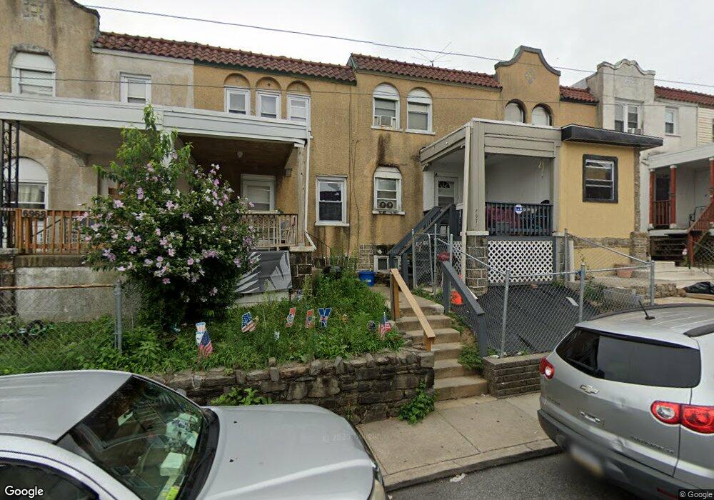
6970 Clinton Rd Upper Darby, PA 19082
Estimated Value: $123,000 - $149,000
2
Beds
1
Bath
1,152
Sq Ft
$120/Sq Ft
Est. Value
About This Home
This home is located at 6970 Clinton Rd, Upper Darby, PA 19082 and is currently estimated at $138,152, approximately $119 per square foot. 6970 Clinton Rd is a home located in Delaware County with nearby schools including Upper Darby Kdg Center, Upper Darby High School, and Vision Academy Charter School.
Ownership History
Date
Name
Owned For
Owner Type
Purchase Details
Closed on
Jun 6, 2012
Sold by
Khan Mohammad M
Bought by
Kakkanattu Anna and Kakkanattu Jome J
Current Estimated Value
Purchase Details
Closed on
Sep 23, 2004
Sold by
Huddell Mason T and Lamb Thomas J
Bought by
Khan Mohammad M
Home Financials for this Owner
Home Financials are based on the most recent Mortgage that was taken out on this home.
Original Mortgage
$40,800
Interest Rate
5.63%
Mortgage Type
Fannie Mae Freddie Mac
Purchase Details
Closed on
Mar 5, 2004
Sold by
Estate Of James S Mcallister
Bought by
Huddell Mason T and Lamb Thomas J
Home Financials for this Owner
Home Financials are based on the most recent Mortgage that was taken out on this home.
Original Mortgage
$27,000
Interest Rate
5.6%
Mortgage Type
Fannie Mae Freddie Mac
Create a Home Valuation Report for This Property
The Home Valuation Report is an in-depth analysis detailing your home's value as well as a comparison with similar homes in the area
Home Values in the Area
Average Home Value in this Area
Purchase History
| Date | Buyer | Sale Price | Title Company |
|---|---|---|---|
| Kakkanattu Anna | $50,000 | None Available | |
| Khan Mohammad M | $51,000 | -- | |
| Huddell Mason T | $30,000 | -- |
Source: Public Records
Mortgage History
| Date | Status | Borrower | Loan Amount |
|---|---|---|---|
| Previous Owner | Khan Mohammad M | $40,800 | |
| Previous Owner | Huddell Mason T | $27,000 |
Source: Public Records
Tax History
| Year | Tax Paid | Tax Assessment Tax Assessment Total Assessment is a certain percentage of the fair market value that is determined by local assessors to be the total taxable value of land and additions on the property. | Land | Improvement |
|---|---|---|---|---|
| 2025 | $2,782 | $65,790 | $13,560 | $52,230 |
| 2024 | $2,782 | $65,790 | $13,560 | $52,230 |
| 2023 | $2,756 | $65,790 | $13,560 | $52,230 |
| 2022 | $2,682 | $65,790 | $13,560 | $52,230 |
| 2021 | $3,616 | $65,790 | $13,560 | $52,230 |
| 2020 | $2,587 | $40,000 | $12,330 | $27,670 |
| 2019 | $2,542 | $40,000 | $12,330 | $27,670 |
| 2018 | $2,513 | $40,000 | $0 | $0 |
| 2017 | $2,447 | $40,000 | $0 | $0 |
| 2016 | $220 | $40,000 | $0 | $0 |
| 2015 | $224 | $40,000 | $0 | $0 |
| 2014 | $220 | $40,000 | $0 | $0 |
Source: Public Records
Map
Nearby Homes
- 6984 Aberdeen Rd
- 7046 Radbourne Rd
- 6997 Guilford Rd
- 7042 Clinton Rd
- 540 Snowden Rd
- 7139 Greenwood Ave
- 535 Wiltshire Rd
- 7000 Greenwood Ave
- 7160 Clover Ln
- 641 Copley Rd
- 7123 Seaford Rd
- 7129 Seaford Rd
- 513 Woodcliffe Rd
- 607 Briarcliff Rd
- 7218 Radbourne Rd
- 703 Briarcliff Rd
- 7010 Atlantic Ave
- 424 Woodcliffe Rd
- 418 Littlecroft Rd Unit 6A
- 418 Hampden Rd
- 6968 Clinton Rd
- 6966 Clinton Rd
- 6964 Clinton Rd
- 6972 Clinton Rd
- 6962 Clinton Rd
- 6974 Clinton Rd
- 6960 Clinton Rd
- 6976 Clinton Rd
- 7067 Radbourne Rd
- 7065 Radbourne Rd
- 7063 Radbourne Rd
- 7061 Radbourne Rd
- 6958 Clinton Rd
- 7069 Radbourne Rd
- 7059 Radbourne Rd
- 6978 Clinton Rd
- 7071 Radbourne Rd
- 7057 Radbourne Rd
- 7073 Radbourne Rd
- 6980 Clinton Rd