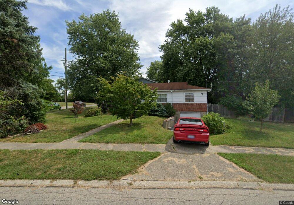
6970 Memory Ln Cincinnati, OH 45239
Estimated Value: $173,000 - $181,000
3
Beds
1
Bath
1,036
Sq Ft
$169/Sq Ft
Est. Value
About This Home
This home is located at 6970 Memory Ln, Cincinnati, OH 45239 and is currently estimated at $175,494, approximately $169 per square foot. 6970 Memory Ln is a home located in Hamilton County with nearby schools including White Oak Middle School, Colerain High School, and Cincinnati Achievement Academy.
Ownership History
Date
Name
Owned For
Owner Type
Purchase Details
Closed on
Jun 29, 1999
Sold by
Grande Joann M
Bought by
Hacker Sherry L
Current Estimated Value
Home Financials for this Owner
Home Financials are based on the most recent Mortgage that was taken out on this home.
Original Mortgage
$68,800
Outstanding Balance
$17,407
Interest Rate
7.28%
Estimated Equity
$158,087
Purchase Details
Closed on
Sep 10, 1993
Sold by
Grande James J
Bought by
Grande Jo Ann M
Create a Home Valuation Report for This Property
The Home Valuation Report is an in-depth analysis detailing your home's value as well as a comparison with similar homes in the area
Home Values in the Area
Average Home Value in this Area
Purchase History
| Date | Buyer | Sale Price | Title Company |
|---|---|---|---|
| Hacker Sherry L | $72,500 | -- | |
| Grande Jo Ann M | -- | -- |
Source: Public Records
Mortgage History
| Date | Status | Borrower | Loan Amount |
|---|---|---|---|
| Open | Hacker Sherry L | $68,800 |
Source: Public Records
Tax History
| Year | Tax Paid | Tax Assessment Tax Assessment Total Assessment is a certain percentage of the fair market value that is determined by local assessors to be the total taxable value of land and additions on the property. | Land | Improvement |
|---|---|---|---|---|
| 2025 | $2,247 | $39,012 | $8,607 | $30,405 |
| 2023 | $2,096 | $39,012 | $8,607 | $30,405 |
| 2022 | $1,487 | $22,537 | $6,727 | $15,810 |
| 2021 | $1,474 | $22,537 | $6,727 | $15,810 |
| 2020 | $1,489 | $22,537 | $6,727 | $15,810 |
| 2019 | $1,352 | $19,100 | $5,702 | $13,398 |
| 2018 | $1,213 | $19,100 | $5,702 | $13,398 |
| 2017 | $1,149 | $19,100 | $5,702 | $13,398 |
| 2016 | $1,499 | $24,616 | $7,851 | $16,765 |
| 2015 | $1,513 | $24,616 | $7,851 | $16,765 |
| 2014 | $1,516 | $24,616 | $7,851 | $16,765 |
| 2013 | $1,567 | $26,758 | $8,533 | $18,225 |
Source: Public Records
Map
Nearby Homes
- 7170 Longwood Ct
- 2757 Banning Rd
- 2427 Crosley Meadow
- 2391 Deblin Dr
- 2405 Amelia Ct
- 2424 Banning Rd
- 2820 Geraldine Dr
- 2806 Breezy Way
- 2801 Byrneside Dr
- 2503 Flanigan Ct
- 2342 Banning Rd
- 5970 Colerain Ave
- 2268 Deblin Dr
- 7864 Sequoia Ct
- 3161 Preserve Ln Unit 3D
- 3161 Preserve Ln
- 3140 Banning Rd
- 3150 Banning Rd
- 2603 Kipling Ave
- 2922 Royal Glen Dr
- 2595 Sandhurst Dr
- 6942 Memory Ln
- 6943 Grange Ct
- 2610 Sandhurst Dr
- 2627 Sandhurst Dr
- 6917 Grange Ct
- 6951 Memory Ln
- 6912 Memory Ln
- 7054 Memory Ln
- 2592 Sandhurst Dr
- 7011 Memory Ln
- 6970 Grange Ct
- 6931 Memory Ln
- 6942 Grange Ct
- 6891 Grange Ct
- 6884 Memory Ln
- 7068 Memory Ln
- 2636 Sandhurst Dr
- 6916 Grange Ct
- 6913 Memory Ln
Your Personal Tour Guide
Ask me questions while you tour the home.