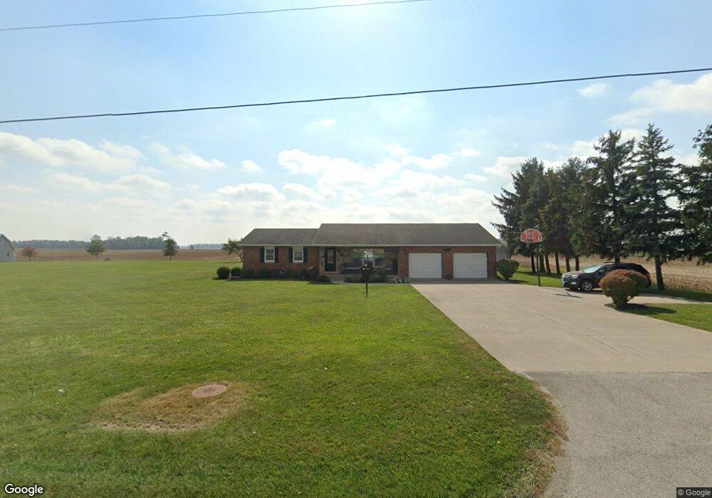
6971 State Route 705 New Weston, OH 45348
Estimated Value: $196,000 - $396,000
3
Beds
2
Baths
1,646
Sq Ft
$167/Sq Ft
Est. Value
About This Home
This home is located at 6971 State Route 705, New Weston, OH 45348 and is currently estimated at $275,145, approximately $167 per square foot. 6971 State Route 705 is a home located in Darke County with nearby schools including Versailles Elementary School, Versailles Middle School, and Versailles High School.
Ownership History
Date
Name
Owned For
Owner Type
Purchase Details
Closed on
Aug 27, 2010
Sold by
Hemmelgarn Dorothy H
Bought by
Frey Alan E
Current Estimated Value
Home Financials for this Owner
Home Financials are based on the most recent Mortgage that was taken out on this home.
Original Mortgage
$105,000
Outstanding Balance
$71,278
Interest Rate
5%
Mortgage Type
New Conventional
Estimated Equity
$203,867
Purchase Details
Closed on
Feb 26, 1993
Bought by
Frey Alan E
Create a Home Valuation Report for This Property
The Home Valuation Report is an in-depth analysis detailing your home's value as well as a comparison with similar homes in the area
Home Values in the Area
Average Home Value in this Area
Purchase History
| Date | Buyer | Sale Price | Title Company |
|---|---|---|---|
| Frey Alan E | $146,000 | Attorney | |
| Frey Alan E | $95,000 | -- |
Source: Public Records
Mortgage History
| Date | Status | Borrower | Loan Amount |
|---|---|---|---|
| Open | Frey Alan E | $105,000 |
Source: Public Records
Tax History Compared to Growth
Tax History
| Year | Tax Paid | Tax Assessment Tax Assessment Total Assessment is a certain percentage of the fair market value that is determined by local assessors to be the total taxable value of land and additions on the property. | Land | Improvement |
|---|---|---|---|---|
| 2024 | $2,137 | $68,230 | $8,300 | $59,930 |
| 2023 | $2,139 | $68,230 | $8,300 | $59,930 |
| 2022 | $1,780 | $56,040 | $7,020 | $49,020 |
| 2021 | $1,928 | $56,040 | $7,020 | $49,020 |
| 2020 | $1,938 | $56,040 | $7,020 | $49,020 |
| 2019 | $1,617 | $47,110 | $6,930 | $40,180 |
| 2018 | $1,587 | $47,110 | $6,930 | $40,180 |
| 2017 | $1,260 | $47,110 | $6,930 | $40,180 |
| 2016 | $1,261 | $39,200 | $6,760 | $32,440 |
| 2015 | $1,261 | $39,200 | $6,760 | $32,440 |
| 2014 | $1,326 | $39,200 | $6,760 | $32,440 |
| 2013 | $1,428 | $38,920 | $6,480 | $32,440 |
Source: Public Records
Map
Nearby Homes
- 45 Cassella Montezuma Rd
- 63 Cassella-Montezuma Rd
- 21 E Star Rd
- 159 Mendenhall Rd
- 158 Mendenhall Rd
- 157 Mendenhall Rd
- 140 Liberty Dr
- 139 Liberty Dr
- 136 Liberty Dr
- 137 Liberty Dr
- 138 Liberty Dr
- 141 Liberty Dr
- 142 Liberty Dr
- 135 Veterans Dr
- 144 Liberty Dr
- 143 Liberty Dr
- 155 Liberty Dr
- 146 Liberty Dr
- 156 Veterans Dr
- 145 Liberty Dr
- 6995 State Route 705
- 6984 State Route 705
- 14552 Whiterd Rd
- 6888 State Route 705
- 14551 Friend Rd
- 6848 State Route 705
- 14633 Friend Rd
- 14633 Friend Rd
- 14279 Friend Rd
- 6704 State Route 705
- 14238 Friend Rd
- 6688 State Route 705
- 14226 Friend Rd
- 14200 Friend Rd
- 7296 State Route 705
- 14194 Friend Rd
- 14190 Friend Rd
- 7328 State Route 705
- 6612 State Route 705
- 14125 Friend Rd