Estimated Value: $147,000 - $216,000
3
Beds
2
Baths
1,978
Sq Ft
$93/Sq Ft
Est. Value
About This Home
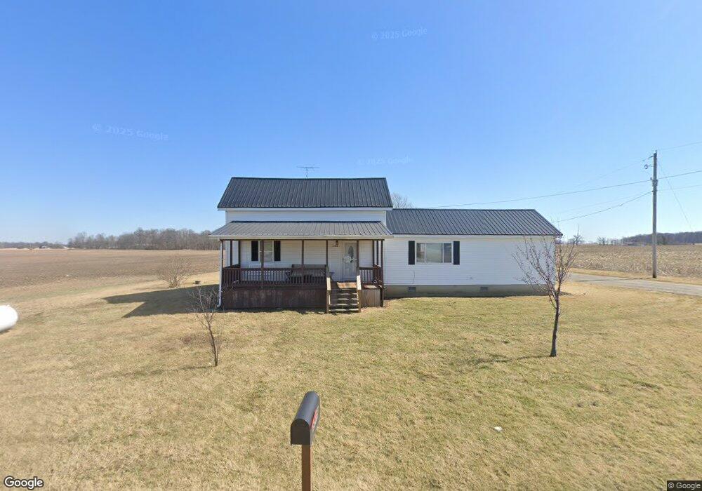
This home is located at 6978 State Route 195, Alger, OH 45812 and is currently estimated at $183,765, approximately $92 per square foot. 6978 State Route 195 is a home located in Hardin County with nearby schools including Upper Scioto Valley Elementary School, Upper Scioto Valley Middle School, and Upper Scioto Valley High School.
Ownership History
Date
Name
Owned For
Owner Type
Purchase Details
Closed on
Jun 30, 2023
Sold by
Wilson Alonzo and Wilson Tracy
Bought by
Wireman Logan and Hunsicker Emma
Current Estimated Value
Home Financials for this Owner
Home Financials are based on the most recent Mortgage that was taken out on this home.
Original Mortgage
$85,500
Outstanding Balance
$83,304
Interest Rate
6.39%
Mortgage Type
New Conventional
Estimated Equity
$100,461
Purchase Details
Closed on
Jul 2, 2020
Sold by
Shepherd Everett Kirk and Shepherd Zelma Lynn
Bought by
Wilson Alonzo and Wilson Tracy
Home Financials for this Owner
Home Financials are based on the most recent Mortgage that was taken out on this home.
Original Mortgage
$231,696
Interest Rate
2.9%
Mortgage Type
New Conventional
Purchase Details
Closed on
Jul 18, 1989
Create a Home Valuation Report for This Property
The Home Valuation Report is an in-depth analysis detailing your home's value as well as a comparison with similar homes in the area
Home Values in the Area
Average Home Value in this Area
Purchase History
| Date | Buyer | Sale Price | Title Company |
|---|---|---|---|
| Wireman Logan | $90,000 | None Listed On Document | |
| Wilson Alonzo | $230,000 | None Available | |
| -- | $40,800 | -- |
Source: Public Records
Mortgage History
| Date | Status | Borrower | Loan Amount |
|---|---|---|---|
| Open | Wireman Logan | $85,500 | |
| Previous Owner | Wilson Alonzo | $231,696 |
Source: Public Records
Tax History Compared to Growth
Tax History
| Year | Tax Paid | Tax Assessment Tax Assessment Total Assessment is a certain percentage of the fair market value that is determined by local assessors to be the total taxable value of land and additions on the property. | Land | Improvement |
|---|---|---|---|---|
| 2024 | $1,633 | $42,730 | $7,850 | $34,880 |
| 2023 | $1,633 | $59,690 | $24,810 | $34,880 |
| 2022 | $1,545 | $38,530 | $13,940 | $24,590 |
| 2021 | $1,634 | $38,530 | $13,940 | $24,590 |
| 2020 | $1,294 | $38,530 | $13,940 | $24,590 |
| 2019 | $1,282 | $40,700 | $20,940 | $19,760 |
| 2018 | $1,340 | $40,700 | $20,940 | $19,760 |
| 2017 | $700 | $41,750 | $20,940 | $20,810 |
| 2016 | $1,440 | $47,490 | $28,710 | $18,780 |
| 2015 | $1,601 | $47,490 | $28,710 | $18,780 |
| 2014 | $1,440 | $47,490 | $28,710 | $18,780 |
| 2013 | $1,351 | $33,850 | $13,430 | $20,420 |
Source: Public Records
Map
Nearby Homes
- 3931 County Road 80
- 501 Elm St
- 2864 Ohio 309
- 900 N Front St
- 203 Belmont St
- 710 S Main St
- 314 E University Ave
- 308-310 S Simon St
- 301 S Main St
- 212 N Simon St
- 211 S Main St
- 211 W Buckeye Ave Unit 211 1/2
- 4071 Township Road 35
- 210 N Gilbert St
- 442 Edwards St
- 444 Edwards St Unit A, B
- 444 Edwards St Unit 2
- 128 W North Ave
- 629 N Main St
- 6782 County Road 15
- 6978 Sr
- 4967 County Rd
- 4967 County Road 80
- 6935 State Route 195
- 6867 State Route 195
- 6845 State Route 195
- 6804 State Route 195
- 6804 Ohio 195
- 4794 County Road 80
- 6750 State Route 195
- 6751 State Route 195
- 5032 Township Road 84
- 5132 Township Road 84
- 7304 State Route 195
- 5267 Township Road 84
- 7330 State Route 195
- 4666 County Road 80
- 7366 State Route 195
- 7410 Ohio 195