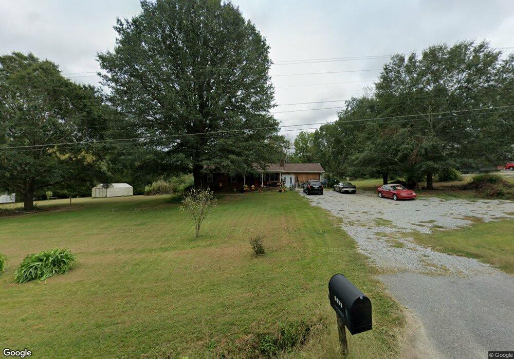
6979 Highway 115 W Cleveland, GA 30528
Estimated Value: $331,000 - $376,000
3
Beds
2
Baths
1,375
Sq Ft
$250/Sq Ft
Est. Value
About This Home
This home is located at 6979 Highway 115 W, Cleveland, GA 30528 and is currently estimated at $344,298, approximately $250 per square foot. 6979 Highway 115 W is a home located in White County with nearby schools including Tesnatee Gap Elementary (Old White County Intermediate), White County 9th Grade Academy, and Jack P. Nix Elementary School.
Ownership History
Date
Name
Owned For
Owner Type
Purchase Details
Closed on
Apr 1, 2022
Sold by
Dragoo Tyler W
Bought by
Roub Mark and Roub Karen
Current Estimated Value
Home Financials for this Owner
Home Financials are based on the most recent Mortgage that was taken out on this home.
Original Mortgage
$190,000
Outstanding Balance
$177,198
Interest Rate
3.76%
Mortgage Type
New Conventional
Estimated Equity
$167,100
Purchase Details
Closed on
Mar 2, 2021
Sold by
Dragoo Tina B
Bought by
Dragoo Tyler W
Purchase Details
Closed on
May 14, 2013
Sold by
Dragoo Timothy D
Bought by
Dragoo Timothy D and Dragoo Tina B
Home Financials for this Owner
Home Financials are based on the most recent Mortgage that was taken out on this home.
Original Mortgage
$112,142
Interest Rate
3.42%
Mortgage Type
New Conventional
Create a Home Valuation Report for This Property
The Home Valuation Report is an in-depth analysis detailing your home's value as well as a comparison with similar homes in the area
Home Values in the Area
Average Home Value in this Area
Purchase History
| Date | Buyer | Sale Price | Title Company |
|---|---|---|---|
| Roub Mark | $260,000 | -- | |
| Dragoo Tyler W | $95,000 | -- | |
| Dragoo Timothy D | -- | -- | |
| Dragoo Timothy D | $109,750 | -- | |
| Borwn Alan H | -- | -- |
Source: Public Records
Mortgage History
| Date | Status | Borrower | Loan Amount |
|---|---|---|---|
| Open | Roub Mark | $190,000 | |
| Previous Owner | Borwn Alan H | $112,142 |
Source: Public Records
Tax History Compared to Growth
Tax History
| Year | Tax Paid | Tax Assessment Tax Assessment Total Assessment is a certain percentage of the fair market value that is determined by local assessors to be the total taxable value of land and additions on the property. | Land | Improvement |
|---|---|---|---|---|
| 2025 | $2,483 | $119,188 | $21,080 | $98,108 |
| 2024 | $2,483 | $119,188 | $21,080 | $98,108 |
| 2023 | $2,472 | $108,976 | $18,736 | $90,240 |
| 2022 | $1,451 | $61,160 | $16,396 | $44,764 |
| 2021 | $1,331 | $49,660 | $13,252 | $36,408 |
| 2020 | $1,295 | $45,996 | $12,304 | $33,692 |
| 2019 | $1,299 | $45,996 | $12,304 | $33,692 |
| 2018 | $1,299 | $45,996 | $12,304 | $33,692 |
| 2017 | $1,226 | $43,824 | $12,304 | $31,520 |
| 2016 | $1,203 | $43,008 | $12,304 | $30,704 |
| 2015 | $1,148 | $107,520 | $12,304 | $30,704 |
| 2014 | $1,083 | $101,260 | $0 | $0 |
Source: Public Records
Map
Nearby Homes
- LOT 24 Luther Palmer Rd
- 3395 Asbury Mill Rd
- 0 Valhalla Dr Unit 10621291
- 31 Valhalla Dr
- 0 Waterfall Dr Unit 9 10472076
- 966 Wahoo Creek Rd
- 635 White Oak Trail
- 0 Westmoreland Rd Unit 10596625
- 987 Peaceful Valley Dr
- 174 Leighs Crossing
- 499 Old Deer Path Way
- 4872 Highway 115 W
- 0 Asbury Mill Rd Unit 10599324
- 0 Asbury Mill Rd Unit 7644389
- 00 Deer Run Trail
- 55 Santa Pera Dr
- LOT 55 Teel Mtn Dr
- 86.99 Acres Mincie Mountain
- LOT 57 Teel Mtn Dr
- 6.2 Mincey Acres Dr
- 195 Ferguson Cir
- 30 Ferguson Cir
- 0 Ed Lewis Rd
- 0 Ed Lewis Rd Unit 7168423
- 0 Ed Lewis Rd Unit 7396145
- 0 Ed Lewis Rd Unit 7004672
- 0 Ed Lewis Rd Unit 3213052
- 280 Ferguson Cir
- 6954 Highway 115 W
- 307 Ferguson Cir
- 183 Martin Springs Ln
- 7130 Highway 115 W
- 71 Ferguson Cir
- 0 Ferguson Cir Unit 8095533
- 0 Ferguson Cir Unit 5769573
- 0 Ferguson Cir
- 0 Ferguson Cir Unit 8272729
- 0 Ferguson Cir Unit 8238795
- 6461 Highway 115 W
- 37 Martin Springs Ln