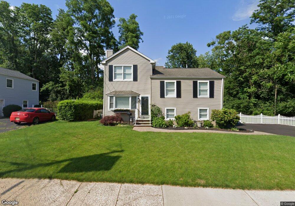
698 Cedarbrook Ave South Plainfield, NJ 07080
Estimated Value: $575,049 - $684,000
--
Bed
--
Bath
--
Sq Ft
10,498
Sq Ft Lot
About This Home
This home is located at 698 Cedarbrook Ave, South Plainfield, NJ 07080 and is currently estimated at $651,512. 698 Cedarbrook Ave is a home located in Middlesex County with nearby schools including South Plainfield High School, Koinonia Academy, and Holy Savior Academy.
Ownership History
Date
Name
Owned For
Owner Type
Purchase Details
Closed on
Jul 27, 2018
Sold by
Gemenden Deborah Ballard and The Estate Of Babara Ballard
Bought by
Gemenden Randy and Gemenden Jessica
Current Estimated Value
Home Financials for this Owner
Home Financials are based on the most recent Mortgage that was taken out on this home.
Original Mortgage
$275,000
Interest Rate
4.9%
Mortgage Type
New Conventional
Purchase Details
Closed on
Oct 14, 2011
Sold by
Ballard Barbara L
Bought by
Ballard Barbara L and Ballard Kimberly R
Create a Home Valuation Report for This Property
The Home Valuation Report is an in-depth analysis detailing your home's value as well as a comparison with similar homes in the area
Home Values in the Area
Average Home Value in this Area
Purchase History
| Date | Buyer | Sale Price | Title Company |
|---|---|---|---|
| Gemenden Randy | $375,000 | All Ahead Title Agency Llc | |
| Ballard Barbara L | -- | None Available |
Source: Public Records
Mortgage History
| Date | Status | Borrower | Loan Amount |
|---|---|---|---|
| Previous Owner | Gemenden Randy | $275,000 |
Source: Public Records
Tax History Compared to Growth
Tax History
| Year | Tax Paid | Tax Assessment Tax Assessment Total Assessment is a certain percentage of the fair market value that is determined by local assessors to be the total taxable value of land and additions on the property. | Land | Improvement |
|---|---|---|---|---|
| 2025 | $10,096 | $144,600 | $32,300 | $112,300 |
| 2024 | $9,656 | $144,600 | $32,300 | $112,300 |
| 2023 | $9,656 | $144,600 | $32,300 | $112,300 |
| 2022 | $9,536 | $144,600 | $32,300 | $112,300 |
| 2021 | $9,312 | $144,600 | $32,300 | $112,300 |
| 2020 | $9,176 | $144,600 | $32,300 | $112,300 |
| 2019 | $8,805 | $144,600 | $32,300 | $112,300 |
| 2018 | $8,328 | $144,600 | $32,300 | $112,300 |
| 2017 | $7,720 | $144,600 | $32,300 | $112,300 |
| 2016 | $7,890 | $144,600 | $32,300 | $112,300 |
| 2015 | $7,504 | $144,600 | $32,300 | $112,300 |
| 2014 | $7,280 | $144,600 | $32,300 | $112,300 |
Source: Public Records
Map
Nearby Homes
- 533 Edgar Ave
- 1726 Kenyon Ave
- 1712 Kenyon Ave
- 1400 Kenyon Ave
- 127 Remington Ave Unit 31
- 260 Merchants Ave
- 241 Van Fleet Ave
- 77 Parkside Rd Unit 89
- 1905 Park Ave
- 132 Parkside Rd
- 105 Firth St
- 1210 Field Ave
- 117 Golf Ave E
- 1066 Allenwood Dr
- 6 Stacey Ct
- 102 Jerome Ave
- 2415 Maple Ave
- 1349 Park Ave Unit 53
- 1339 Park Ave Unit 41
- 551 Melrose Ave
- 702 Cedarbrook Ave
- 615 Cedarbrook Ave
- 701 Cedarbrook Ave
- 706 Cedarbrook Ave
- 1804 Stratford Ave
- 1805 Stratford Ave
- 705 Cedarbrook Ave
- 710 Cedarbrook Ave
- 709 Cedarbrook Ave
- 1809 Stratford Ave
- 1914 Kenyon Ave
- 713 Cedarbrook Ave
- 1910 Kenyon Ave
- 714 Cedarbrook Ave
- 21 Salem St
- 1812 Stratford Ave
- 1906 Kenyon Ave
- 717 Cedarbrook Ave
- 1902 Stratford Ave
- 1902 Kenyon Ave