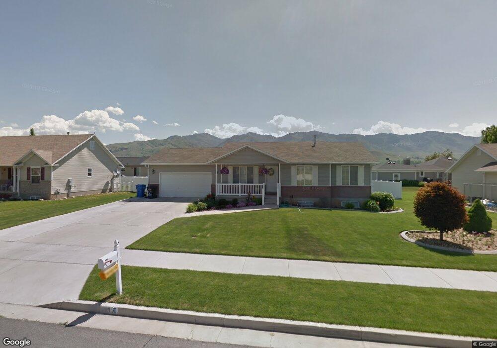
698 S 180 E Smithfield, UT 84335
Estimated Value: $427,000 - $500,000
5
Beds
3
Baths
2,296
Sq Ft
$203/Sq Ft
Est. Value
About This Home
This home is located at 698 S 180 E, Smithfield, UT 84335 and is currently estimated at $464,954, approximately $202 per square foot. 698 S 180 E is a home located in Cache County with nearby schools including Summit School, Cedar Ridge School, and North Cache Middle School.
Ownership History
Date
Name
Owned For
Owner Type
Purchase Details
Closed on
Mar 20, 2024
Sold by
Gordon G And Kathryn G Geddes Family Liv
Bought by
Gordon G And Kathryn G Geddes Family Living T and Geddes
Current Estimated Value
Purchase Details
Closed on
May 17, 2019
Sold by
Garner Rebecca Jo
Bought by
Gordon G And Kathryn G Geddes Fam Liv Tr
Purchase Details
Closed on
May 7, 2019
Sold by
Tanaka Joanne H
Bought by
Garner Rebecca Jo
Purchase Details
Closed on
Jun 22, 2006
Sold by
Meacham Karen L
Bought by
Tanaka Dan D and Tanaka Joanne H
Home Financials for this Owner
Home Financials are based on the most recent Mortgage that was taken out on this home.
Original Mortgage
$100,000
Interest Rate
6.63%
Mortgage Type
New Conventional
Purchase Details
Closed on
Aug 20, 2002
Sold by
L Robert & Annette G Saxton Investments
Bought by
Meacham Karen L
Home Financials for this Owner
Home Financials are based on the most recent Mortgage that was taken out on this home.
Original Mortgage
$50,000
Interest Rate
6.51%
Create a Home Valuation Report for This Property
The Home Valuation Report is an in-depth analysis detailing your home's value as well as a comparison with similar homes in the area
Home Values in the Area
Average Home Value in this Area
Purchase History
| Date | Buyer | Sale Price | Title Company |
|---|---|---|---|
| Gordon G And Kathryn G Geddes Family Living T | -- | Cache Title | |
| Gordon G And Kathryn G Geddes Fam Liv Tr | -- | None Available | |
| Garner Rebecca Jo | -- | None Available | |
| Tanaka Dan D | -- | Hickman Land Title Company | |
| Meacham Karen L | -- | Cache Title Company |
Source: Public Records
Mortgage History
| Date | Status | Borrower | Loan Amount |
|---|---|---|---|
| Previous Owner | Tanaka Dan D | $100,000 | |
| Previous Owner | Meacham Karen L | $50,000 |
Source: Public Records
Tax History
| Year | Tax Paid | Tax Assessment Tax Assessment Total Assessment is a certain percentage of the fair market value that is determined by local assessors to be the total taxable value of land and additions on the property. | Land | Improvement |
|---|---|---|---|---|
| 2025 | $1,687 | $225,855 | $0 | $0 |
| 2023 | $2,111 | $250,660 | $0 | $0 |
| 2022 | $2,145 | $250,655 | $0 | $0 |
| 2021 | $2,121 | $378,595 | $70,000 | $308,595 |
| 2020 | $1,621 | $269,996 | $70,000 | $199,996 |
| 2019 | $1,568 | $248,996 | $49,000 | $199,996 |
| 2018 | $1,452 | $222,910 | $49,000 | $173,910 |
| 2017 | $1,358 | $113,905 | $0 | $0 |
| 2016 | $1,382 | $113,905 | $0 | $0 |
| 2015 | $1,195 | $98,115 | $0 | $0 |
| 2014 | $1,175 | $98,390 | $0 | $0 |
| 2013 | -- | $98,390 | $0 | $0 |
Source: Public Records
Map
Nearby Homes
- 698 S 180 E Unit 17
- 684 S 180 E Unit 20
- 697 S 220 E Unit 18
- 697 S 220 E
- 714 S 180 E Unit 14
- 714 S 180 E
- 713 S 220 E Unit 15
- 683 S 220 E Unit 21
- 683 S 220 E
- 693 S 180 E
- 707 S 180 E
- 668 S 180 E Unit 23
- 681 S 180 E Unit 5
- 681 S 180 E
- 730 S 180 E Unit 11
- 730 S 180 E
- 667 S 220 E
- 729 S 220 E Unit 12
- 729 S 220 E
- 725 S 180 E Unit 8
Your Personal Tour Guide
Ask me questions while you tour the home.