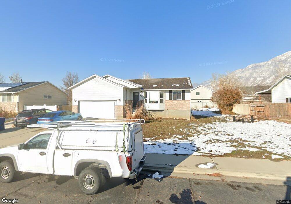
698 W 550 N Pleasant Grove, UT 84062
Estimated Value: $505,000 - $562,000
5
Beds
2
Baths
2,100
Sq Ft
$253/Sq Ft
Est. Value
About This Home
This home is located at 698 W 550 N, Pleasant Grove, UT 84062 and is currently estimated at $530,875, approximately $252 per square foot. 698 W 550 N is a home located in Utah County with nearby schools including Mount Mahogany School, Pleasant Grove Junior High School, and Pleasant Grove High School.
Ownership History
Date
Name
Owned For
Owner Type
Purchase Details
Closed on
Jul 28, 2015
Sold by
Bekker John
Bought by
Whatcott David Chadwick
Current Estimated Value
Home Financials for this Owner
Home Financials are based on the most recent Mortgage that was taken out on this home.
Original Mortgage
$189,400
Outstanding Balance
$149,063
Interest Rate
4.05%
Mortgage Type
New Conventional
Estimated Equity
$381,812
Purchase Details
Closed on
Feb 26, 2015
Sold by
Jeffcoats Jimmy and Jeffcoats Mary
Bought by
Bekker John
Home Financials for this Owner
Home Financials are based on the most recent Mortgage that was taken out on this home.
Original Mortgage
$175,100
Interest Rate
3.57%
Mortgage Type
Purchase Money Mortgage
Purchase Details
Closed on
Feb 13, 2004
Sold by
Funk Lane W and Funk Lari W
Bought by
Jeffcoats Jimmy and Jeffcoats Mary
Create a Home Valuation Report for This Property
The Home Valuation Report is an in-depth analysis detailing your home's value as well as a comparison with similar homes in the area
Home Values in the Area
Average Home Value in this Area
Purchase History
| Date | Buyer | Sale Price | Title Company |
|---|---|---|---|
| Whatcott David Chadwick | -- | 1St Liberty Title Lc | |
| Bekker John | -- | 1St Liberty Title Lc | |
| Jeffcoats Jimmy | -- | Mountain West Title Co |
Source: Public Records
Mortgage History
| Date | Status | Borrower | Loan Amount |
|---|---|---|---|
| Open | Whatcott David Chadwick | $189,400 | |
| Previous Owner | Bekker John | $175,100 |
Source: Public Records
Tax History Compared to Growth
Tax History
| Year | Tax Paid | Tax Assessment Tax Assessment Total Assessment is a certain percentage of the fair market value that is determined by local assessors to be the total taxable value of land and additions on the property. | Land | Improvement |
|---|---|---|---|---|
| 2025 | $2,026 | $264,000 | $192,600 | $287,400 |
| 2024 | $2,026 | $241,835 | $0 | $0 |
| 2023 | $1,999 | $244,200 | $0 | $0 |
| 2022 | $2,054 | $249,645 | $0 | $0 |
| 2021 | $1,814 | $335,700 | $129,000 | $206,700 |
| 2020 | $1,661 | $301,400 | $115,200 | $186,200 |
| 2019 | $1,521 | $285,400 | $111,700 | $173,700 |
| 2018 | $1,441 | $255,700 | $104,700 | $151,000 |
| 2017 | $1,436 | $135,685 | $0 | $0 |
| 2016 | $1,373 | $125,180 | $0 | $0 |
| 2015 | $1,324 | $114,345 | $0 | $0 |
| 2014 | $1,241 | $106,205 | $0 | $0 |
Source: Public Records
Map
Nearby Homes
- 854 N 1010 W
- 1130 W State Rd
- 685 W 1000 N
- 1078 W 70 N
- 123 N Romney Ln Unit 103
- 165 S Pleasant Blvd Unit 45
- 909 W 1180 N
- 1249 W Cambria Dr Unit 101
- 150 N 1300 W
- 1267 W 20 S
- 1152 N 200 W
- 1429 W 110 N
- 1406 W 50 N
- 278 S 740 W
- 1525 W 300 N
- 1443 W 1010 N
- 1541 W 250 N
- 1051 N 600 W
- 1031 N 600 W
- 1041 N 600 W