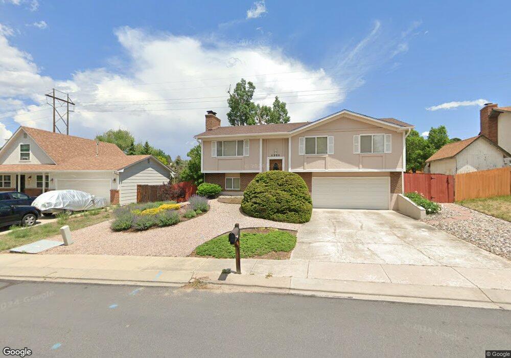
6980 Snowbird Dr Colorado Springs, CO 80918
Pulpit Rock NeighborhoodEstimated Value: $417,003 - $454,000
3
Beds
3
Baths
1,138
Sq Ft
$381/Sq Ft
Est. Value
About This Home
This home is located at 6980 Snowbird Dr, Colorado Springs, CO 80918 and is currently estimated at $433,251, approximately $380 per square foot. 6980 Snowbird Dr is a home located in El Paso County with nearby schools including Pioneer Elementary School, Mountain Ridge Middle School, and Rampart High School.
Ownership History
Date
Name
Owned For
Owner Type
Purchase Details
Closed on
Feb 28, 1997
Sold by
Thelen Todd S and Thelen Christine A
Bought by
Mcchesney Kevin R
Current Estimated Value
Home Financials for this Owner
Home Financials are based on the most recent Mortgage that was taken out on this home.
Original Mortgage
$122,700
Outstanding Balance
$15,117
Interest Rate
7.92%
Mortgage Type
FHA
Estimated Equity
$418,134
Purchase Details
Closed on
Nov 3, 1994
Sold by
Nissen Arthur J and Nissen Denise P
Bought by
Thelen Todd S and Thelen Christine A
Home Financials for this Owner
Home Financials are based on the most recent Mortgage that was taken out on this home.
Original Mortgage
$80,000
Interest Rate
8.73%
Purchase Details
Closed on
Feb 1, 1980
Bought by
Mcchesney Kevin R
Create a Home Valuation Report for This Property
The Home Valuation Report is an in-depth analysis detailing your home's value as well as a comparison with similar homes in the area
Home Values in the Area
Average Home Value in this Area
Purchase History
| Date | Buyer | Sale Price | Title Company |
|---|---|---|---|
| Mcchesney Kevin R | $124,000 | -- | |
| Thelen Todd S | $105,000 | -- | |
| Mcchesney Kevin R | -- | -- |
Source: Public Records
Mortgage History
| Date | Status | Borrower | Loan Amount |
|---|---|---|---|
| Open | Mcchesney Kevin R | $122,700 | |
| Previous Owner | Thelen Todd S | $80,000 |
Source: Public Records
Tax History Compared to Growth
Tax History
| Year | Tax Paid | Tax Assessment Tax Assessment Total Assessment is a certain percentage of the fair market value that is determined by local assessors to be the total taxable value of land and additions on the property. | Land | Improvement |
|---|---|---|---|---|
| 2025 | $1,503 | $29,110 | -- | -- |
| 2024 | $1,452 | $29,020 | $5,700 | $23,320 |
| 2022 | $1,383 | $20,900 | $5,060 | $15,840 |
| 2021 | $1,536 | $21,500 | $5,210 | $16,290 |
| 2020 | $1,388 | $18,030 | $4,530 | $13,500 |
| 2019 | $1,373 | $18,030 | $4,530 | $13,500 |
| 2018 | $1,183 | $15,260 | $3,810 | $11,450 |
| 2017 | $1,178 | $15,260 | $3,810 | $11,450 |
| 2016 | $1,123 | $14,530 | $3,940 | $10,590 |
| 2015 | $1,121 | $14,530 | $3,940 | $10,590 |
| 2014 | $1,020 | $13,210 | $3,890 | $9,320 |
Source: Public Records
Map
Nearby Homes
- 2113 Roundtop Ct
- 6641 Gambol Quail Dr W
- 6655 Sproul Ln
- 6447 Jonathan Ct Unit E1
- 6530 Brook Park Dr
- 6470 Lehman Dr
- 2570 Covington Place
- 2563 Integrity Ct
- 6868 Los Reyes Cir
- 6633 Dublin Loop W Unit 4
- 6872 Los Reyes Cir
- 2635 Canton Ln
- 6632 Dublin Loop W
- 2650 Canton Ln
- 1871 Brookwood Dr
- 6881 Los Reyes Cir
- 6806 Los Reyes Cir
- 2661 Hatch Cir
- 6041 Kingdom View
- 6145 Pine Hill Dr
- 6970 Snowbird Dr
- 6990 Snowbird Dr
- 6960 Snowbird Dr
- 6965 Snowbird Dr
- 6950 Snowbird Dr
- 6945 Snowbird Dr
- 2172 Roundtop Ct
- 2162 Roundtop Ct
- 2182 Roundtop Ct
- 6935 Snowbird Dr
- 6940 Snowbird Dr
- 2152 Roundtop Ct
- 6530 Gambol Quail Dr W
- 6540 Gambol Quail Dr W
- 6745 Dublin Terrace
- 6715 Dublin Terrace
- 6520 Gambol Quail Dr W
- 6550 Gambol Quail Dr W
- 2142 Roundtop Ct
- 6925 Snowbird Dr