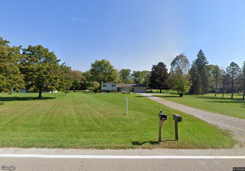
69800 Wolcott Rd Armada, MI 48005
Estimated Value: $335,553 - $413,000
Studio
1
Bath
1,862
Sq Ft
$204/Sq Ft
Est. Value
About This Home
This home is located at 69800 Wolcott Rd, Armada, MI 48005 and is currently estimated at $380,388, approximately $204 per square foot. 69800 Wolcott Rd is a home located in Macomb County with nearby schools including Orville C. Krause Elementary School, Armada Middle School, and Armada High School.
Ownership History
Date
Name
Owned For
Owner Type
Purchase Details
Closed on
Aug 5, 2014
Sold by
Anderson Lois J and Slating Irene M
Bought by
Hegwood Johnny C
Current Estimated Value
Purchase Details
Closed on
Sep 8, 2004
Sold by
Anderson Lois J
Bought by
Gallagher Myrna E
Home Financials for this Owner
Home Financials are based on the most recent Mortgage that was taken out on this home.
Original Mortgage
$81,000
Interest Rate
5.95%
Mortgage Type
Credit Line Revolving
Create a Home Valuation Report for This Property
The Home Valuation Report is an in-depth analysis detailing your home's value as well as a comparison with similar homes in the area
Home Values in the Area
Average Home Value in this Area
Purchase History
| Date | Buyer | Sale Price | Title Company |
|---|---|---|---|
| Hegwood Johnny C | $20,000 | None Available | |
| Gallagher Myrna E | -- | Metropolitan Title Company |
Source: Public Records
Mortgage History
| Date | Status | Borrower | Loan Amount |
|---|---|---|---|
| Previous Owner | Gallagher Myrna E | $81,000 |
Source: Public Records
Tax History
| Year | Tax Paid | Tax Assessment Tax Assessment Total Assessment is a certain percentage of the fair market value that is determined by local assessors to be the total taxable value of land and additions on the property. | Land | Improvement |
|---|---|---|---|---|
| 2025 | $1,899 | $147,600 | $0 | $0 |
| 2024 | $18 | $143,700 | $0 | $0 |
| 2023 | $1,750 | $126,800 | $0 | $0 |
| 2022 | $2,649 | $114,700 | $0 | $0 |
| 2021 | $2,577 | $110,300 | $0 | $0 |
| 2020 | $1,609 | $107,900 | $0 | $0 |
| 2019 | $2,329 | $99,400 | $0 | $0 |
| 2018 | $2,135 | $99,300 | $0 | $0 |
| 2017 | $2,106 | $93,100 | $21,000 | $72,100 |
| 2016 | $2,091 | $93,100 | $0 | $0 |
| 2015 | -- | $85,800 | $0 | $0 |
| 2011 | -- | $74,983 | $18,460 | $56,523 |
Source: Public Records
Map
Nearby Homes
- 00 Armada Ridge Rd
- 00000 32 Mile Rd
- 69455 Hicks Rd
- 20500 Armada Ridge Rd
- 20144 32 Mile Rd
- 71800 Coon Creek Rd
- 0 32 Mile Rd Unit 50104250
- Lot 2 33 Mile Rd
- 0 Capac Rd Unit G50063654
- 16364 34 Mile Rd
- 71649 Hidden River Dr
- 71714 Hidden River Dr
- 71608 Hidden River Dr
- 71712 Hidden River Dr
- 73213 Coon Creek Rd
- 0 31 Mile Rd Unit 50156618
- 73325 Coon Creek Rd
- 21572 34 Mile Rd
- 67800 Powell Rd Unit 67990 Powell
- 0 31 Mile Rd Parcel 3
- 69870 Wolcott Rd
- 69740 Wolcott Rd
- 69700 Wolcott Rd
- 69717 Wolcott Rd
- 69853 Wolcott Rd
- 69600 Wolcott Rd
- 70100 Wolcott Rd
- 69540 Wolcott Rd
- 70011 Wolcott Rd
- 69587 Wolcott Rd
- 18820 Armada Ridge Rd
- 18770 Armada Ridge Rd
- 69420 Wolcott Rd
- 70199 Wolcott Rd
- 69451 Wolcott Rd
- 18775 Armada Ridge Rd
- 18900 Armada Ridge Rd
- 18401 Gilmore Rd
- 70278 Wolcott Rd
- 69341 Wolcott Rd
Your Personal Tour Guide
Ask me questions while you tour the home.