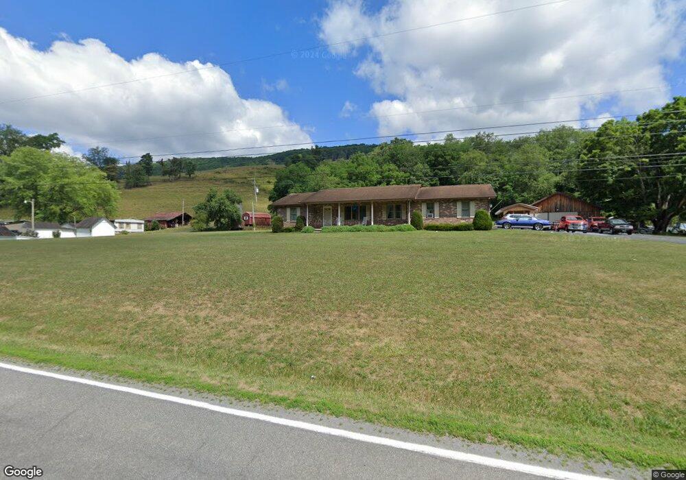
6983 Clearfork Rd Bastian, VA 24314
Estimated Value: $249,000 - $306,000
3
Beds
3
Baths
1,796
Sq Ft
$149/Sq Ft
Est. Value
About This Home
This home is located at 6983 Clearfork Rd, Bastian, VA 24314 and is currently estimated at $267,485, approximately $148 per square foot. 6983 Clearfork Rd is a home located in Tazewell County.
Ownership History
Date
Name
Owned For
Owner Type
Purchase Details
Closed on
Apr 12, 2013
Sold by
Neel Ronnie J and Neel Kenneth S
Bought by
Justice Quintin G and Justice Abigail Leann
Current Estimated Value
Home Financials for this Owner
Home Financials are based on the most recent Mortgage that was taken out on this home.
Original Mortgage
$171,830
Outstanding Balance
$120,475
Interest Rate
3.55%
Mortgage Type
FHA
Estimated Equity
$147,011
Create a Home Valuation Report for This Property
The Home Valuation Report is an in-depth analysis detailing your home's value as well as a comparison with similar homes in the area
Home Values in the Area
Average Home Value in this Area
Purchase History
| Date | Buyer | Sale Price | Title Company |
|---|---|---|---|
| Justice Quintin G | $176,100 | None Available |
Source: Public Records
Mortgage History
| Date | Status | Borrower | Loan Amount |
|---|---|---|---|
| Open | Justice Quintin G | $171,830 |
Source: Public Records
Tax History
| Year | Tax Paid | Tax Assessment Tax Assessment Total Assessment is a certain percentage of the fair market value that is determined by local assessors to be the total taxable value of land and additions on the property. | Land | Improvement |
|---|---|---|---|---|
| 2025 | $1,212 | $208,900 | $34,700 | $174,200 |
| 2023 | $1,052 | $181,400 | $33,800 | $147,600 |
| 2022 | $1,052 | $181,400 | $33,800 | $147,600 |
| 2021 | $1,052 | $181,400 | $33,800 | $147,600 |
| 2020 | $1,052 | $181,400 | $33,800 | $147,600 |
| 2019 | $1,052 | $181,400 | $33,800 | $147,600 |
| 2018 | $969 | $181,400 | $33,800 | $147,600 |
| 2017 | $969 | $176,100 | $33,800 | $142,300 |
| 2016 | -- | $176,100 | $33,800 | $142,300 |
| 2015 | -- | $176,100 | $33,800 | $142,300 |
| 2014 | -- | $176,100 | $33,800 | $142,300 |
| 2013 | -- | $176,100 | $33,800 | $142,300 |
Source: Public Records
Map
Nearby Homes
- 215 Squire Dr
- Lot 88 Nye Valley Rd - Cove Creek
- Lot 17 Fox Hollow Dr
- Lot 17 Fox Hollow Dr
- 127 Anns Ln
- 31 Clear Fork Creek Rd
- TBD Carriage Ln
- 900 Tanager Dr
- 621 Robin St
- 619 Robin St
- 2059 Clearfork Rd
- 0 Robin St
- 0 Robin St
- 6 Sedgewood Townhouses
- TBD Stoney Ridge Ln
- 6 Fairlane Dr
- 103 W Mountain View Ave
- 0 Burkes Garden Rd
- TBD Cliffview St
- 215 W Mountain View Ave
- 7017 Clearfork Rd
- 6947 Clearfork Rd
- 7004 Clearfork Rd
- 7032 Clearfork Rd
- 7082 Clearfork Rd
- 6795 Clearfork Rd
- 7120 Clearfork Rd
- 7146 Clearfork Rd
- 6636 Clearfork Rd
- 7210 Clearfork Rd
- 7321 Clearfork Rd
- 315 Cove Creek Rd
- 7391 Clearfork Rd
- 6635 Clearfork Rd
- 7392 Clearfork Rd
- #65 Cove Creek
- 4500 Cove Ck Rd
- 65 Acres Buckhorn Mountain Ln
- 359 Leffel Farm Rd
- 7458 Clearfork Rd
Your Personal Tour Guide
Ask me questions while you tour the home.