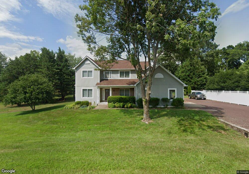
6989 Wayland Dr Warrenton, VA 20187
Estimated Value: $750,262 - $861,000
4
Beds
4
Baths
2,732
Sq Ft
$289/Sq Ft
Est. Value
About This Home
This home is located at 6989 Wayland Dr, Warrenton, VA 20187 and is currently estimated at $790,566, approximately $289 per square foot. 6989 Wayland Dr is a home located in Fauquier County with nearby schools including P.B. Smith Elementary School, Marshall Middle School, and Fauquier High School.
Ownership History
Date
Name
Owned For
Owner Type
Purchase Details
Closed on
May 26, 1998
Sold by
New Dimensions Inc
Bought by
Tilden Thomas J and Tilden Kathy M
Current Estimated Value
Home Financials for this Owner
Home Financials are based on the most recent Mortgage that was taken out on this home.
Original Mortgage
$192,000
Outstanding Balance
$38,344
Interest Rate
7.03%
Mortgage Type
New Conventional
Estimated Equity
$752,222
Create a Home Valuation Report for This Property
The Home Valuation Report is an in-depth analysis detailing your home's value as well as a comparison with similar homes in the area
Home Values in the Area
Average Home Value in this Area
Purchase History
| Date | Buyer | Sale Price | Title Company |
|---|---|---|---|
| Tilden Thomas J | $240,000 | -- |
Source: Public Records
Mortgage History
| Date | Status | Borrower | Loan Amount |
|---|---|---|---|
| Open | Tilden Thomas J | $192,000 |
Source: Public Records
Tax History Compared to Growth
Tax History
| Year | Tax Paid | Tax Assessment Tax Assessment Total Assessment is a certain percentage of the fair market value that is determined by local assessors to be the total taxable value of land and additions on the property. | Land | Improvement |
|---|---|---|---|---|
| 2025 | $5,890 | $609,100 | $162,300 | $446,800 |
| 2024 | $5,757 | $609,100 | $162,300 | $446,800 |
| 2023 | $5,514 | $609,100 | $162,300 | $446,800 |
| 2022 | $5,514 | $609,100 | $162,300 | $446,800 |
| 2021 | $4,519 | $453,300 | $137,300 | $316,000 |
| 2020 | $4,519 | $453,300 | $137,300 | $316,000 |
| 2019 | $4,492 | $453,300 | $137,300 | $316,000 |
| 2018 | $4,244 | $453,300 | $137,300 | $316,000 |
| 2016 | -- | $385,900 | $137,300 | $248,600 |
| 2015 | -- | $385,900 | $137,300 | $248,600 |
| 2014 | -- | $385,900 | $137,300 | $248,600 |
Source: Public Records
Map
Nearby Homes
- 7038 Beaconsfield Ln
- 7057 Blackwell Rd
- 7131 Northampton St
- 6416 Airlie Rd
- 7213 Princess Anne Ct
- 6397 Tazewell St
- 0 Airlie Road Lee Hwy Unit VAFQ2018058
- 0 Hwy Unit VAFQ2018052
- 7241 Blackwell Rd
- 7245 Blackwell Rd
- 7253 Blackwell Rd
- 7333 Hazelwood Ct
- 7085 Bramble Way
- 7176 Homestead Ct
- 5985 Whippoorwill Dr
- 116 Oak Tree Ln
- 7040 Hi Rock Ridge Rd
- 6704 Holly Farm Ln Unit 204
- 6704 Holly Farm Ln Unit 109
- 7323 Bayfield Ln
- 6983 Wayland Dr
- 6984 Wayland Dr
- 7000 Wayland Dr
- 6980 Wayland Dr
- 6981 Wayland Dr
- 6754 Carter Ct
- 6744 Carter Ct
- 6749 Carter Ct
- 6783 Spruce Hill Ct
- 7001 Wayland Dr
- 7005 Wayland Dr
- 6729 Carter Ct
- 6791 Spruce Hill Ct
- 7020 Wayland Dr
- 7082 Beaconsfield Ln
- 6790 Spruce Hill Ct
- 7041 Wayland Dr
- 0 Wayland Dr Unit FQ7711838
- 0 Wayland Dr Unit FQ7686613
- 0 Wayland Dr Unit 1009476834