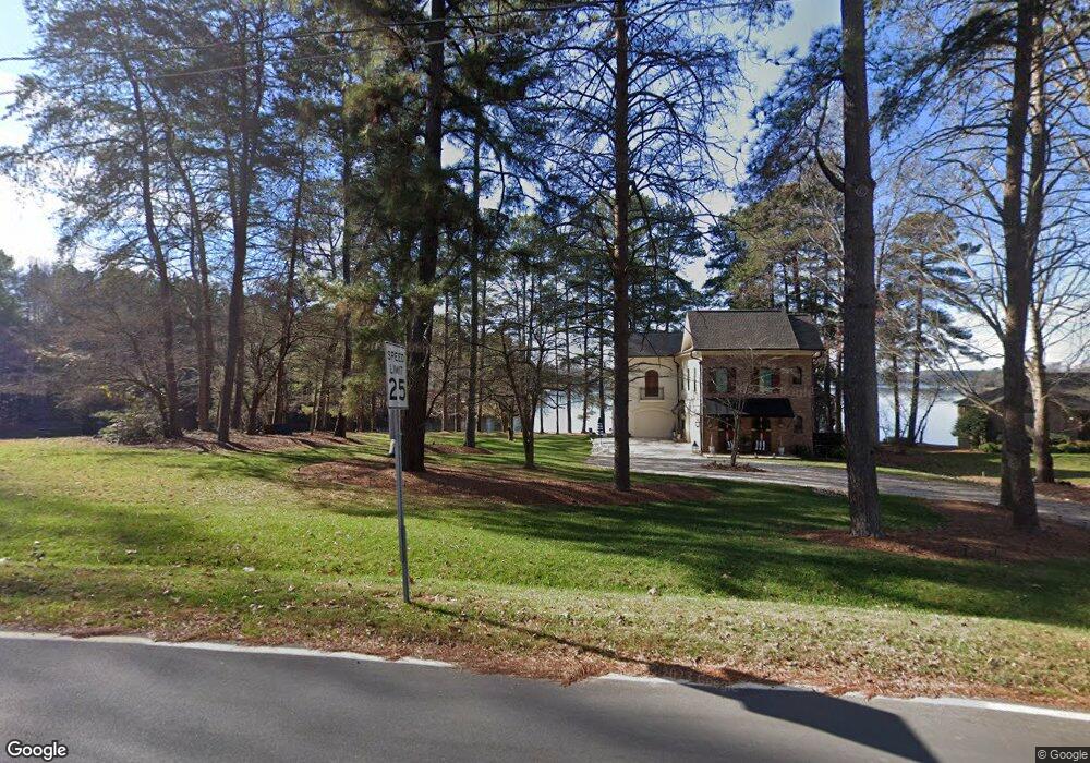
699 Big Indian Loop Mooresville, NC 28117
Estimated Value: $792,000 - $1,106,532
3
Beds
3
Baths
1,882
Sq Ft
$523/Sq Ft
Est. Value
About This Home
This home is located at 699 Big Indian Loop, Mooresville, NC 28117 and is currently estimated at $983,633, approximately $522 per square foot. 699 Big Indian Loop is a home located in Iredell County with nearby schools including Lakeshore Elementary School, Lakeshore Middle School, and Lake Norman High School.
Ownership History
Date
Name
Owned For
Owner Type
Purchase Details
Closed on
Nov 18, 2016
Sold by
Rudisill Robert P
Bought by
Dipascal Keith and Dipascal Leah
Current Estimated Value
Home Financials for this Owner
Home Financials are based on the most recent Mortgage that was taken out on this home.
Original Mortgage
$320,000
Interest Rate
3.47%
Mortgage Type
Purchase Money Mortgage
Purchase Details
Closed on
Oct 1, 1995
Purchase Details
Closed on
Dec 1, 1994
Purchase Details
Closed on
Jun 1, 1976
Create a Home Valuation Report for This Property
The Home Valuation Report is an in-depth analysis detailing your home's value as well as a comparison with similar homes in the area
Home Values in the Area
Average Home Value in this Area
Purchase History
| Date | Buyer | Sale Price | Title Company |
|---|---|---|---|
| Dipascal Keith | $400,000 | Meridian Title Company | |
| -- | -- | -- | |
| -- | -- | -- | |
| -- | $7,500 | -- |
Source: Public Records
Mortgage History
| Date | Status | Borrower | Loan Amount |
|---|---|---|---|
| Closed | Dipascal Keith | $320,000 |
Source: Public Records
Tax History
| Year | Tax Paid | Tax Assessment Tax Assessment Total Assessment is a certain percentage of the fair market value that is determined by local assessors to be the total taxable value of land and additions on the property. | Land | Improvement |
|---|---|---|---|---|
| 2025 | $6,006 | $1,007,860 | $570,000 | $437,860 |
| 2024 | $6,006 | $1,007,860 | $570,000 | $437,860 |
| 2023 | $6,006 | $1,007,860 | $570,000 | $437,860 |
| 2022 | $4,192 | $658,420 | $357,500 | $300,920 |
| 2021 | $4,188 | $658,420 | $357,500 | $300,920 |
| 2020 | $3,660 | $574,280 | $357,500 | $216,780 |
| 2019 | $2,190 | $366,450 | $357,500 | $8,950 |
| 2018 | $1,992 | $333,360 | $330,000 | $3,360 |
| 2017 | $2,211 | $361,350 | $330,000 | $31,350 |
| 2016 | $2,211 | $361,350 | $330,000 | $31,350 |
| 2015 | $2,211 | $361,350 | $330,000 | $31,350 |
| 2014 | $2,158 | $379,450 | $330,000 | $49,450 |
Source: Public Records
Map
Nearby Homes
- 127 Palos Verde Dr
- 123 Palos Verde Dr
- 130 Canoe Pole Ln
- 149 Little Indian Loop
- 147 Castle Dr
- 110 Hunts Landing Dr
- 117 Hunts Landing Dr
- 124 Cedar Woods Dr
- 145 Morgan Bluff Rd
- 107 Blackbeard Ln Unit 2
- 124 Sisters Cove Ct
- 903 Cornelius Rd
- 000 Bluefield Rd
- 129 Rosebay Dr
- 228 Creek View Rd
- 107 Rosebay Dr
- 103 Spartina Ct
- 162 W Maranta Rd
- 108 Fransher Ln
- 134 Mills Valley Dr
- 701 Big Indian Loop
- 703 Big Indian Loop
- 700 Big Indian Loop
- 671 Big Indian Loop
- 116 Churchill Ln
- 694 Big Indian Loop
- 709 Big Indian Loop
- 112 Churchill Ln
- 119 Churchill Ln
- 717 Big Indian Loop
- 718 Big Indian Loop Unit 6
- 718 Big Indian Loop
- 111 Churchill Ln
- 686 Big Indian Loop
- 725 Big Indian Loop
- 682 Big Indian Loop
- 724 Big Indian Loop
- 678 Big Indian Loop
- 670 Big Indian Loop
- 670 Big Indian Loop Unit 42
Your Personal Tour Guide
Ask me questions while you tour the home.