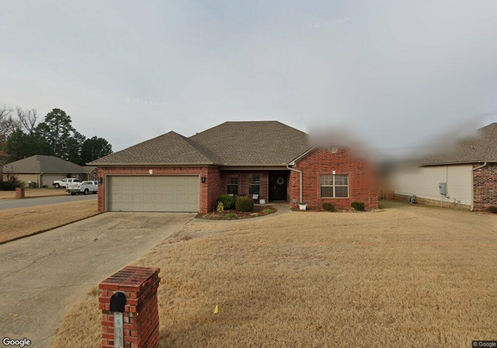
699 Keesee Cove Benton, AR 72019
Estimated Value: $246,000 - $257,000
Studio
2
Baths
1,835
Sq Ft
$137/Sq Ft
Est. Value
About This Home
This home is located at 699 Keesee Cove, Benton, AR 72019 and is currently estimated at $251,854, approximately $137 per square foot. 699 Keesee Cove is a home located in Saline County with nearby schools including Benton Middle School, Caldwell Elementary School, and Benton Junior High School.
Ownership History
Date
Name
Owned For
Owner Type
Purchase Details
Closed on
Dec 10, 2012
Sold by
Goodson Denny A and Goodson Alicia L
Bought by
Goodson Denny A and Goodson Alicia L
Current Estimated Value
Home Financials for this Owner
Home Financials are based on the most recent Mortgage that was taken out on this home.
Original Mortgage
$141,000
Outstanding Balance
$24,966
Interest Rate
2.71%
Mortgage Type
New Conventional
Estimated Equity
$226,888
Purchase Details
Closed on
Oct 21, 2005
Sold by
Circle Y Development Llc
Bought by
Goodson Denny A
Home Financials for this Owner
Home Financials are based on the most recent Mortgage that was taken out on this home.
Original Mortgage
$157,429
Interest Rate
5.73%
Mortgage Type
FHA
Create a Home Valuation Report for This Property
The Home Valuation Report is an in-depth analysis detailing your home's value as well as a comparison with similar homes in the area
Home Values in the Area
Average Home Value in this Area
Purchase History
| Date | Buyer | Sale Price | Title Company |
|---|---|---|---|
| Goodson Denny A | -- | None Available | |
| Goodson Denny A | $160,000 | -- |
Source: Public Records
Mortgage History
| Date | Status | Borrower | Loan Amount |
|---|---|---|---|
| Open | Goodson Denny A | $141,000 | |
| Closed | Goodson Denny A | $157,429 |
Source: Public Records
Tax History
| Year | Tax Paid | Tax Assessment Tax Assessment Total Assessment is a certain percentage of the fair market value that is determined by local assessors to be the total taxable value of land and additions on the property. | Land | Improvement |
|---|---|---|---|---|
| 2025 | $2,243 | $42,240 | $6,000 | $36,240 |
| 2024 | $2,295 | $42,240 | $6,000 | $36,240 |
| 2023 | $1,720 | $42,240 | $6,000 | $36,240 |
| 2022 | $1,673 | $42,240 | $6,000 | $36,240 |
| 2021 | $1,575 | $35,200 | $5,400 | $29,800 |
| 2020 | $1,575 | $35,200 | $5,400 | $29,800 |
| 2019 | $1,575 | $35,200 | $5,400 | $29,800 |
| 2018 | $1,545 | $35,200 | $5,400 | $29,800 |
| 2017 | $1,458 | $35,200 | $5,400 | $29,800 |
| 2016 | $1,766 | $31,140 | $5,000 | $26,140 |
| 2015 | $1,747 | $31,140 | $5,000 | $26,140 |
| 2014 | $1,397 | $31,140 | $5,000 | $26,140 |
Source: Public Records
Map
Nearby Homes
- 701 Keesee Cove
- 706 Maia Loop
- 702 Maia Loop
- 698 Keesee Cove
- 607 Earle Dr
- 611 Earle Dr
- 700 Keesee Cove
- 703 Keesee Cove
- 0 Earle Dr Unit 15031265
- 0 Earle Dr Unit 16003026
- 0 Earle Dr Unit 16019800
- 0 Earle Dr Unit 20038714
- 605 Earle Dr
- Lot 44 Earle Dr
- 603 Earle Dr
- 613 Earle Dr
- 710 Maia Loop
- 703 Maia Loop
- 600 Earle Dr
- 715 Maia Loop
Your Personal Tour Guide
Ask me questions while you tour the home.