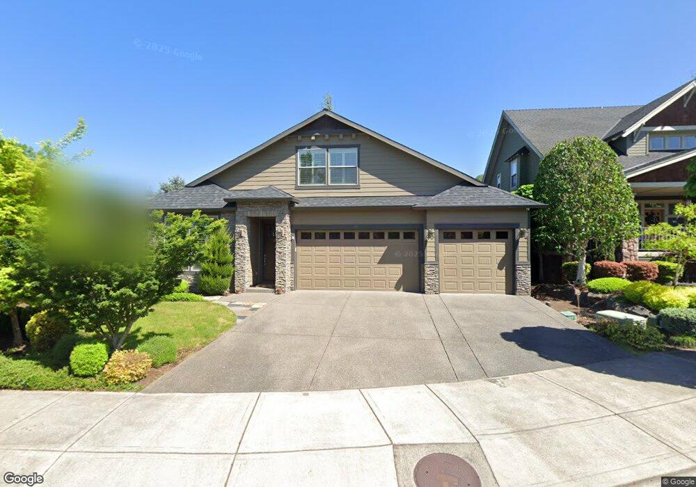
699 W T St Washougal, WA 98671
Estimated Value: $781,129 - $1,149,000
4
Beds
4
Baths
2,965
Sq Ft
$334/Sq Ft
Est. Value
About This Home
This home is located at 699 W T St, Washougal, WA 98671 and is currently estimated at $990,532, approximately $334 per square foot. 699 W T St is a home located in Clark County with nearby schools including Woodburn Elementary School, Liberty Middle School, and Camas High School.
Ownership History
Date
Name
Owned For
Owner Type
Purchase Details
Closed on
Apr 11, 2016
Sold by
Forest View Inc
Bought by
Carli Brandi
Current Estimated Value
Purchase Details
Closed on
Dec 29, 2014
Sold by
Mceldery Thomas
Bought by
Zach William J and Zach Debra
Purchase Details
Closed on
May 12, 2011
Sold by
Mceldery Debra
Bought by
Mceldery Thomas
Purchase Details
Closed on
Mar 13, 2007
Sold by
Rvt Llc
Bought by
Mceldery Thomas M and Mceldery Debra D
Home Financials for this Owner
Home Financials are based on the most recent Mortgage that was taken out on this home.
Original Mortgage
$130,500
Interest Rate
6.87%
Mortgage Type
Purchase Money Mortgage
Create a Home Valuation Report for This Property
The Home Valuation Report is an in-depth analysis detailing your home's value as well as a comparison with similar homes in the area
Home Values in the Area
Average Home Value in this Area
Purchase History
| Date | Buyer | Sale Price | Title Company |
|---|---|---|---|
| Carli Brandi | $519,000 | Fidelity Title Dt Vancouver | |
| Zach William J | $69,719 | Chicago Title Insurance | |
| Mceldery Thomas | -- | None Available | |
| Mceldery Thomas M | $145,000 | Chicago Title Insurance |
Source: Public Records
Mortgage History
| Date | Status | Borrower | Loan Amount |
|---|---|---|---|
| Previous Owner | Mceldery Thomas M | $130,500 |
Source: Public Records
Tax History Compared to Growth
Tax History
| Year | Tax Paid | Tax Assessment Tax Assessment Total Assessment is a certain percentage of the fair market value that is determined by local assessors to be the total taxable value of land and additions on the property. | Land | Improvement |
|---|---|---|---|---|
| 2025 | $6,879 | $715,003 | $110,000 | $605,003 |
| 2024 | $6,745 | $730,751 | $144,100 | $586,651 |
| 2023 | $6,714 | $755,252 | $147,400 | $607,852 |
| 2022 | $6,523 | $731,905 | $147,400 | $584,505 |
| 2021 | $6,292 | $597,797 | $121,000 | $476,797 |
| 2020 | $6,657 | $532,575 | $110,000 | $422,575 |
| 2019 | $6,407 | $526,125 | $110,000 | $416,125 |
| 2018 | $6,441 | $536,635 | $0 | $0 |
| 2017 | $5,138 | $448,628 | $0 | $0 |
| 2016 | $722 | $406,697 | $0 | $0 |
| 2015 | -- | $54,590 | $0 | $0 |
| 2014 | -- | $53,000 | $0 | $0 |
| 2013 | -- | $53,000 | $0 | $0 |
Source: Public Records
Map
Nearby Homes
- 585 W U St
- 632 W T St
- 835 W U St
- 654 W S St
- 410 W U St
- 795 W X St
- 867 W Lookout Ridge Dr
- 877 W Lookout Ridge Dr
- 356 W W St
- 940 W Lookout Ridge Dr
- 927 W Lookout Ridge Dr
- 943 W Y St
- 2873 W 5th St
- 2193 NE 3rd Ave
- 174 N X St
- 293 N Shepherd Rd
- 750 NE Province Ct
- 522 NE Province Dr
- 520 NE Province Dr
- 451 N X St