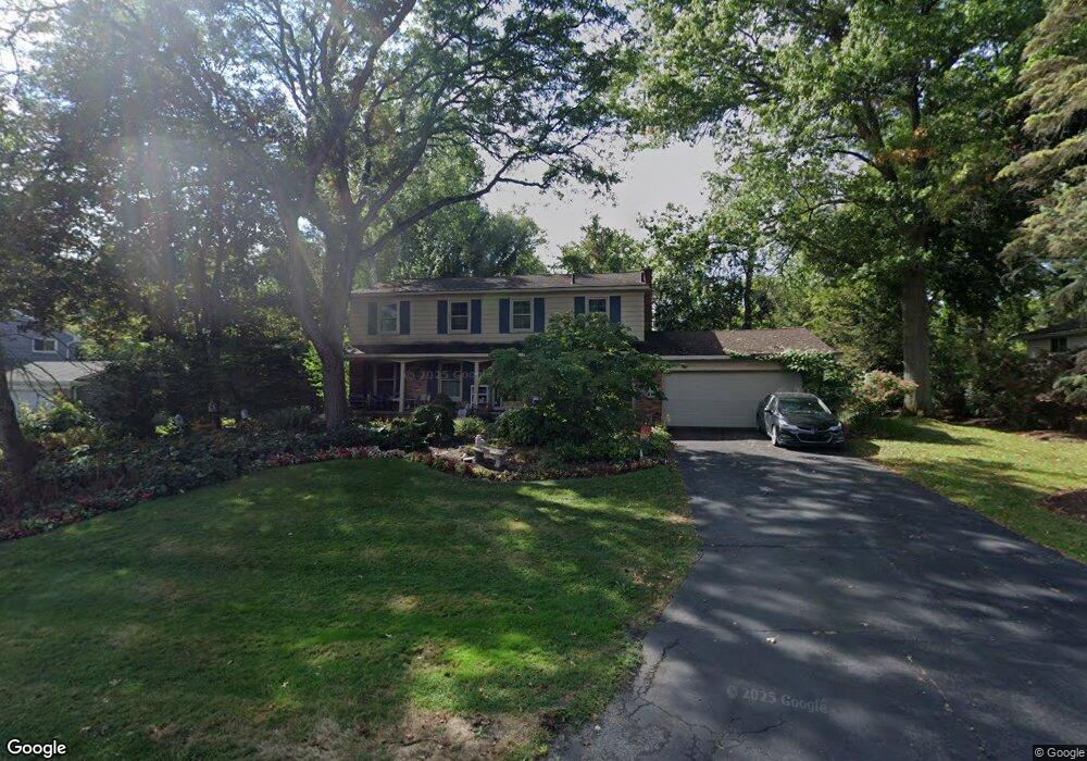
6990 Cathedral Dr Bloomfield Hills, MI 48301
Estimated Value: $623,000 - $701,000
4
Beds
3
Baths
2,559
Sq Ft
$262/Sq Ft
Est. Value
About This Home
This home is located at 6990 Cathedral Dr, Bloomfield Hills, MI 48301 and is currently estimated at $669,614, approximately $261 per square foot. 6990 Cathedral Dr is a home located in Oakland County with nearby schools including Conant Elementary School, South Hills Middle School, and Bloomfield Hills High School.
Ownership History
Date
Name
Owned For
Owner Type
Purchase Details
Closed on
Aug 7, 2012
Sold by
Cook Martha L and Leone Martha L
Bought by
Leone Martha L
Current Estimated Value
Home Financials for this Owner
Home Financials are based on the most recent Mortgage that was taken out on this home.
Original Mortgage
$268,800
Outstanding Balance
$114,646
Interest Rate
3.48%
Mortgage Type
New Conventional
Estimated Equity
$554,968
Purchase Details
Closed on
Jan 3, 2005
Sold by
Gasser Stephen and Gasser Charlotte
Bought by
Cook Martha L
Home Financials for this Owner
Home Financials are based on the most recent Mortgage that was taken out on this home.
Original Mortgage
$312,000
Interest Rate
5.9%
Mortgage Type
Purchase Money Mortgage
Create a Home Valuation Report for This Property
The Home Valuation Report is an in-depth analysis detailing your home's value as well as a comparison with similar homes in the area
Home Values in the Area
Average Home Value in this Area
Purchase History
| Date | Buyer | Sale Price | Title Company |
|---|---|---|---|
| Leone Martha L | -- | None Available | |
| Cook Martha L | $390,000 | Metropolitan Title Company |
Source: Public Records
Mortgage History
| Date | Status | Borrower | Loan Amount |
|---|---|---|---|
| Open | Leone Martha L | $268,800 | |
| Closed | Cook Martha L | $312,000 |
Source: Public Records
Tax History Compared to Growth
Tax History
| Year | Tax Paid | Tax Assessment Tax Assessment Total Assessment is a certain percentage of the fair market value that is determined by local assessors to be the total taxable value of land and additions on the property. | Land | Improvement |
|---|---|---|---|---|
| 2024 | $2,850 | $251,810 | $0 | $0 |
| 2023 | $2,758 | $228,580 | $0 | $0 |
| 2022 | $5,182 | $199,410 | $0 | $0 |
| 2021 | $5,145 | $190,750 | $0 | $0 |
| 2020 | $2,522 | $194,380 | $0 | $0 |
| 2019 | $5,186 | $187,740 | $0 | $0 |
| 2018 | $4,890 | $180,910 | $0 | $0 |
| 2017 | $4,829 | $175,540 | $0 | $0 |
| 2016 | $4,838 | $161,530 | $0 | $0 |
| 2015 | -- | $152,760 | $0 | $0 |
| 2014 | -- | $145,680 | $0 | $0 |
| 2011 | -- | $124,910 | $0 | $0 |
Source: Public Records
Map
Nearby Homes
- 7005 Cathedral Dr
- 7100 Wing Lake Rd
- 6952 Sandalwood Dr
- 7303 Brookside Village Ct
- 7200 Telegraph Rd
- 6940 Wing Lake Rd
- 6660 Woodbank Dr
- 6750 Wing Lake Rd
- 4428 Old Trinity Ct
- 6572 Spruce Dr
- 4017 Hidden Woods Dr
- 32890 Whatley Rd
- 25690 W 14 Mile Rd
- 7357 W Greenwich Dr
- 750 Trailwood Path Unit B
- 450 Billingsgate Ct Unit C
- 1760 Trailwood Path
- 4456 W Maple Rd
- 6701 Franklin Rd
- 7310 Sandy Creek Ln
- 6974 Cathedral Dr
- 7004 Cathedral Dr
- 6991 Cathedral Dr
- 6975 Cathedral Dr
- 7022 Cathedral Dr
- 6960 Cathedral Dr
- 4295 Spruce Hill Ln
- 4288 Spruce Hill Ln
- 6961 Cathedral Dr
- 7025 Cathedral Dr
- 6984 Woodbank Dr
- 6976 Woodbank Dr
- 7046 Cathedral Dr
- 4303 Spruce Hill Ln
- 7002 Woodbank Dr Unit Bldg-Unit
- 7002 Woodbank Dr
- 6946 Cathedral Dr
- 4327 Spruce Hill Ln
- 6958 Woodbank Dr
- 6945 Cathedral Dr