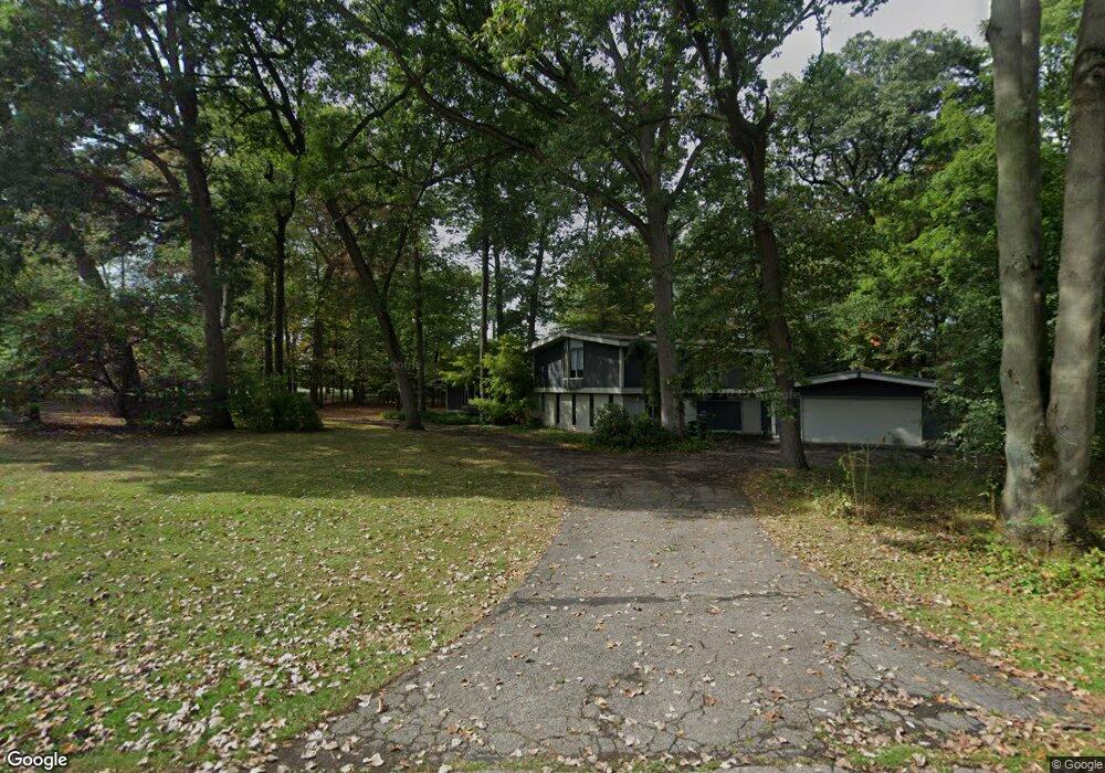
6990 Holiday Dr Unit Bldg-Unit Bloomfield Hills, MI 48301
Estimated Value: $540,000 - $629,000
4
Beds
4
Baths
2,535
Sq Ft
$231/Sq Ft
Est. Value
About This Home
This home is located at 6990 Holiday Dr Unit Bldg-Unit, Bloomfield Hills, MI 48301 and is currently estimated at $585,901, approximately $231 per square foot. 6990 Holiday Dr Unit Bldg-Unit is a home located in Oakland County with nearby schools including Conant Elementary School, South Hills Middle School, and Bloomfield Hills High School.
Ownership History
Date
Name
Owned For
Owner Type
Purchase Details
Closed on
Oct 19, 2018
Sold by
Nicolo Fernando
Bought by
Rumpel Steven A
Current Estimated Value
Purchase Details
Closed on
Sep 1, 2016
Sold by
Weir Ii Thomas R
Bought by
Nicolo Fernanda
Purchase Details
Closed on
Aug 18, 2004
Sold by
Weintraub Gerald S and Weintraub Rosalyn Y
Bought by
Weir Ii Thomas R
Purchase Details
Closed on
Jul 16, 2004
Sold by
Weintraub Dr Gerald S and Weintraub Dr Rosalyn Y
Bought by
Weir Ii Thomas R
Create a Home Valuation Report for This Property
The Home Valuation Report is an in-depth analysis detailing your home's value as well as a comparison with similar homes in the area
Home Values in the Area
Average Home Value in this Area
Purchase History
| Date | Buyer | Sale Price | Title Company |
|---|---|---|---|
| Rumpel Steven A | $306,000 | Visionary Title Agency Llc | |
| Nicolo Fernanda | $302,500 | None Available | |
| Weir Ii Thomas R | $350,000 | -- | |
| Weir Ii Thomas R | $350,000 | -- |
Source: Public Records
Tax History Compared to Growth
Tax History
| Year | Tax Paid | Tax Assessment Tax Assessment Total Assessment is a certain percentage of the fair market value that is determined by local assessors to be the total taxable value of land and additions on the property. | Land | Improvement |
|---|---|---|---|---|
| 2024 | $4,219 | $229,760 | $0 | $0 |
| 2023 | $4,083 | $218,450 | $0 | $0 |
| 2022 | $7,673 | $205,620 | $0 | $0 |
| 2021 | $7,897 | $206,330 | $0 | $0 |
| 2020 | $4,073 | $214,320 | $0 | $0 |
| 2019 | $7,977 | $210,090 | $0 | $0 |
| 2018 | $8,411 | $194,270 | $0 | $0 |
| 2017 | $9,225 | $187,930 | $0 | $0 |
| 2016 | $6,141 | $181,530 | $0 | $0 |
| 2015 | -- | $181,950 | $0 | $0 |
| 2014 | -- | $155,230 | $0 | $0 |
| 2011 | -- | $118,770 | $0 | $0 |
Source: Public Records
Map
Nearby Homes
- 4428 Old Trinity Ct
- 7100 Wing Lake Rd
- 6940 Wing Lake Rd
- 4647 Private Lake Dr
- 25690 W 14 Mile Rd
- 6940 Castle Dr
- 6720 Castle Dr
- 32890 Whatley Rd
- 6701 Franklin Rd
- 7005 Cathedral Dr
- 6800 Crestway Dr
- 32696 Ravine Dr
- 6572 Spruce Dr
- 25635 River Dr
- 4665 W Maple Rd
- 6952 Sandalwood Dr
- 7200 Telegraph Rd
- 6660 Woodbank Dr
- 6041 Eastmoor Rd
- 7371 Lindenmere Dr
- 6990 Holiday Dr
- 6990 Holiday Dr
- 6980 Holiday Dr
- 4480 Chisholm Trail
- 4440 Chisholm Trail
- 6966 Holiday Dr
- 4475 Chisholm Trail
- 7003 Franklin Rd
- 4445 Chisholm Trail
- 6961 Holiday Dr
- 4477 Chisholm Trail
- 4481 Chisholm Trail
- 4485 Chisholm Trail
- 6950 Holiday Dr
- 4495 Chisholm Trail
- 4435 Chisholm Trail
- 7010 Franklin Rd
- 7080 Holiday Dr
- 0 Holiday Dr
- 4535 Pickering Rd