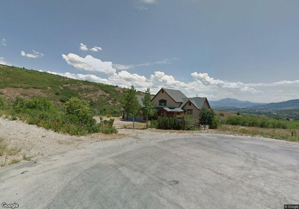
6992 Durfee Way Liberty, UT 84310
Estimated Value: $1,231,000 - $1,268,229
3
Beds
3
Baths
4,133
Sq Ft
$304/Sq Ft
Est. Value
About This Home
This home is located at 6992 Durfee Way, Liberty, UT 84310 and is currently estimated at $1,254,807, approximately $303 per square foot. 6992 Durfee Way is a home located in Weber County with nearby schools including Valley Elementary School, Snowcrest Junior High School, and Weber High School.
Ownership History
Date
Name
Owned For
Owner Type
Purchase Details
Closed on
Sep 6, 2018
Sold by
Sanzenbacher Larry J and Sanzenbacher Carolyn K
Bought by
Rebolledo Robert and Rebolledo Peggy
Current Estimated Value
Purchase Details
Closed on
Feb 16, 1998
Sold by
Clapham Jeff Dennis and Fabert Terri L
Bought by
Sanzenbacher Larry J and Sanzenbacher Carolyn K
Purchase Details
Closed on
Jan 19, 1996
Sold by
Carter Brothers Inc
Bought by
Clapham Jeff Dennis and Fabert Terri L
Create a Home Valuation Report for This Property
The Home Valuation Report is an in-depth analysis detailing your home's value as well as a comparison with similar homes in the area
Home Values in the Area
Average Home Value in this Area
Purchase History
| Date | Buyer | Sale Price | Title Company |
|---|---|---|---|
| Rebolledo Robert | -- | Integrated Title Ins Service | |
| Sanzenbacher Larry J | -- | Mountain View Title | |
| Clapham Jeff Dennis | -- | U S Title |
Source: Public Records
Tax History Compared to Growth
Tax History
| Year | Tax Paid | Tax Assessment Tax Assessment Total Assessment is a certain percentage of the fair market value that is determined by local assessors to be the total taxable value of land and additions on the property. | Land | Improvement |
|---|---|---|---|---|
| 2025 | $5,862 | $1,089,982 | $243,177 | $846,805 |
| 2024 | $5,383 | $566,826 | $139,540 | $427,286 |
| 2023 | $5,579 | $580,081 | $132,121 | $447,960 |
| 2022 | $4,820 | $505,153 | $116,106 | $389,047 |
| 2021 | $4,045 | $714,000 | $139,268 | $574,732 |
| 2020 | $4,120 | $667,418 | $139,268 | $528,150 |
| 2019 | $4,531 | $703,490 | $139,268 | $564,222 |
| 2018 | $3,953 | $685,206 | $130,566 | $554,640 |
| 2017 | $3,763 | $619,921 | $120,550 | $499,371 |
| 2016 | $4,197 | $334,112 | $66,050 | $268,062 |
| 2015 | $3,676 | $289,318 | $66,050 | $223,268 |
| 2014 | $3,935 | $302,548 | $66,050 | $236,498 |
Source: Public Records
Map
Nearby Homes
- 2163 E 6825 N
- 2314 E 6825 N
- 6481 N Fork Rd Unit N
- 2127 E 5950 N
- 3178 E 5400 N
- 3151 E 5225 St N Unit 11
- 4691 N 3300 E
- 4691 E 3300
- 4548 N Sheep Creek Dr
- 3462 E 4100 N
- 4601 N 2900 E
- 4046 E 4500 N Unit 65
- 3440 E 4100 N
- 4068 N 3300 E
- 410 E 5100 S
- 1874 N Shamy Way Unit 26
- 2522 N Nordic Valley Dr Unit 23
- 5013 E Maple Oak E Unit 28
- 3615 N Wolf Lodge Dr E Unit 608
- 5237 E Harbor View Ct N Unit 201
- 6992 N Durfee Way
- 7003 Durfee Way
- 1984 E 6925 N
- 6962 Durfee Way
- 6989 N Durfee Way Unit 21
- 1942 E 6925 N
- 6999 Durfee Way
- 6975 N Durfee Way Unit 20
- 1983 E 6925 N
- 6989 Durfee Way
- 6975 Durfee Way
- 6975 Durfee Way Unit 20
- 1963 E 6925 N
- 1963 E 6925 N Unit 14
- 6961 N Durfee Way
- 1941 E 6925 N
- 1941 E 6925 N Unit 15
- 6961 Durfee Way
- 1919 E 6925 N
- 1919 E 6925 N Unit 16