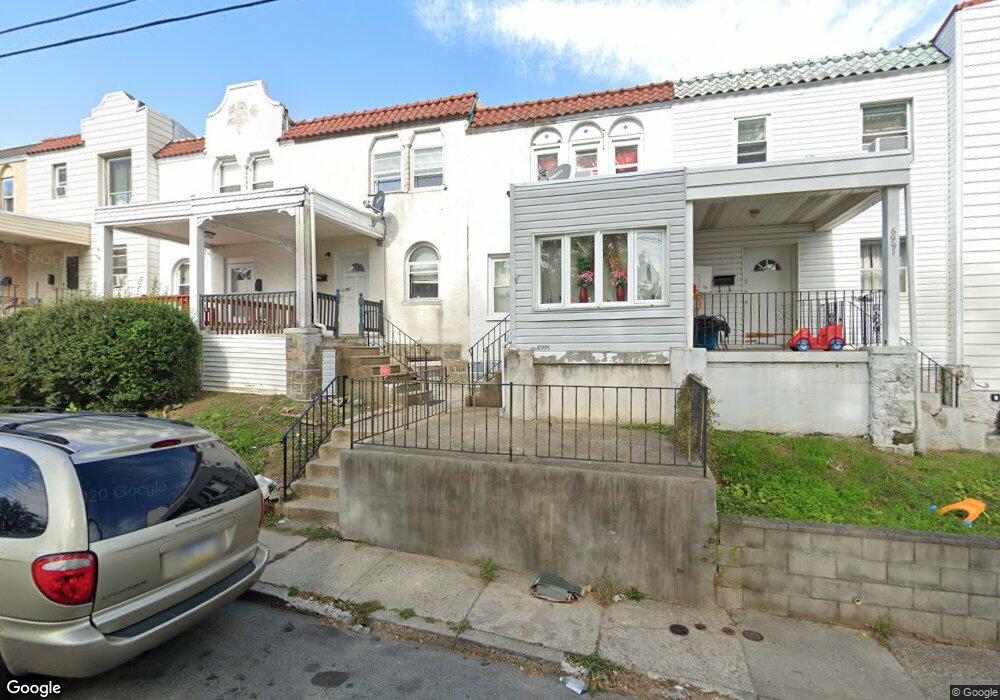
6993 Guilford Rd Upper Darby, PA 19082
Estimated Value: $105,000 - $135,000
2
Beds
2
Baths
840
Sq Ft
$142/Sq Ft
Est. Value
About This Home
This home is located at 6993 Guilford Rd, Upper Darby, PA 19082 and is currently estimated at $119,652, approximately $142 per square foot. 6993 Guilford Rd is a home located in Delaware County with nearby schools including Upper Darby Kdg Center, Upper Darby High School, and Vision Academy Charter School.
Ownership History
Date
Name
Owned For
Owner Type
Purchase Details
Closed on
Dec 22, 2023
Sold by
Lira Cynthia
Bought by
Lira Eric Saul and Lira Bridget C
Current Estimated Value
Home Financials for this Owner
Home Financials are based on the most recent Mortgage that was taken out on this home.
Original Mortgage
$72,250
Outstanding Balance
$71,037
Interest Rate
7.44%
Mortgage Type
New Conventional
Estimated Equity
$48,615
Purchase Details
Closed on
Dec 2, 1988
Sold by
Mccollum Bruce and Mccollum Diana L
Bought by
King Cynthia
Create a Home Valuation Report for This Property
The Home Valuation Report is an in-depth analysis detailing your home's value as well as a comparison with similar homes in the area
Home Values in the Area
Average Home Value in this Area
Purchase History
| Date | Buyer | Sale Price | Title Company |
|---|---|---|---|
| Lira Eric Saul | $85,000 | None Listed On Document | |
| King Cynthia | $44,500 | -- |
Source: Public Records
Mortgage History
| Date | Status | Borrower | Loan Amount |
|---|---|---|---|
| Open | Lira Eric Saul | $72,250 |
Source: Public Records
Tax History Compared to Growth
Tax History
| Year | Tax Paid | Tax Assessment Tax Assessment Total Assessment is a certain percentage of the fair market value that is determined by local assessors to be the total taxable value of land and additions on the property. | Land | Improvement |
|---|---|---|---|---|
| 2025 | $2,424 | $57,320 | $14,140 | $43,180 |
| 2024 | $2,424 | $57,320 | $14,140 | $43,180 |
| 2023 | $2,401 | $57,320 | $14,140 | $43,180 |
| 2022 | $2,337 | $57,320 | $14,140 | $43,180 |
| 2021 | $3,151 | $57,320 | $14,140 | $43,180 |
| 2020 | $2,428 | $37,540 | $12,850 | $24,690 |
| 2019 | $2,386 | $37,540 | $12,850 | $24,690 |
| 2018 | $2,358 | $37,540 | $0 | $0 |
| 2017 | $2,297 | $37,540 | $0 | $0 |
| 2016 | $210 | $37,540 | $0 | $0 |
| 2015 | $210 | $37,540 | $0 | $0 |
| 2014 | $210 | $37,540 | $0 | $0 |
Source: Public Records
Map
Nearby Homes
- 6982 Clinton Rd
- 577 Snowden Rd
- 6948 Clinton Rd
- 607 Littlecroft Rd
- 7155 Radbourne Rd
- 525 Wiltshire Rd
- 517 Wiltshire Rd
- 7162 Radbourne Rd
- 7066 Clover Ln
- 513 Woodcliffe Rd
- 504 Woodcliffe Rd
- 669 Long Ln
- 7139 Guilford Rd
- 7000 Greenwood Ave
- 424 Woodcliffe Rd
- 7123 Seaford Rd
- 6858 Clover Ln
- 607 Briarcliff Rd
- 346 Long Ln
- 426 Hampden Rd
- 6991 Guilford Rd
- 6989 Guilford Rd
- 6987 Guilford Rd
- 6995 Guilford Rd Unit B
- 6995 Guilford Rd
- 6995 Guilford Rd
- 6985 Guilford Rd
- 6983 Guilford Rd
- 6997 Guilford Rd
- 6997 Guilford Rd
- 6981 Guilford Rd
- 6979 Guilford Rd Unit 1
- 6979 Guilford Rd Unit 2
- 6979 Guilford Rd
- 6979 Guilford Rd Unit B
- 6977 Guilford Rd
- 6999 Guilford Rd
- 238 Guilford Rd
- 6999 Guilford Rd
- 6975 Guilford Rd