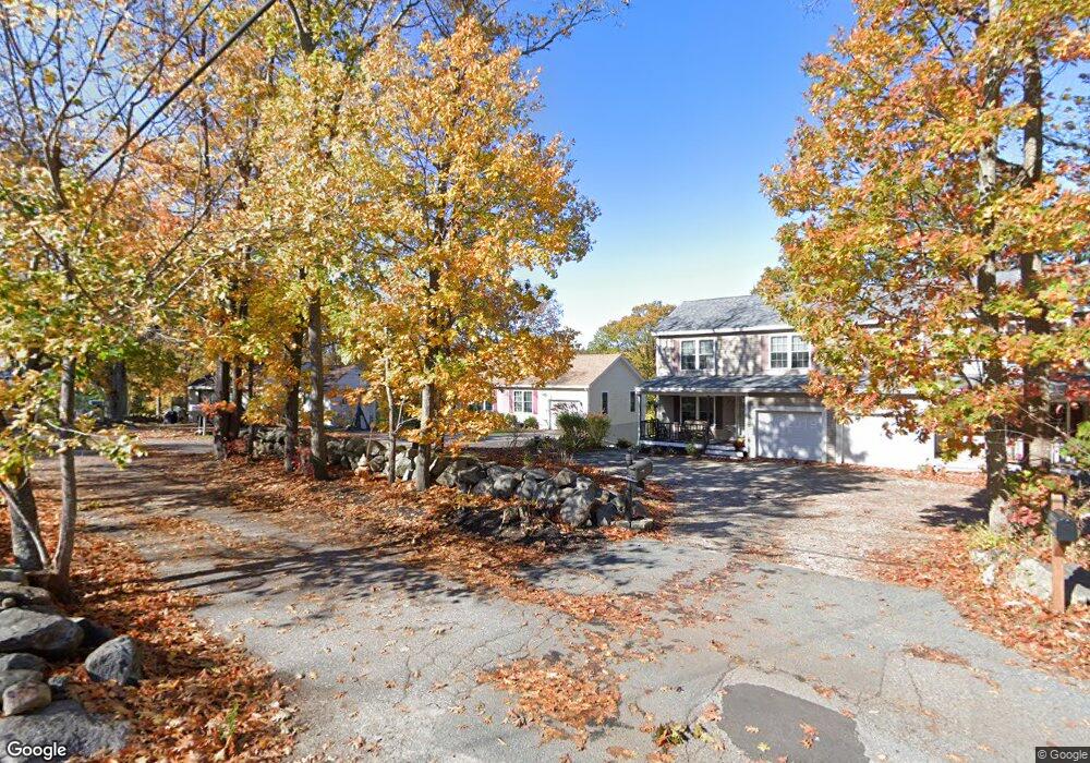
6C Tarrs Ln W Unit n/a Rockport, MA 01966
Estimated Value: $756,000 - $824,518
2
Beds
2
Baths
1,288
Sq Ft
$608/Sq Ft
Est. Value
About This Home
This home is located at 6C Tarrs Ln W Unit n/a, Rockport, MA 01966 and is currently estimated at $783,173, approximately $608 per square foot. 6C Tarrs Ln W Unit n/a is a home located in Essex County with nearby schools including Rockport Elementary School, Rockport Middle School, and Rockport High School.
Ownership History
Date
Name
Owned For
Owner Type
Purchase Details
Closed on
Sep 16, 2016
Sold by
Oconnell Timothy K and Oconnell Danielle L
Bought by
Fleming Lawrence M and Fleming Krystal L
Current Estimated Value
Home Financials for this Owner
Home Financials are based on the most recent Mortgage that was taken out on this home.
Original Mortgage
$399,000
Outstanding Balance
$318,706
Interest Rate
3.43%
Mortgage Type
New Conventional
Estimated Equity
$464,467
Purchase Details
Closed on
Aug 16, 2013
Sold by
Oconnell Timothy and Oconnell Danielle L
Bought by
Oconnell Timothy K and Oconnell Danielle L
Home Financials for this Owner
Home Financials are based on the most recent Mortgage that was taken out on this home.
Original Mortgage
$297,000
Interest Rate
4.31%
Mortgage Type
New Conventional
Purchase Details
Closed on
Dec 18, 2012
Sold by
Shon Whon K
Bought by
Oconnell Timothy and Frontierro Danielle
Purchase Details
Closed on
Jul 27, 2012
Sold by
Barnett Helen R
Bought by
Shon Whon K
Purchase Details
Closed on
Nov 22, 2004
Sold by
Cunningham
Bought by
Barnett Helen R
Create a Home Valuation Report for This Property
The Home Valuation Report is an in-depth analysis detailing your home's value as well as a comparison with similar homes in the area
Home Values in the Area
Average Home Value in this Area
Purchase History
| Date | Buyer | Sale Price | Title Company |
|---|---|---|---|
| Fleming Lawrence M | $420,000 | -- | |
| Oconnell Timothy K | -- | -- | |
| Oconnell Timothy K | -- | -- | |
| Oconnell Timothy | $365,000 | -- | |
| Shon Whon K | $368,000 | -- | |
| Barnett Helen R | $250,000 | -- |
Source: Public Records
Mortgage History
| Date | Status | Borrower | Loan Amount |
|---|---|---|---|
| Open | Fleming Lawrence M | $399,000 | |
| Previous Owner | Barnett Helen R | $297,000 |
Source: Public Records
Tax History Compared to Growth
Tax History
| Year | Tax Paid | Tax Assessment Tax Assessment Total Assessment is a certain percentage of the fair market value that is determined by local assessors to be the total taxable value of land and additions on the property. | Land | Improvement |
|---|---|---|---|---|
| 2025 | $6,809 | $777,300 | $323,400 | $453,900 |
| 2024 | $6,415 | $761,900 | $308,000 | $453,900 |
Source: Public Records
Map
Nearby Homes
- 135 A&B Main St
- 123 Main St Unit 2
- 36 Broadway Ave
- 36 Broadway Ave
- 5 Marshall Ln
- 73-77 Main St
- 63R Main St Unit 2
- 15 High St Unit D
- 1 Doctors Run
- 13 Pleasant St Unit 3
- 4 Alpaca Ct
- 2 Mount Pleasant St Unit 3
- 6 Prospect St
- 29 Summer St
- 34 Mount Pleasant St
- 57 Mt Pleasant St Unit 2B
- 4 Norwood Ave
- 12 Seagull St
- 13 Rowe Point
- 2 Boulder Top
- 6C Tarrs Ln W
- 6B Tarrs Ln W Unit B
- 6 Tarrs Ln W Unit B
- 6 Tarrs Ln W Unit 1
- 6 Tarrs Ln W
- 6 Tarrs Ln W Unit 2
- 8 Tarrs Ln W
- 9 Applecart Rd
- 7 Applecart Rd
- 4 Tarrs Ln W
- 4 Tarrs Ln W Unit 1
- 11 Applecart Rd
- 7 Tarrs Ln W
- 7 Tarrs Ln W
- 12 Tarrs Ln W
- 5 Tarrs Ln W
- 13 Applecart Rd
- 8 Applecart Rd
- 11 Tarrs Ln W
- 2 Tarrs Ln W