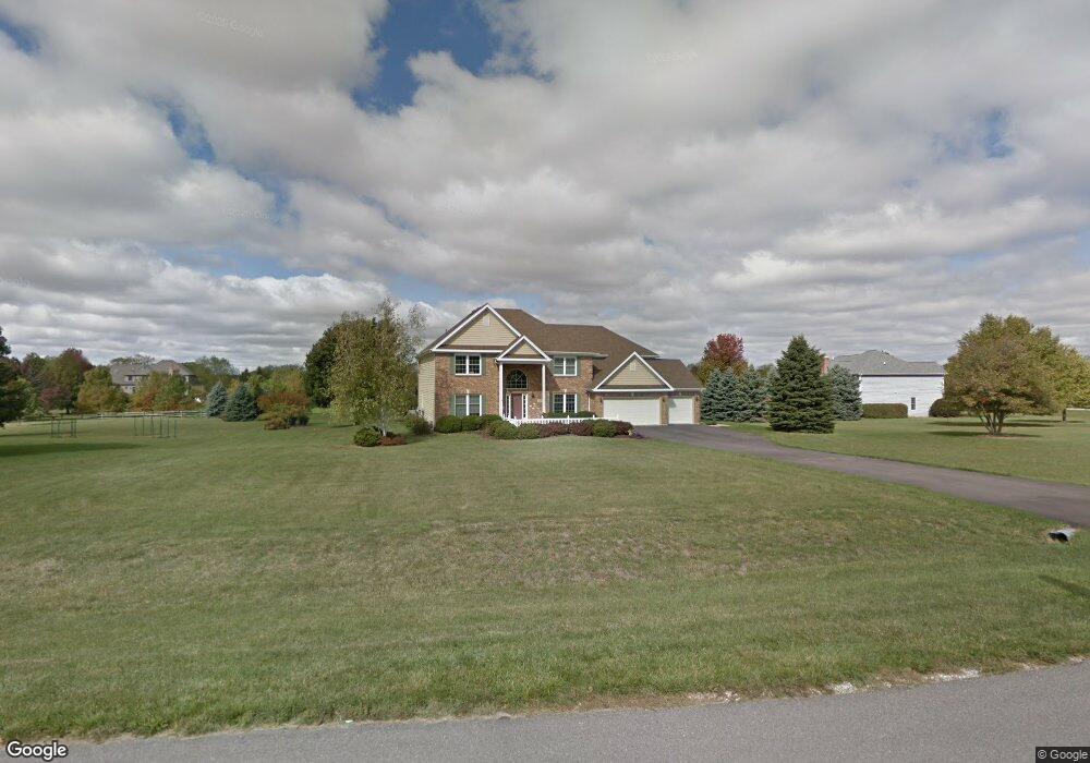
6N762 Willowbrook Dr Saint Charles, IL 60175
Estimated Value: $650,485 - $736,000
Studio
--
Bath
3,553
Sq Ft
$195/Sq Ft
Est. Value
About This Home
This home is located at 6N762 Willowbrook Dr, Saint Charles, IL 60175 and is currently estimated at $691,621, approximately $194 per square foot. 6N762 Willowbrook Dr is a home located in Kane County with nearby schools including Wasco Elementary School, Thompson Middle School, and St Charles North High School.
Ownership History
Date
Name
Owned For
Owner Type
Purchase Details
Closed on
Aug 21, 1997
Sold by
Dorrance David and Dorrance Peggy
Bought by
Ricketts Jeff R and Ricketts Julie A
Current Estimated Value
Home Financials for this Owner
Home Financials are based on the most recent Mortgage that was taken out on this home.
Original Mortgage
$260,000
Interest Rate
7.56%
Purchase Details
Closed on
Jan 16, 1997
Sold by
Armor Homes
Bought by
Dorrance David and Dorrance Peggy
Purchase Details
Closed on
Dec 8, 1994
Sold by
Cole Taylor Bank
Bought by
Armor Homes and Better Shelter Inc
Create a Home Valuation Report for This Property
The Home Valuation Report is an in-depth analysis detailing your home's value as well as a comparison with similar homes in the area
Home Values in the Area
Average Home Value in this Area
Purchase History
| Date | Buyer | Sale Price | Title Company |
|---|---|---|---|
| Ricketts Jeff R | $219,666 | Fox Title Company | |
| Dorrance David | $69,000 | Chicago Title Insurance Co | |
| Armor Homes | $74,000 | Chicago Title Insurance Co |
Source: Public Records
Mortgage History
| Date | Status | Borrower | Loan Amount |
|---|---|---|---|
| Closed | Ricketts Jeff R | $260,000 |
Source: Public Records
Tax History
| Year | Tax Paid | Tax Assessment Tax Assessment Total Assessment is a certain percentage of the fair market value that is determined by local assessors to be the total taxable value of land and additions on the property. | Land | Improvement |
|---|---|---|---|---|
| 2024 | $11,784 | $186,289 | $28,502 | $157,787 |
| 2023 | $11,519 | $166,552 | $25,482 | $141,070 |
| 2022 | $10,932 | $151,756 | $23,218 | $128,538 |
| 2021 | $10,273 | $143,287 | $21,922 | $121,365 |
| 2020 | $10,257 | $141,226 | $21,607 | $119,619 |
| 2019 | $10,129 | $139,153 | $21,290 | $117,863 |
| 2018 | $10,114 | $139,153 | $21,290 | $117,863 |
| 2017 | $10,440 | $144,082 | $20,977 | $123,105 |
| 2016 | $11,100 | $140,444 | $20,447 | $119,997 |
| 2015 | -- | $136,565 | $19,882 | $116,683 |
| 2014 | -- | $138,659 | $20,187 | $118,472 |
| 2013 | -- | $157,980 | $20,526 | $137,454 |
Source: Public Records
Map
Nearby Homes
- 7N072 Willowbrook Dr
- 7N108 Hastings Dr
- 40W412 Winchester Way
- 39W796 Dairyherd Ln Unit 1
- 6N530 Crestwood Dr
- 41W461 Burlington Rd
- 41W331 Empire Rd
- 40W789 Whitney Rd
- 1857 Chandolin Ln
- 1865 Chandolin Ln
- 1863 Chandolin Ln
- 1867 Chandolin Ln
- 1858 Chandolin Ln
- 1854 Chandolin Ln
- 6N680 Somerset Dr
- 1855 Diamond Dr
- 1847 Diamond Dr
- 1851 Diamond Dr
- 3620 Sahara Rd
- 1849 Diamond Dr
- 6N724 Willowbrook Dr
- 6N810 Willowbrook Dr
- 6N757 Willowbrook Dr
- 40W601 Willowbrook Dr
- 6N783 Willowbrook Dr
- 6N705 Willowbrook Dr
- 6N694 Willowbrook Dr
- 6N801 Willowbrook Dr
- 6N785 Colonel Bennett Ln
- 6N825 Willowbrook Dr
- 6N759 Colonel Bennett Ln
- 6N677 Willowbrook Dr
- 6N665 Willowbrook Dr
- 6N735 Colonel Bennett Ln
- 6N879 Balmoral Ln
- 12 Balmoral Ln
- 6N839 Willowbrook Dr
- 5 Willowbrook Dr
- 6 Willowbrook Dr
Your Personal Tour Guide
Ask me questions while you tour the home.