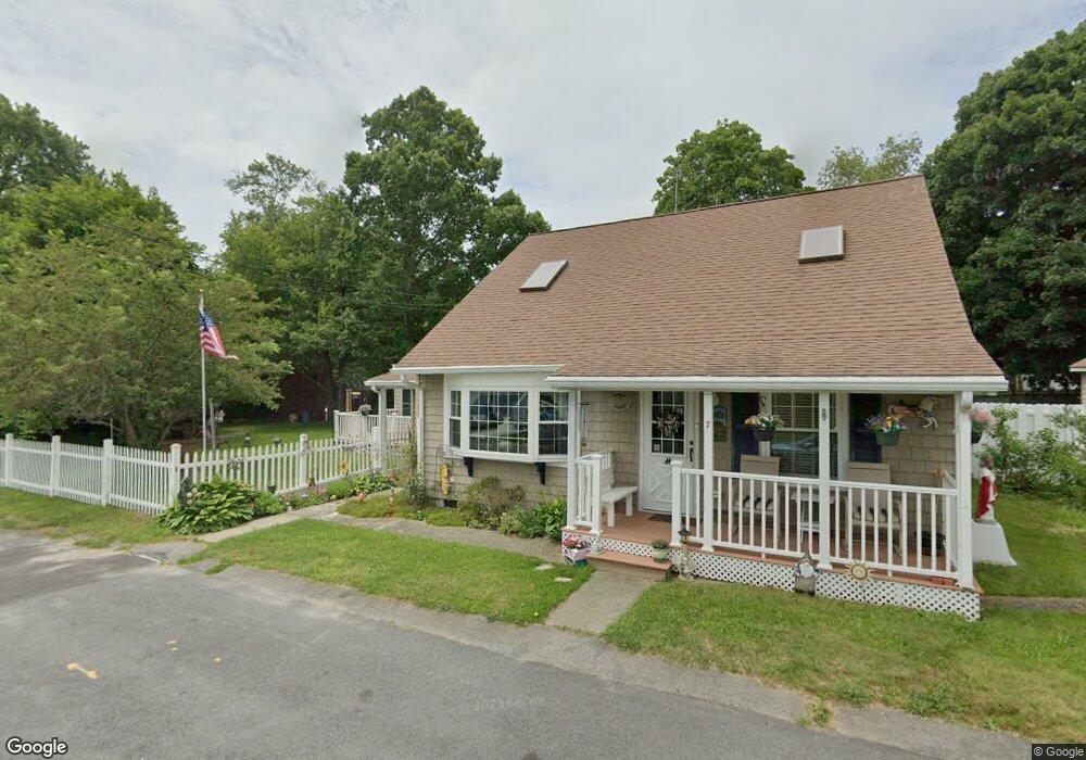
7 1st Ave Westport, MA 02790
North Westport NeighborhoodEstimated Value: $401,000 - $473,000
3
Beds
3
Baths
1,392
Sq Ft
$312/Sq Ft
Est. Value
About This Home
This home is located at 7 1st Ave, Westport, MA 02790 and is currently estimated at $434,177, approximately $311 per square foot. 7 1st Ave is a home located in Bristol County with nearby schools including Alice A. Macomber Primary School, Westport Elementary School, and Westport Middle-High School.
Ownership History
Date
Name
Owned For
Owner Type
Purchase Details
Closed on
Mar 3, 2021
Sold by
Duquette Mary A and Duquette Norman E
Bought by
Duquette Mary A and Duquette Norman E
Current Estimated Value
Purchase Details
Closed on
Oct 13, 1966
Bought by
Duquette Norman E and Duquette Mary Ann
Create a Home Valuation Report for This Property
The Home Valuation Report is an in-depth analysis detailing your home's value as well as a comparison with similar homes in the area
Home Values in the Area
Average Home Value in this Area
Purchase History
| Date | Buyer | Sale Price | Title Company |
|---|---|---|---|
| Duquette Mary A | -- | None Available | |
| Duquette Norman E | -- | -- |
Source: Public Records
Mortgage History
| Date | Status | Borrower | Loan Amount |
|---|---|---|---|
| Previous Owner | Duquette Norman E | $36,000 | |
| Previous Owner | Duquette Norman E | $40,000 |
Source: Public Records
Tax History Compared to Growth
Tax History
| Year | Tax Paid | Tax Assessment Tax Assessment Total Assessment is a certain percentage of the fair market value that is determined by local assessors to be the total taxable value of land and additions on the property. | Land | Improvement |
|---|---|---|---|---|
| 2025 | $2,447 | $328,400 | $144,900 | $183,500 |
| 2024 | $2,428 | $314,100 | $134,200 | $179,900 |
| 2023 | $2,393 | $293,200 | $121,800 | $171,400 |
| 2022 | $2,225 | $262,400 | $115,700 | $146,700 |
| 2021 | $3,053 | $247,500 | $105,200 | $142,300 |
| 2020 | $5,038 | $237,900 | $95,600 | $142,300 |
| 2019 | $1,906 | $230,500 | $95,600 | $134,900 |
| 2018 | $2,546 | $181,200 | $83,200 | $98,000 |
| 2017 | $1,502 | $188,400 | $88,900 | $99,500 |
| 2016 | $1,454 | $183,800 | $84,300 | $99,500 |
| 2015 | $1,529 | $192,800 | $96,900 | $95,900 |
Source: Public Records
Map
Nearby Homes
- 116 Gifford Rd
- 80 Gifford Rd
- 15 S Breault St
- 16 S Berryman St
- 23 Donna St
- 380 Gifford Rd
- 79 Center St
- 565 Highland Ave
- 100 D Dr
- 3 Diane Way
- 96 Forge Rd
- 1276 Old Fall River Rd
- 29 Union Ave
- 56 Lakeside Ave
- 92 Benoit St
- 2 Donna Marie Dr
- 55 Lakeside Ave
- 818 Reed Rd
- 3 Roller Coaster Way Unit Lot 1
- 2 Mackady Ct