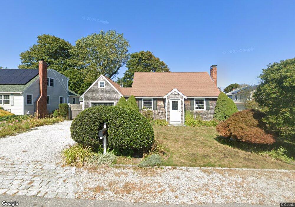
7 2nd Ave Scituate, MA 02066
Estimated Value: $940,000 - $1,037,000
2
Beds
2
Baths
1,911
Sq Ft
$512/Sq Ft
Est. Value
About This Home
This home is located at 7 2nd Ave, Scituate, MA 02066 and is currently estimated at $978,310, approximately $511 per square foot. 7 2nd Ave is a home located in Plymouth County with nearby schools including Wampatuck Elementary School, Lester J. Gates Middle School, and Scituate High School.
Ownership History
Date
Name
Owned For
Owner Type
Purchase Details
Closed on
Aug 25, 2011
Sold by
Merchant Leonard P and Merchant Madeline L
Bought by
Lp & Mi Merchant Irt and Merchant
Current Estimated Value
Purchase Details
Closed on
Mar 31, 2004
Sold by
Curcio Joseph V and Oleary-Curcio Jennifer L
Bought by
Merchant Leonard P and Merchant Madeline I
Purchase Details
Closed on
Jun 29, 2001
Sold by
Coleman James W
Bought by
Curcio Joseph V and Oleary-Curcio Jennifer
Home Financials for this Owner
Home Financials are based on the most recent Mortgage that was taken out on this home.
Original Mortgage
$265,900
Interest Rate
7.14%
Mortgage Type
Purchase Money Mortgage
Purchase Details
Closed on
Mar 28, 1994
Sold by
Wellesley Mtg Corp and Cheney
Bought by
Coleman James W and Coleman Dorothy A
Purchase Details
Closed on
Nov 16, 1989
Sold by
King Linda
Bought by
Wellesley Mortgage Cor
Purchase Details
Closed on
Nov 13, 1989
Sold by
King Linda
Bought by
Wellesley Mtg Corp
Purchase Details
Closed on
Jun 29, 1989
Sold by
Crocker Joseph
Bought by
King Linda
Create a Home Valuation Report for This Property
The Home Valuation Report is an in-depth analysis detailing your home's value as well as a comparison with similar homes in the area
Home Values in the Area
Average Home Value in this Area
Purchase History
| Date | Buyer | Sale Price | Title Company |
|---|---|---|---|
| Lp & Mi Merchant Irt | -- | -- | |
| Merchant Leonard P | $419,000 | -- | |
| Curcio Joseph V | $279,900 | -- | |
| Coleman James W | $119,000 | -- | |
| Wellesley Mortgage Cor | $76,000 | -- | |
| Wellesley Mtg Corp | $76,000 | -- | |
| King Linda | $76,000 | -- |
Source: Public Records
Mortgage History
| Date | Status | Borrower | Loan Amount |
|---|---|---|---|
| Previous Owner | King Linda | $265,900 | |
| Previous Owner | King Linda | $93,000 |
Source: Public Records
Tax History
| Year | Tax Paid | Tax Assessment Tax Assessment Total Assessment is a certain percentage of the fair market value that is determined by local assessors to be the total taxable value of land and additions on the property. | Land | Improvement |
|---|---|---|---|---|
| 2025 | $8,118 | $812,600 | $390,200 | $422,400 |
| 2024 | $7,967 | $769,000 | $354,700 | $414,300 |
| 2023 | $7,318 | $691,100 | $322,500 | $368,600 |
| 2022 | $7,318 | $579,900 | $266,700 | $313,200 |
| 2021 | $6,920 | $519,100 | $254,000 | $265,100 |
| 2020 | $6,708 | $496,900 | $244,200 | $252,700 |
| 2019 | $6,608 | $480,900 | $239,400 | $241,500 |
| 2018 | $6,635 | $475,600 | $244,200 | $231,400 |
| 2017 | $6,557 | $465,400 | $234,000 | $231,400 |
| 2016 | $6,292 | $445,000 | $213,600 | $231,400 |
| 2015 | $5,697 | $434,900 | $203,500 | $231,400 |
Source: Public Records
Map
Nearby Homes
- 3 Egypt Ave
- 92 Marion Rd
- 33 Oceanside Dr
- 23 Oceanside Dr
- 49 Jackson Rd
- 54 Woodland Rd
- 32 Barker Rd Unit 3
- 32 Ann Vinal Rd
- 11 Brookline Rd
- 59 Captain Peirce Rd
- 20 Lawson Rd
- 74 Branch St Unit 15
- 430 Hatherly Rd
- 430 Hatherly Rd Unit Exhibit “A”
- 430 Hatherly Rd Unit Exhibit “B”
- 1 Washington Ln
- 27 Curtis St
- 46 Tilden Rd
- 33 Beaver Dam Rd
- 25 Morton Place
Your Personal Tour Guide
Ask me questions while you tour the home.