Estimated Value: $840,000 - $1,144,000
4
Beds
2
Baths
1,960
Sq Ft
$481/Sq Ft
Est. Value
About This Home
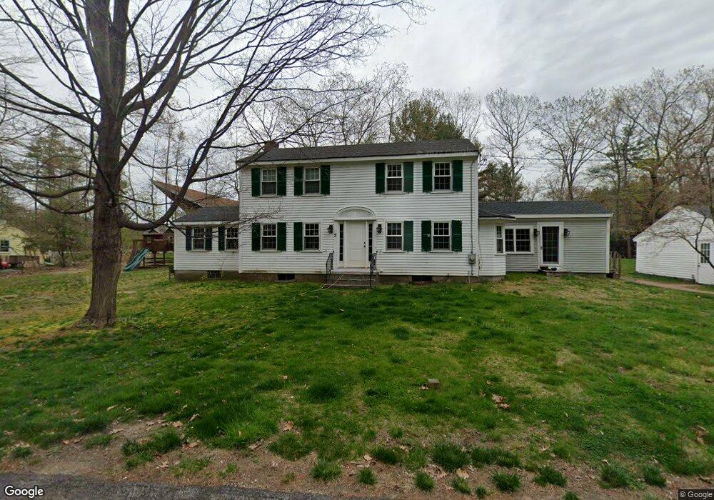
This home is located at 7 Agawam Rd, Acton, MA 01720 and is currently estimated at $943,302, approximately $481 per square foot. 7 Agawam Rd is a home located in Middlesex County with nearby schools including Acton-Boxborough Regional High School.
Ownership History
Date
Name
Owned For
Owner Type
Purchase Details
Closed on
Aug 17, 2011
Sold by
Putnam William S and Putnam Bern W
Bought by
Frost Seth D and Frost Meredith A
Current Estimated Value
Home Financials for this Owner
Home Financials are based on the most recent Mortgage that was taken out on this home.
Original Mortgage
$270,000
Outstanding Balance
$172,707
Interest Rate
3%
Mortgage Type
Purchase Money Mortgage
Estimated Equity
$770,595
Create a Home Valuation Report for This Property
The Home Valuation Report is an in-depth analysis detailing your home's value as well as a comparison with similar homes in the area
Home Values in the Area
Average Home Value in this Area
Purchase History
| Date | Buyer | Sale Price | Title Company |
|---|---|---|---|
| Frost Seth D | $430,000 | -- |
Source: Public Records
Mortgage History
| Date | Status | Borrower | Loan Amount |
|---|---|---|---|
| Open | Frost Seth D | $270,000 |
Source: Public Records
Tax History
| Year | Tax Paid | Tax Assessment Tax Assessment Total Assessment is a certain percentage of the fair market value that is determined by local assessors to be the total taxable value of land and additions on the property. | Land | Improvement |
|---|---|---|---|---|
| 2025 | $13,651 | $796,000 | $319,900 | $476,100 |
| 2024 | $12,774 | $766,300 | $319,900 | $446,400 |
| 2023 | $12,466 | $709,900 | $291,000 | $418,900 |
| 2022 | $11,828 | $608,100 | $253,100 | $355,000 |
| 2021 | $11,630 | $574,900 | $234,200 | $340,700 |
| 2020 | $10,973 | $570,300 | $234,200 | $336,100 |
| 2019 | $10,378 | $535,800 | $234,200 | $301,600 |
| 2018 | $9,130 | $471,100 | $234,200 | $236,900 |
| 2017 | $8,907 | $467,300 | $234,200 | $233,100 |
| 2016 | $8,163 | $424,500 | $234,200 | $190,300 |
| 2015 | $8,129 | $426,700 | $234,200 | $192,500 |
| 2014 | $7,939 | $408,200 | $234,200 | $174,000 |
Source: Public Records
Map
Nearby Homes
- 5 Perkins Ln
- 79 Charter Rd
- 20 Joseph Reed Ln
- 60 Nashoba Rd
- 235 Arlington St
- 4 Littlefield Rd
- 96 Newtown Rd
- 18 Hayward Rd
- 246 Main St Unit 2
- 11 Braebrook
- 7 Kelley Rd
- 33 Meadowbrook Rd
- 46 Taylor Rd
- 92 Willow St Unit 3
- 92 Willow St Unit 2
- 90 Willow St Unit 1
- 184 Main St Unit 3
- 491 Main St
- 4 Omega Way
- 27 Forest Rd
Your Personal Tour Guide
Ask me questions while you tour the home.