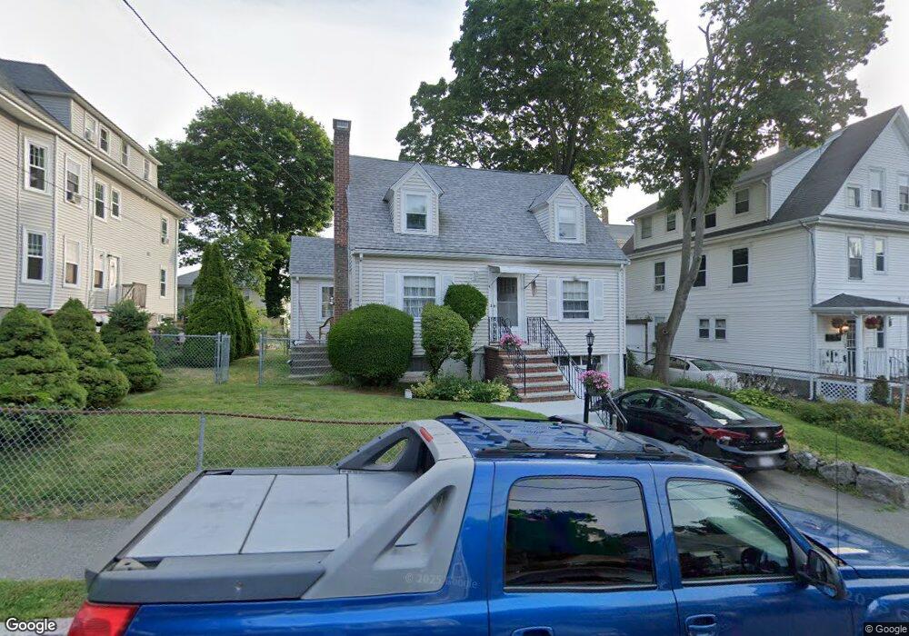
7 Alton Rd Quincy, MA 02169
South Quincy NeighborhoodEstimated Value: $516,000 - $696,000
2
Beds
1
Bath
1,062
Sq Ft
$570/Sq Ft
Est. Value
About This Home
This home is located at 7 Alton Rd, Quincy, MA 02169 and is currently estimated at $604,998, approximately $569 per square foot. 7 Alton Rd is a home located in Norfolk County with nearby schools including Lincoln-Hancock Community School, South West Middle School, and Quincy High School.
Ownership History
Date
Name
Owned For
Owner Type
Purchase Details
Closed on
Jul 9, 2021
Sold by
Rourke James M
Bought by
James M Rourke T
Current Estimated Value
Purchase Details
Closed on
Apr 25, 2019
Sold by
Rourke Steven F
Bought by
Rourke James M
Purchase Details
Closed on
Jan 15, 2013
Sold by
Rourke Ft
Bought by
Rourke Irt
Create a Home Valuation Report for This Property
The Home Valuation Report is an in-depth analysis detailing your home's value as well as a comparison with similar homes in the area
Home Values in the Area
Average Home Value in this Area
Purchase History
| Date | Buyer | Sale Price | Title Company |
|---|---|---|---|
| James M Rourke T | -- | None Available | |
| James M Rourke T M | -- | None Available | |
| Rourke James M | $200,000 | -- | |
| Rourke James M | $200,000 | -- | |
| Rourke James M | -- | -- | |
| Rourke James M | -- | -- | |
| Rourke Irt | -- | -- | |
| Rourke Irt | -- | -- |
Source: Public Records
Tax History Compared to Growth
Tax History
| Year | Tax Paid | Tax Assessment Tax Assessment Total Assessment is a certain percentage of the fair market value that is determined by local assessors to be the total taxable value of land and additions on the property. | Land | Improvement |
|---|---|---|---|---|
| 2025 | $5,203 | $451,300 | $251,300 | $200,000 |
| 2024 | $4,932 | $437,600 | $239,300 | $198,300 |
| 2023 | $4,484 | $402,900 | $217,600 | $185,300 |
| 2022 | $4,242 | $354,100 | $181,300 | $172,800 |
| 2021 | $4,219 | $347,500 | $181,300 | $166,200 |
| 2020 | $4,169 | $335,400 | $181,300 | $154,100 |
| 2019 | $3,858 | $307,400 | $171,100 | $136,300 |
| 2018 | $4,174 | $312,900 | $158,400 | $154,500 |
| 2017 | $3,993 | $281,800 | $150,800 | $131,000 |
| 2016 | $3,649 | $254,100 | $131,200 | $122,900 |
| 2015 | $3,634 | $248,900 | $131,200 | $117,700 |
| 2014 | $3,360 | $226,100 | $131,200 | $94,900 |
Source: Public Records
Map
Nearby Homes
- 155 Kendrick Ave Unit T7
- 83 Madison Ave
- 166 Phipps St
- 72 Federal Ave
- 5 Pearl St
- 10 Hughes St
- 8 Jackson St Unit B2
- 102 Conrad St
- 106 Home Park Rd
- 218 Independence Ave Unit B
- 195 Independence Ave Unit 137
- 25 John Paul Cir
- 11 Rogers Cir
- 94 Brook Rd Unit 3
- 33 Brook Rd
- 161 Cedar St
- 200 Falls Blvd Unit A105
- 200 Falls Blvd Unit G110
- 200 Falls Blvd Unit F206
- 200 Falls Blvd Unit B305
- 15 Alton Rd Unit 2
- 15 Alton Rd Unit 1
- 13 Alton Rd Unit 2
- 13 Alton Rd Unit 1
- 162 Kendrick Ave
- 166 Kendrick Ave
- 166 Kendrick Ave Unit 2
- 166 Kendrick Ave Unit 1
- 12 Alton Rd
- 12 Alton Rd Unit 2
- 19 Alton Rd
- 4 Alton Rd
- 10 Alton Rd
- 14 Alton Rd
- 174 Kendrick Ave Unit 1
- 172 Kendrick Ave
- 174 Kendrick Ave
- 172 Kendrick Ave Unit 1
- 134 Madison Ave
- 172 - 174 Kendrick Ave