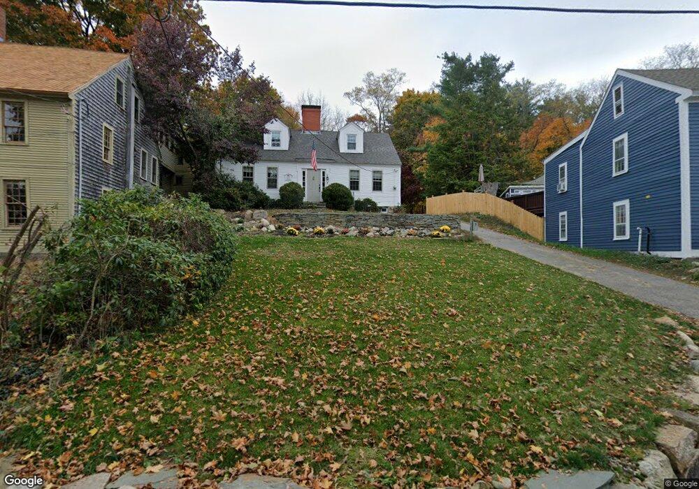
7 Andrews Ln Amesbury, MA 01913
Estimated Value: $775,000 - $938,000
3
Beds
2
Baths
2,281
Sq Ft
$366/Sq Ft
Est. Value
About This Home
This home is located at 7 Andrews Ln, Amesbury, MA 01913 and is currently estimated at $835,521, approximately $366 per square foot. 7 Andrews Ln is a home located in Essex County with nearby schools including Amesbury High School and River Valley Charter School.
Ownership History
Date
Name
Owned For
Owner Type
Purchase Details
Closed on
Dec 10, 2012
Sold by
Symmes David P and Symmes Diane E
Bought by
Symmes Ft
Current Estimated Value
Purchase Details
Closed on
Oct 22, 2004
Sold by
Bonomi Jane T and Bonomi Robert A
Bought by
Symmes David P
Create a Home Valuation Report for This Property
The Home Valuation Report is an in-depth analysis detailing your home's value as well as a comparison with similar homes in the area
Home Values in the Area
Average Home Value in this Area
Purchase History
| Date | Buyer | Sale Price | Title Company |
|---|---|---|---|
| Symmes Ft | -- | -- | |
| Symmes David P | $550,000 | -- |
Source: Public Records
Mortgage History
| Date | Status | Borrower | Loan Amount |
|---|---|---|---|
| Open | Symmes David P | $50,000 | |
| Previous Owner | Symmes David P | $372,445 |
Source: Public Records
Tax History Compared to Growth
Tax History
| Year | Tax Paid | Tax Assessment Tax Assessment Total Assessment is a certain percentage of the fair market value that is determined by local assessors to be the total taxable value of land and additions on the property. | Land | Improvement |
|---|---|---|---|---|
| 2025 | $10,770 | $703,900 | $275,400 | $428,500 |
| 2024 | $10,765 | $688,300 | $259,800 | $428,500 |
| 2023 | $9,546 | $584,200 | $225,900 | $358,300 |
| 2022 | $8,772 | $495,900 | $196,400 | $299,500 |
| 2021 | $8,353 | $457,700 | $157,800 | $299,900 |
| 2020 | $7,616 | $443,300 | $151,800 | $291,500 |
| 2019 | $7,638 | $415,800 | $151,800 | $264,000 |
| 2018 | $7,611 | $400,800 | $144,600 | $256,200 |
| 2017 | $7,370 | $369,400 | $144,600 | $224,800 |
| 2016 | $7,173 | $353,700 | $144,600 | $209,100 |
| 2015 | $7,144 | $347,800 | $144,600 | $203,200 |
| 2014 | $6,627 | $316,000 | $144,600 | $171,400 |
Source: Public Records
Map
Nearby Homes
- 434 Main St
- 435 Main St
- 394 Main St
- 47 Macy St
- 356 Main St
- 473 Main St
- 3 Birchwood Ct Unit 102
- 45 Macy St Unit 302C
- 486 Main St
- 2 Birchwood Ct Unit 101
- 25 Clarks Rd Unit 307
- 18 Hawkswood Estates
- 35 Merrimac St
- 204 Elm St
- 3 Pinecrest Ave
- 6 Wells Ave Unit C
- 179 Elm St
- 60 Merrimac St Unit 907
- 60 Merrimac St Unit 604
- 60 Merrimac St Unit 508